How to get to Cfids Network of Baltimore by bus?
Click on the bus route to see step by step directions with maps, line arrival times and updated time schedules.
From Eastern Ave (eastern avenue and dundalk av)
67 minFrom Morgan State University
69 minFrom Bwi2 Employee Shuttles
48 minFrom Lyric Theater
38 minFrom Johns Hopkins Bayview Medical Center
57 minFrom Mitchell Court House
26 minFrom Baltimore Marriott Waterfront
37 minFrom Reisterstown Road Plaza
62 minFrom I-695 @ Exit 18 (Liberty Rd/MD 26)
59 minFrom Mva
55 min
How to get to Cfids Network of Baltimore by train?
Click on the train route to see step by step directions with maps, line arrival times and updated time schedules.
Bus stops near Cfids Network of Baltimore
Train station near Cfids Network of Baltimore
- West Baltimore Marc Nb, 12 min walk,VIEW
Bus lines to Cfids Network of Baltimore
What are the closest stations to Cfids Network of Baltimore?
The closest stations to Cfids Network of Baltimore are:
- Wilkens Ave & Primson Ave Opp Eb is 176 yards away, 3 min walk.
- Caton Ave & Wilkens Ave Sb is 363 yards away, 5 min walk.
- West Baltimore Marc Nb is 946 yards away, 12 min walk.
Which bus lines stop near Cfids Network of Baltimore?
These bus lines stop near Cfids Network of Baltimore: 29, 76.
Which train line stops near Cfids Network of Baltimore?
MARC (Outbound - Washington)
What’s the nearest train station to Cfids Network of Baltimore?
The nearest train station to Cfids Network of Baltimore is West Baltimore Marc Nb. It’s a 12 min walk away.
What’s the nearest bus station to Cfids Network of Baltimore?
The nearest bus station to Cfids Network of Baltimore is Wilkens Ave & Primson Ave Opp Eb. It’s a 3 min walk away.
What time is the first train to Cfids Network of Baltimore?
The MARC is the first train that goes to Cfids Network of Baltimore. It stops nearby at 4:39 AM.
What time is the last train to Cfids Network of Baltimore?
The MARC is the last train that goes to Cfids Network of Baltimore. It stops nearby at 10:53 PM.
What time is the first bus to Cfids Network of Baltimore?
The 76 is the first bus that goes to Cfids Network of Baltimore. It stops nearby at 4:07 AM.
What time is the last bus to Cfids Network of Baltimore?
The 29 is the last bus that goes to Cfids Network of Baltimore. It stops nearby at 1:51 AM.
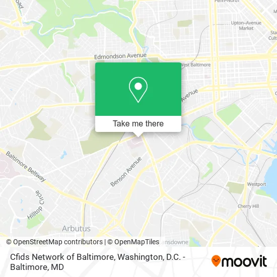
See Cfids Network of Baltimore on the map
Public Transportation to Cfids Network of Baltimore
Wondering how to get to Cfids Network of Baltimore? Moovit helps you find the best way to get to Cfids Network of Baltimore with step-by-step directions from the nearest public transit station.
Moovit provides free maps and live directions to help you navigate through your city. View schedules, routes, timetables, and find out how long does it take to get to Cfids Network of Baltimore in real time.
Looking for the nearest stop or station to Cfids Network of Baltimore? Check out this list of stops closest to your destination: Wilkens Ave & Primson Ave Opp Eb; Caton Ave & Wilkens Ave Sb; West Baltimore Marc Nb.
Bus: 29, 76.Train: MARC.
Want to see if there’s another route that gets you there at an earlier time? Moovit helps you find alternative routes or times. Get directions from and directions to Cfids Network of Baltimore easily from the Moovit App or Website.
We make riding to Cfids Network of Baltimore easy, which is why over 1.5 million users, including users in Baltimore, trust Moovit as the best app for public transit. You don’t need to download an individual bus app or train app, Moovit is your all-in-one transit app that helps you find the best bus time or train time available.
For information on prices of bus, metro and train, costs and ride fares to Cfids Network of Baltimore, please check the Moovit app.
Use the app to navigate to popular places including to the airport, hospital, stadium, grocery store, mall, coffee shop, school, college, and university.
Cfids Network of Baltimore Address: 900 S Caton Ave Baltimore, MD 21229 street in Baltimore
- Villa Maria Behavioral Health,
- Farris Laura E Pa - Farris, Laura E Pa,
- Radiation Oncology Healthcare,
- St. Agnes Hospital cardiac Catheterization Laboratory,
- Alagia Auditorium,
- Saint Agnes Hospital,
- Emergency Department - Saint Agnes Hospital,
- Labcorp Mdb66,
- St Agnes Women's Health Center,
- Baltimore Medical System - Saint Agnes,
- Sylvester Dziuba,
- Summit Amblatory,
- Ascension Saint Agnes Maryland Surgeons,
- Keith D. M. Falcao, MD,
- Ascension Saint Agnes Lab Services Angelos,
- American Lock & Key,
- Guardian Therapeutic Center,
- St Agnes Healthcare,
- Wound Healing Center,
- Crystal S. Janani, MD
Places Near Cfids Network of Baltimore
- Georgetown, Washington,
- Sibley Memorial Hospital, Washington,
- National Mall, Washington,
- Museum Of The Bible, Washington,
- Marriott Marquis Washington, DC, Washington,
- PG Mall, Prince George's County,
- Westfield Montgomery Mall, Montgomery County,
- The Anthem, Washington,
- Capital One Arena, Washington,
- Camden Yards, Baltimore,
- Washington DC VA Medical Center, Washington,
- Pennsylvania Ave NW (3rd st and pennsylvania), Washington,
- Basilica of the National Shrine, Washington,
- National Museum of African American History and Culture, Washington,
- Amazon Hq2, Arlington County,
- Washington National Cathedral, Washington,
- National Zoo, Washington,
- M&T Bank Stadium, Baltimore,
- Rock Creek Tennis Center, Washington,
- Warner Theatre, Washington
How to get to popular places in Washington, D.C. - Baltimore, MD with public transit
Get around Baltimore by public transit!
Traveling around Baltimore has never been so easy. See step by step directions as you travel to any attraction, street or major public transit station. View bus and train schedules, arrival times, service alerts and detailed routes on a map, so you know exactly how to get to anywhere in Baltimore.
When traveling to any destination around Baltimore use Moovit's Live Directions with Get Off Notifications to know exactly where and how far to walk, how long to wait for your line, and how many stops are left. Moovit will alert you when it's time to get off — no need to constantly re-check whether yours is the next stop.
Wondering how to use public transit in Baltimore or how to pay for public transit in Baltimore? Moovit public transit app can help you navigate your way with public transit easily, and at minimum cost. It includes public transit fees, ticket prices, and costs. Looking for a map of Baltimore public transit lines? Moovit public transit app shows all public transit maps in Baltimore with all Bus, Train, Metro, Light Rail and Ferry routes and stops on an interactive map.
Washington, D.C. - Baltimore, MD has 5 transit type(s), including: Bus, Train, Metro, Light Rail and Ferry, operated by several transit agencies, including WMATA, Montgomery County Ride On, Fairfax Connector, TheBus, PRTC, DASH - Alexandria, Arlington Transit (ART), RTA of Central Maryland, MDOT MTA, MDOT MTA Light RailLink, MDOT MTA Commuter Bus, MDOT MTA Local Bus, FXBGO!, Virginia Railway Express (VRE) and MARC