How to get to Change Fusion by bus?
Click on the bus route to see step by step directions with maps, line arrival times and updated time schedules.
From Glover Park Hotel Georgetown, Washington
83 minFrom Embassy Of Russia, Washington
85 minFrom Duke Ellington School of the Arts, Washington
62 minFrom Carderock Division of the Naval Surface Warfare Center, Montgomery County
121 minFrom Hyatt Place-Arlington Courthouse Plaza (Hyatt Place Arlington/Courthouse Plaza), Arlington County
44 minFrom Arlington Cinema 'N' Drafthouse, Arlington County
51 minFrom Pasquerilla Healthcare Center, Georgetown University, Washington
64 minFrom Homewood Suites by Hilton Arlington Rosslyn Key Bridge, Arlington County
43 minFrom Sheraton-Pentagon City Hotel (Sheraton Arlington), Arlington County
58 minFrom Georgetown Cupcake, Washington
54 min
How to get to Change Fusion by metro?
Click on the metro route to see step by step directions with maps, line arrival times and updated time schedules.
From Duke Ellington School of the Arts, Washington
69 minFrom Hyatt Place-Arlington Courthouse Plaza (Hyatt Place Arlington/Courthouse Plaza), Arlington County
47 minFrom Homewood Suites by Hilton Arlington Rosslyn Key Bridge, Arlington County
54 minFrom Sheraton-Pentagon City Hotel (Sheraton Arlington), Arlington County
78 minFrom Georgetown Cupcake, Washington
59 min
Bus stop near Change Fusion in Falls Church
- W Broad St+S Oak St, 2 min walk,VIEW
Metro stations near Change Fusion in Falls Church
Bus lines to Change Fusion in Falls Church
- F20, East To King St-Old Town,VIEW
What are the closest stations to Change Fusion?
The closest stations to Change Fusion are:
- W Broad St+S Oak St is 136 yards away, 2 min walk.
- West Falls Church-Vt is 4220 yards away, 49 min walk.
- East Falls Church is 5162 yards away, 60 min walk.
Which bus line stops near Change Fusion?
F20 (East To King St-Old Town)
Which metro line stops near Change Fusion?
ORANGE (Vienna)
What’s the nearest bus station to Change Fusion in Falls Church?
The nearest bus station to Change Fusion in Falls Church is W Broad St+S Oak St. It’s a 2 min walk away.
What time is the first metro to Change Fusion in Falls Church?
The ORANGE is the first metro that goes to Change Fusion in Falls Church. It stops nearby at 5:07 AM.
What time is the last metro to Change Fusion in Falls Church?
The SILVER is the last metro that goes to Change Fusion in Falls Church. It stops nearby at 12:31 AM.
What time is the first bus to Change Fusion in Falls Church?
The F20 is the first bus that goes to Change Fusion in Falls Church. It stops nearby at 4:53 AM.
What time is the last bus to Change Fusion in Falls Church?
The F20 is the last bus that goes to Change Fusion in Falls Church. It stops nearby at 2:09 AM.
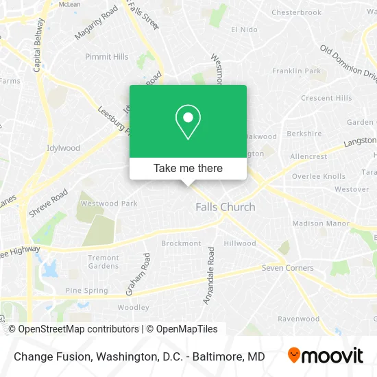
See Change Fusion, Falls Church, on the map
Public Transit to Change Fusion in Falls Church
Wondering how to get to Change Fusion in Falls Church? Moovit helps you find the best way to get to Change Fusion with step-by-step directions from the nearest public transit station.
Moovit provides free maps and live directions to help you navigate through your city. View schedules, routes, timetables, and find out how long does it take to get to Change Fusion in real time.
Looking for the nearest stop or station to Change Fusion? Check out this list of stops closest to your destination: W Broad St+S Oak St; West Falls Church-Vt; East Falls Church.
Bus: F20.Metro: ORANGE, SILVER.
Want to see if there’s another route that gets you there at an earlier time? Moovit helps you find alternative routes or times. Get directions from and directions to Change Fusion easily from the Moovit App or Website.
We make riding to Change Fusion easy, which is why over 1.5 million users, including users in Falls Church, trust Moovit as the best app for public transit. You don’t need to download an individual bus app or train app, Moovit is your all-in-one transit app that helps you find the best bus time or train time available.
For information on prices of bus and metro, costs and ride fares to Change Fusion, please check the Moovit app.
Use the app to navigate to popular places including to the airport, hospital, stadium, grocery store, mall, coffee shop, school, college, and university.
Change Fusion Address: 111 S Oak St Falls Church, VA 22046 street in Falls Church
- Agilenova,
- Spacebar (Space Bar),
- Upholstery Cleaning,
- Vanaheim Studio,
- Hillier St & S Oak St,
- Video Production Services,
- Success Realtors,
- Eclectic Elegance Home Decor & Staging,
- Post-OP Media,
- The Glowy Esthetician,
- Lucuma Boutique,
- Working America,
- Optimal Performance an,
- Kaleidos,
- Serene Rejuvenation,
- Tricom Associates Inc,
- Business Culture & Language Centre,
- Farmers,
- Group Purchasing Solutions,
- Canary Rose Retreat
Places Near Change Fusion (Falls Church)
- National Mall, Washington,
- Georgetown, Washington,
- National Museum of African American History and Culture, Washington,
- Westfield Montgomery Mall, Montgomery County,
- Rock Creek Tennis Center, Washington,
- National Zoo, Washington,
- Sibley Memorial Hospital, Washington,
- Marriott Marquis Washington, DC, Washington,
- The Anthem, Washington,
- Amazon Hq2, Arlington County,
- Basilica of the National Shrine, Washington,
- Capital One Arena, Washington,
- Warner Theatre, Washington,
- Museum Of The Bible, Washington,
- Washington National Cathedral, Washington,
- PG Mall, Prince George's County,
- Camden Yards, Baltimore,
- Pennsylvania Ave NW (3rd st and pennsylvania), Washington,
- Washington DC VA Medical Center, Washington,
- M&T Bank Stadium, Baltimore
How to get to popular places in Washington, D.C. - Baltimore, MD with public transit
Get around Falls Church by public transit!
Traveling around Falls Church has never been so easy. See step by step directions as you travel to any attraction, street or major public transit station. View bus and train schedules, arrival times, service alerts and detailed routes on a map, so you know exactly how to get to anywhere in Falls Church.
When traveling to any destination around Falls Church use Moovit's Live Directions with Get Off Notifications to know exactly where and how far to walk, how long to wait for your line, and how many stops are left. Moovit will alert you when it's time to get off — no need to constantly re-check whether yours is the next stop.
Wondering how to use public transit in Falls Church or how to pay for public transit in Falls Church? Moovit public transit app can help you navigate your way with public transit easily, and at minimum cost. It includes public transit fees, ticket prices, and costs. Looking for a map of Falls Church public transit lines? Moovit public transit app shows all public transit maps in Falls Church with all Bus, Train, Metro, Light Rail and Ferry routes and stops on an interactive map.
Washington, D.C. - Baltimore, MD has 5 transit type(s), including: Bus, Train, Metro, Light Rail and Ferry, operated by several transit agencies, including WMATA, Montgomery County Ride On, Fairfax Connector, TheBus, PRTC, DASH - Alexandria, Arlington Transit (ART), RTA of Central Maryland, MDOT MTA, MDOT MTA Light RailLink, MDOT MTA Commuter Bus, MDOT MTA Local Bus, FXBGO!, Virginia Railway Express (VRE) and MARC