How to get to ChargeIT mobility by bus?
Click on the bus route to see step by step directions with maps, line arrival times and updated time schedules.
From Schwaben Park, Vereinbarte Verwaltungsgemeinschaft Der Stadt Welzheim
158 minFrom McDonald's (McDrive), Vereinbarte Verwaltungsgemeinschaft Der Stadt Backnang
127 minFrom Modepark Röther, Vereinbarte Verwaltungsgemeinschaft Der Stadt Backnang
97 minFrom Kaufland Schwäbisch Hall Hessental, Verwaltungsgemeinschaft Schwäbisch Hall
32 minFrom Kaufland Backnang Sulzbacher Str., Vereinbarte Verwaltungsgemeinschaft Der Stadt Backnang
97 minFrom Klinik Löwenstein, Verwaltungsgemeinschaft Obersulm
62 minFrom Wonnemar Backnang (Murrbader Backnang Wonnemar), Vereinbarte Verwaltungsgemeinschaft Der Stadt Backnang
130 min
Bus stop near ChargeIT mobility in Verwaltungsgemeinschaft Schwäbisch Hall
- Michelfeld Abzw. Bibersfeld, 3 min walk,VIEW
Bus lines to ChargeIT mobility in Verwaltungsgemeinschaft Schwäbisch Hall
What are the closest stations to ChargeIT mobility?
The closest stations to ChargeIT mobility are:
- Michelfeld Abzw. Bibersfeld is 167 meters away, 3 min walk.
Which bus lines stop near ChargeIT mobility?
These bus lines stop near ChargeIT mobility: 20, 8, 9.
What’s the nearest bus station to ChargeIT mobility in Verwaltungsgemeinschaft Schwäbisch Hall?
The nearest bus station to ChargeIT mobility in Verwaltungsgemeinschaft Schwäbisch Hall is Michelfeld Abzw. Bibersfeld. It’s a 3 min walk away.
What time is the first bus to ChargeIT mobility in Verwaltungsgemeinschaft Schwäbisch Hall?
The 32 is the first bus that goes to ChargeIT mobility in Verwaltungsgemeinschaft Schwäbisch Hall. It stops nearby at 5:55 AM.
What time is the last bus to ChargeIT mobility in Verwaltungsgemeinschaft Schwäbisch Hall?
The R20 is the last bus that goes to ChargeIT mobility in Verwaltungsgemeinschaft Schwäbisch Hall. It stops nearby at 10:34 PM.
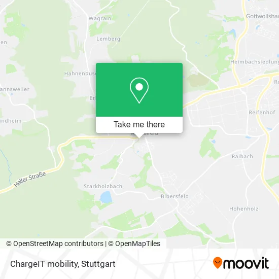
See ChargeIT mobility, Verwaltungsgemeinschaft Schwäbisch Hall, on the map
Public Transit to ChargeIT mobility in Verwaltungsgemeinschaft Schwäbisch Hall
Wondering how to get to ChargeIT mobility in Verwaltungsgemeinschaft Schwäbisch Hall? Moovit helps you find the best way to get to ChargeIT mobility with step-by-step directions from the nearest public transit station.
Moovit provides free maps and live directions to help you navigate through your city. View schedules, routes, timetables, and find out how long does it take to get to ChargeIT mobility in real time.
Looking for the nearest stop or station to ChargeIT mobility? Check out this list of stops closest to your destination: Michelfeld Abzw. Bibersfeld.
Bus: 20, 8, 9, 32, R20.
Want to see if there’s another route that gets you there at an earlier time? Moovit helps you find alternative routes or times. Get directions from and directions to ChargeIT mobility easily from the Moovit App or Website.
We make riding to ChargeIT mobility easy, which is why over 1.5 million users, including users in Verwaltungsgemeinschaft Schwäbisch Hall, trust Moovit as the best app for public transit. You don’t need to download an individual bus app or train app, Moovit is your all-in-one transit app that helps you find the best bus time or train time available.
For information on prices of bus and train, costs and ride fares to ChargeIT mobility, please check the Moovit app.
Use the app to navigate to popular places including to the airport, hospital, stadium, grocery store, mall, coffee shop, school, college, and university.
ChargeIT mobility Address: Schulstraße 74545 Michelfeld street in Verwaltungsgemeinschaft Schwäbisch Hall
- Dr. Christoph Hespelt,
- Praxis für Zahnheilkunde,
- Grund- und Hauptschule,
- Post Agentur,
- Postfiliale,
- Gls Paketshop,
- DHL,
- Schützenverein Michelfeld,
- R+V Versicherung,
- Dz Bank AG Deutsche Zentral Genossenschaftsbank,
- Volksbanken Raiffeisenbanken,
- Lenz Wohntex,
- Post, Gelbachstraße,
- Gesundheit und Wellness,
- Prüftechnik Buchmann,
- Abnehmen im Li,
- Walter Brodbeck Versich. Agentur,
- TSV Michelfeld Tennisabteilung,
- Ttc Gnadental E V,
- Verlässliche Grundschule
Places Near ChargeIT mobility (Verwaltungsgemeinschaft Schwäbisch Hall)
- Marmorsaal Im Weissenburgpark, Stuttgart-Süd,
- Mercedes-Benz Museum (Mercedes Museum Stuttgart), Bad Cannstatt,
- Mercedes-Benz Museum, Bad Cannstatt,
- Im Wizemann (Halle), Bad Cannstatt,
- Klinikum Stuttgart - Katharinenhospital, Stuttgart-Mitte,
- Pariser Platz Stuttgart, Stuttgart-Mitte,
- Hanns-Martin-Schleyer-Halle (Stuttgart Hans-Martin-Schleyerhalle), Bad Cannstatt,
- Wilhelma (U-Bahn Wilhelma), Bad Cannstatt,
- SI-Centrum, Möhringen,
- FlixBus Haltestelle, Stuttgart,
- Geilhaus Haus 33a, Reutlingen-Betzingen,
- Porsche Museum, Zuffenhausen,
- Schleyerhalle, Bad Cannstatt,
- Gasometer Pforzheim, Pforzheim,
- Hauptbahnhof Stuttgart, Stuttgart-Mitte,
- Gleis 101/102 (tief), Stuttgart-Mitte,
- Hanns-Martin-Schleyer-Halle, Bad Cannstatt,
- Mettingen Eros-Center Puff Laufhaus, Esslingen Am Neckar,
- Porsche-Arena, Bad Cannstatt,
- Waldfriedhof, Degerloch
How to get to popular places in Stuttgart with public transit
Get around Verwaltungsgemeinschaft Schwäbisch Hall by public transit!
Traveling around Verwaltungsgemeinschaft Schwäbisch Hall has never been so easy. See step by step directions as you travel to any attraction, street or major public transit station. View bus and train schedules, arrival times, service alerts and detailed routes on a map, so you know exactly how to get to anywhere in Verwaltungsgemeinschaft Schwäbisch Hall.
When traveling to any destination around Verwaltungsgemeinschaft Schwäbisch Hall use Moovit's Live Directions with Get Off Notifications to know exactly where and how far to walk, how long to wait for your line, and how many stops are left. Moovit will alert you when it's time to get off — no need to constantly re-check whether yours is the next stop.
Wondering how to use public transit in Verwaltungsgemeinschaft Schwäbisch Hall or how to pay for public transit in Verwaltungsgemeinschaft Schwäbisch Hall? Moovit public transit app can help you navigate your way with public transit easily, and at minimum cost. It includes public transit fees, ticket prices, and costs. Looking for a map of Verwaltungsgemeinschaft Schwäbisch Hall public transit lines? Moovit public transit app shows all public transit maps in Verwaltungsgemeinschaft Schwäbisch Hall with all Bus, Train, Subway, Light Rail, Ferry, S-Bahn and Funicular routes and stops on an interactive map.
Stuttgart has 7 transit type(s), including: Bus, Train, Subway, Light Rail, Ferry, S-Bahn and Funicular, operated by several transit agencies, including SSB - Stadtbahn, SSB, SSB - Seilbahn / Zacke, S-Bahn Stuttgart, Rhein-Neckar-Verkehr GmbH (rnv), Karlsruher Verkehrsverbund, DB AG, DB Regiobus BW, Arverio Baden-Württemberg GmbH, DB RegioNetz Verkehrs GmbH Westfrankenbahn, DB Regio AG Baden-Württemberg, Südwestdeutsche Verkehrs-AG, DB Regio AG Mitte Region Hessen, DB and Bodensee-Oberschwaben-Bahn