Directions to ChargePoint (Reux) with public transportation
The following transit lines have routes that pass near ChargePoint
 Bus: L13.
How to get to ChargePoint by bus?
Click on the bus route to see step by step directions with maps, line arrival times and updated time schedules.
From Durant Philippe, Arras
31 minFrom Pompes Funèbres Générales, Arras
33 minFrom Hugues Becquart, Arras
35 minFrom Charcuterie Volailles, Sainte-Catherine
97 minFrom Baudimont, Arras
42 minFrom Agence Auto-Ecole Renoir, Sainte-Catherine
97 minFrom Place Chanteclair, Saint-Nicolas
34 minFrom Utb, Saint-Laurent-Blangy
28 minFrom Clinique Sainte Catherine, Sainte-Catherine
62 minFrom Sainte-Catherine, Sainte-Catherine
98 min
Bus stop near ChargePoint in Reux
- Chapelle De Roeux, 7 min walk,VIEW
Bus lines to ChargePoint in Reux
- L13, Gare Quai D,VIEW
What are the closest stations to ChargePoint?
The closest stations to ChargePoint are:
- Chapelle De Roeux is 483 meters away, 7 min walk.
Which bus line stops near ChargePoint?
L13 (Gare Quai D→Eglise De Gavrelle)
What’s the nearest bus station to ChargePoint in Reux?
The nearest bus station to ChargePoint in Reux is Chapelle De Roeux. It’s a 7 min walk away.
What time is the first bus to ChargePoint in Reux?
The L13 is the first bus that goes to ChargePoint in Reux. It stops nearby at 9:10 AM.
What time is the last bus to ChargePoint in Reux?
The L13 is the last bus that goes to ChargePoint in Reux. It stops nearby at 6:14 PM.
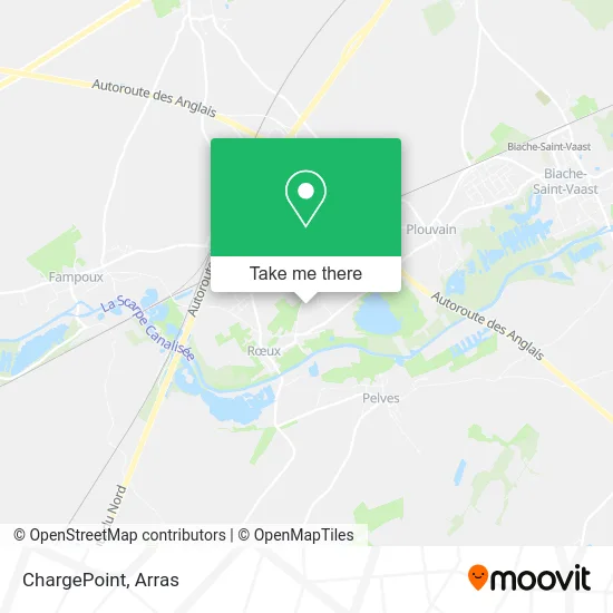
See ChargePoint, Reux, on the map
Public Transit to ChargePoint in Reux
Wondering how to get to ChargePoint in Reux? Moovit helps you find the best way to get to ChargePoint with step-by-step directions from the nearest public transit station.
Moovit provides free maps and live directions to help you navigate through your city. View schedules, routes, timetables, and find out how long does it take to get to ChargePoint in real time.
Looking for the nearest stop or station to ChargePoint? Check out this list of stops closest to your destination: Chapelle De Roeux.
Bus: L13.
Want to see if there’s another route that gets you there at an earlier time? Moovit helps you find alternative routes or times. Get directions from and directions to ChargePoint easily from the Moovit App or Website.
We make riding to ChargePoint easy, which is why over 1.5 million users, including users in Reux, trust Moovit as the best app for public transit. You don’t need to download an individual bus app or train app, Moovit is your all-in-one transit app that helps you find the best bus time or train time available.
For information on prices of bus, costs and ride fares to ChargePoint, please check the Moovit app.
Use the app to navigate to popular places including to the airport, hospital, stadium, grocery store, mall, coffee shop, school, college, and university.
ChargePoint Address: 18 Chemin de Croisette 62118 Roeux street in Reux
- Carrefour,
- Céline Pinol-Petit,
- Lac Des Sapins,
- Natureza,
- Parenthèse Paysage,
- Roeux,
- Marais Des Places,
- Marais Verlaine,
- Guinguette,
- Artisan Waligora,
- Miss'Jack Ink,
- Chez Marcel Arras,
- Family in,
- Estaminet de la Place,
- Créons Vert,
- Letalle Florence,
- European Homes,
- Fermiers de l'Artois,
- Dupayage Bernadette,
- Hervet-Melayers Jocelyne
Places Near ChargePoint (Reux)
- Lycée Robespierre, Arras,
- Lycée Général Gambetta Carnot, Arras,
- Hôpital Privé Arras Les Bonnettes, Arras,
- Centre Commercial Auchan, Arras,
- Artois-Expo, Saint-Laurent-Blangy,
- Caf, Arras,
- Lycée Privé Baudimont Saint-Charles, Arras,
- Marché De Noël, Arras,
- Lycée Du Bâtiment Jacques Le Caron, Arras,
- Le Set Famous Club Roclincourt, Arras,
- Lfb Group Arras, Bailleul-Sir-Berthoult,
- Main Square Festival, Arras,
- Centre Hospitalier D'Arras, Arras,
- Lycée Professionnel Alain Savary, Arras,
- Auchan Arras, Arras,
- Lycée Polyvalent Guy Mollet, Arras,
- Citadelle D'Arras, Arras,
- Université D'Artois, Arras,
- Grand'Place, Arras,
- lycée Baudimont St-Charles, Arras
How to get to popular places in Arras with public transit
Get around Reux by public transit!
Traveling around Reux has never been so easy. See step by step directions as you travel to any attraction, street or major public transit station. View bus and train schedules, arrival times, service alerts and detailed routes on a map, so you know exactly how to get to anywhere in Reux.
When traveling to any destination around Reux use Moovit's Live Directions with Get Off Notifications to know exactly where and how far to walk, how long to wait for your line, and how many stops are left. Moovit will alert you when it's time to get off — no need to constantly re-check whether yours is the next stop.
Wondering how to use public transit in Reux or how to pay for public transit in Reux? Moovit public transit app can help you navigate your way with public transit easily, and at minimum cost. It includes public transit fees, ticket prices, and costs. Looking for a map of Reux public transit lines? Moovit public transit app shows all public transit maps in Reux with all bus routes and stops on an interactive map.
Arras has 1 transit type(s), including: bus, operated by several transit agencies, including Artis