How to get to ChargePoint by bus?
Click on the bus route to see step by step directions with maps, line arrival times and updated time schedules.
From Alberta Aero Engine Lt, Edmonton
66 minFrom Heritage Valley, Edmonton
78 minFrom Francis Winspear Centre, Edmonton
63 minFrom Monsignor Fee Otterson Catholic School, Edmonton
75 minFrom CDI College Edmonton City Centre, Edmonton
58 minFrom Global Cleaning, Edmonton
65 minFrom Riverbend Square, Edmonton
69 minFrom Heritage Valley Park & Ride, Edmonton
82 minFrom Royal Alexandra Hospital, Edmonton
65 minFrom Lillian Osborne High School, Edmonton
67 min
Bus stops near ChargePoint in Edmonton
Light Rail stations near ChargePoint in Edmonton
- Bonnie Doon Stop, 23 min walk,VIEW
Bus lines to ChargePoint in Edmonton
- 505, Davies Transit Centre,VIEW
- 506, Maple Way & Maple Road,VIEW
- 511, Mill Woods Transit Centre,VIEW
- 006, Davies Transit Centre,VIEW
- 501, Capilano Transit Centre,VIEW
- 502, South Campus Fort Edmonton Transit Centre,VIEW
- 503, Millbourne Road E & 38 Avenue,VIEW
- 504, Meadows - Davies,VIEW
- 632, O'Brien - Ottewell - Kenilworth - Davies,VIEW
- 636, Mcnally - Davies,VIEW
- 653, Strathcona - Davies,VIEW
- 656, Allendale - Strathcona,VIEW
What are the closest stations to ChargePoint?
The closest stations to ChargePoint are:
- 75 Street & Roper Road is 105 meters away, 2 min walk.
- 83 Street & Wagner Road is 900 meters away, 12 min walk.
- Davies Transit Centre is 1737 meters away, 23 min walk.
- Bonnie Doon Stop is 1784 meters away, 23 min walk.
Which bus lines stop near ChargePoint?
These bus lines stop near ChargePoint: 006, 501, 506, 507.
Which light rail line stops near ChargePoint?
VALLEY (Mill Woods)
What’s the nearest light rail station to ChargePoint in Edmonton?
The nearest light rail station to ChargePoint in Edmonton is Bonnie Doon Stop. It’s a 23 min walk away.
What’s the nearest bus station to ChargePoint in Edmonton?
The nearest bus station to ChargePoint in Edmonton is 75 Street & Roper Road. It’s a 2 min walk away.
What time is the first light rail to ChargePoint in Edmonton?
The VALLEY is the first light rail that goes to ChargePoint in Edmonton. It stops nearby at 5:12 AM.
What time is the last light rail to ChargePoint in Edmonton?
The VALLEY is the last light rail that goes to ChargePoint in Edmonton. It stops nearby at 1:00 AM.
What time is the first bus to ChargePoint in Edmonton?
The 006 is the first bus that goes to ChargePoint in Edmonton. It stops nearby at 5:55 AM.
What time is the last bus to ChargePoint in Edmonton?
The 511 is the last bus that goes to ChargePoint in Edmonton. It stops nearby at 2:55 AM.
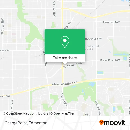
See ChargePoint, Edmonton, on the map
Public Transit to ChargePoint in Edmonton
Wondering how to get to ChargePoint in Edmonton? Moovit helps you find the best way to get to ChargePoint with step-by-step directions from the nearest public transit station.
Moovit provides free maps and live directions to help you navigate through your city. View schedules, routes, timetables, and find out how long does it take to get to ChargePoint in real time.
Looking for the nearest stop or station to ChargePoint? Check out this list of stops closest to your destination: 75 Street & Roper Road; 83 Street & Wagner Road; Davies Transit Centre; Bonnie Doon Stop.
Bus: 006, 501, 506, 507, 505, 511, 502, 503, 504, 632, 636, 653, 656.Light Rail: VALLEY.
Want to see if there’s another route that gets you there at an earlier time? Moovit helps you find alternative routes or times. Get directions from and directions to ChargePoint easily from the Moovit App or Website.
We make riding to ChargePoint easy, which is why over 1.5 million users, including users in Edmonton, trust Moovit as the best app for public transit. You don’t need to download an individual bus app or train app, Moovit is your all-in-one transit app that helps you find the best bus time or train time available.
For information on prices of bus and light rail, costs and ride fares to ChargePoint, please check the Moovit app.
Use the app to navigate to popular places including to the airport, hospital, stadium, grocery store, mall, coffee shop, school, college, and university.
ChargePoint Address: 7450 Roper Rd NW Edmonton, AB T6B street in Edmonton
- Firestone,
- BMWi,
- Rwireless,
- Aly Nail Studio,
- Wesco/TVC Edmonton,
- Filipino Centre,
- Norwest Labs,
- A&T Footwear,
- Victory Homes,
- S C L Engineering,
- Trinity Distributors,
- A-Win Insurance LTD,
- Indigospirit 168,
- Clear Focus Financial LTD,
- Budaboom,
- Vision Concept Floors,
- Proforma Capital Inc,
- Imperial King,
- Hair Dimension,
- RCCG Jubilee Parish, Edmonton,CA
Places Near ChargePoint (Edmonton)
- Fort Edmonton Park, Edmonton,
- Londonderry Mall, Edmonton,
- Kingsway Mall, Edmonton,
- Whyte Avenue, Edmonton,
- Borden Park, Edmonton,
- Canada Place Service Canada Centre, Edmonton,
- Alberta Legislature Building, Edmonton,
- West Edmonton Mall, Edmonton,
- Grey Nuns Community Hospital, Edmonton,
- Northgate Centre, Edmonton,
- Edmonton Valley Zoo, Edmonton,
- Kaye Edmonton Clinic, Edmonton,
- Royal Alexandra Hospital, Edmonton,
- Edmonton Commonwealth Stadium, Edmonton,
- Edmonton VIA Rail Station, Edmonton,
- Rogers Place, Edmonton,
- MacEwan University, Edmonton,
- Cross Cancer Institute, Edmonton,
- Edmonton EXPO Centre, Edmonton,
- University of Alberta, Edmonton
How to get to popular places in Edmonton with public transit
Get around Edmonton by public transit!
Traveling around Edmonton has never been so easy. See step by step directions as you travel to any attraction, street or major public transit station. View bus and train schedules, arrival times, service alerts and detailed routes on a map, so you know exactly how to get to anywhere in Edmonton.
When traveling to any destination around Edmonton use Moovit's Live Directions with Get Off Notifications to know exactly where and how far to walk, how long to wait for your line, and how many stops are left. Moovit will alert you when it's time to get off — no need to constantly re-check whether yours is the next stop.
Wondering how to use public transit in Edmonton or how to pay for public transit in Edmonton? Moovit public transit app can help you navigate your way with public transit easily, and at minimum cost. It includes public transit fees, ticket prices, and costs. Looking for a map of Edmonton public transit lines? Moovit public transit app shows all public transit maps in Edmonton with all Bus and Light Rail routes and stops on an interactive map.
Edmonton has 2 transit type(s), including: Bus and Light Rail, operated by several transit agencies, including ETS LRT, ETS, Strathcona County Transit, St. Albert Transit, Spruce Grove Transit, Fort Saskatchewan Transit, Beaumont Transit and Leduc Transit