Directions to ChargePoint (Lawrence) with public transportation
The following transit lines have routes that pass near ChargePoint
 Bus: 30.
How to get to ChargePoint by bus?
Click on the bus route to see step by step directions with maps, line arrival times and updated time schedules.
From Castleton, Indianapolis City (Balance)
109 minFrom Community Hospital North, Indianapolis City (Balance)
80 minFrom CBC-Nedho, Indianapolis City (Balance)
50 minFrom N Franklin Rd / E 42nd St, Indianapolis City (Balance)
19 minFrom N Emerson Ave / E 38th St, Indianapolis City (Balance)
43 minFrom Carmel, Plaindfield & Greenwood, Indianapolis City (Balance)
35 minFrom The Irish Mutt, Indianapolis City (Balance)
61 minFrom Perfecting Love Apostolic Church, Indianapolis City (Balance)
63 minFrom 38th Street and Shadeland Ave., Indianapolis City (Balance)
37 minFrom Enterprise Rent-A-Car, Indianapolis City (Balance)
68 min
Bus stop near ChargePoint in Lawrence
- Alicia Way & Sunny Side Rd, 7 min walk,VIEW
Bus lines to ChargePoint in Lawrence
- 30, Sunnyside Rd,VIEW
What are the closest stations to ChargePoint?
The closest stations to ChargePoint are:
- Alicia Way & Sunny Side Rd is 564 yards away, 7 min walk.
Which bus line stops near ChargePoint?
30 (Sunnyside Rd)
What’s the nearest bus station to ChargePoint in Lawrence?
The nearest bus station to ChargePoint in Lawrence is Alicia Way & Sunny Side Rd. It’s a 7 min walk away.
What time is the first bus to ChargePoint in Lawrence?
The 30 is the first bus that goes to ChargePoint in Lawrence. It stops nearby at 4:09 AM.
What time is the last bus to ChargePoint in Lawrence?
The 30 is the last bus that goes to ChargePoint in Lawrence. It stops nearby at 12:12 AM.
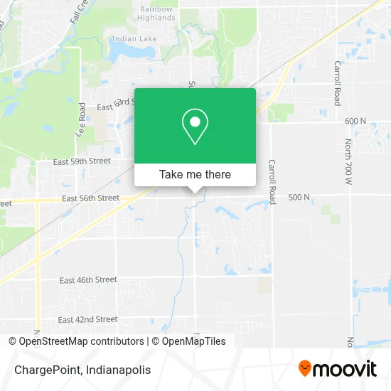
See ChargePoint, Lawrence, on the map
Public Transit to ChargePoint in Lawrence
Wondering how to get to ChargePoint in Lawrence? Moovit helps you find the best way to get to ChargePoint with step-by-step directions from the nearest public transit station.
Moovit provides free maps and live directions to help you navigate through your city. View schedules, routes, timetables, and find out how long does it take to get to ChargePoint in real time.
Looking for the nearest stop or station to ChargePoint? Check out this list of stops closest to your destination: Alicia Way & Sunny Side Rd.
Bus: 30.
Want to see if there’s another route that gets you there at an earlier time? Moovit helps you find alternative routes or times. Get directions from and directions to ChargePoint easily from the Moovit App or Website.
We make riding to ChargePoint easy, which is why over 1.5 million users, including users in Lawrence, trust Moovit as the best app for public transit. You don’t need to download an individual bus app or train app, Moovit is your all-in-one transit app that helps you find the best bus time or train time available.
For information on prices of bus, costs and ride fares to ChargePoint, please check the Moovit app.
Use the app to navigate to popular places including to the airport, hospital, stadium, grocery store, mall, coffee shop, school, college, and university.
ChargePoint Address: 5625 N German Church Rd Indianapolis, IN 46235 street in Lawrence
- Purple Ribbon Office Solutions,
- Kemba Credit Union,
- N German Church Rd / E 56th St,
- Baymont-Indianapolis Northeast,
- Jiffy Lube,
- Locksmiths Express,
- Vonzetta's Lavish Hair Boutique,
- Purple Ribbon Office S,
- Storyjob,
- Scrooge Casino,
- Indiana Home Safety & Mobility,
- S.H.E. Publishing,
- Move with Meme,
- Lee Infinite Solutions,
- Sp8ceculture.Com,
- Stairlifts Equipment in Indianapolis,
- PJ Photography,
- Goodwill Store,
- The Estate,
- Minute Key
Places Near ChargePoint (Lawrence)
- Cotter's Massage Parlor With Happy Endings, Indianapolis City (Balance),
- 119 W 19th St Parking, Indianapolis City (Balance),
- Indianapolis Airport Zone 2, Indianapolis City (Balance),
- Indianapolis Motor Speedway, Speedway,
- Lucas Oil Stadium, Indianapolis City (Balance),
- Plainfield, IN, Plainfield,
- St. Vincent Hospital - Indianapolis, Indianapolis City (Balance),
- Eskenazi Hospital, Indianapolis City (Balance),
- Indiana, Indianapolis City (Balance),
- St. Vincent entrance #1, Indianapolis City (Balance),
- THE BALT, Indianapolis City (Balance),
- I-465 / I-65 Interchange, Indianapolis City (Balance),
- Gainbridge Fieldhouse, Indianapolis City (Balance),
- Indiana Convention Center, Indianapolis City (Balance),
- Lilly Corporate Center (Eli Lilly & Co), Indianapolis City (Balance),
- Castleton Square Mall, Indianapolis,
- Methodist Hospital of Indianapolis, Indianapolis City (Balance),
- Train Ride At Castleton Mall, Indianapolis City (Balance),
- I U Health Methodist Hospital, Indianapolis City (Balance),
- Jersey Barn, Indianapolis City (Balance)
How to get to popular places in Indianapolis with public transit
Get around Lawrence by public transit!
Traveling around Lawrence has never been so easy. See step by step directions as you travel to any attraction, street or major public transit station. View bus and train schedules, arrival times, service alerts and detailed routes on a map, so you know exactly how to get to anywhere in Lawrence.
When traveling to any destination around Lawrence use Moovit's Live Directions with Get Off Notifications to know exactly where and how far to walk, how long to wait for your line, and how many stops are left. Moovit will alert you when it's time to get off — no need to constantly re-check whether yours is the next stop.
Wondering how to use public transit in Lawrence or how to pay for public transit in Lawrence? Moovit public transit app can help you navigate your way with public transit easily, and at minimum cost. It includes public transit fees, ticket prices, and costs. Looking for a map of Lawrence public transit lines? Moovit public transit app shows all public transit maps in Lawrence with all bus routes and stops on an interactive map.
Indianapolis has 1 transit type(s), including: bus, operated by several transit agencies, including IndyGo, FlixBus-us and Greyhound-us