How to get to ChargePoint by bus?
Click on the bus route to see step by step directions with maps, line arrival times and updated time schedules.
Bus stop near ChargePoint in Fort Myers Beach
- Fmb Publix - Estero Blvd @ Sanders Dr, 2 min walk,VIEW
Bus lines to ChargePoint in Fort Myers Beach
- 410, Lovers Key Main Ent @ Estero Blvd,VIEW
What are the closest stations to ChargePoint?
The closest stations to ChargePoint are:
- Fmb Publix - Estero Blvd @ Sanders Dr is 91 yards away, 2 min walk.
Which bus lines stop near ChargePoint?
These bus lines stop near ChargePoint: 410, 490.
What’s the nearest bus station to ChargePoint in Fort Myers Beach?
The nearest bus station to ChargePoint in Fort Myers Beach is Fmb Publix - Estero Blvd @ Sanders Dr. It’s a 2 min walk away.
What time is the first bus to ChargePoint in Fort Myers Beach?
The 410 is the first bus that goes to ChargePoint in Fort Myers Beach. It stops nearby at 6:40 AM.
What time is the last bus to ChargePoint in Fort Myers Beach?
The 410 is the last bus that goes to ChargePoint in Fort Myers Beach. It stops nearby at 10:14 PM.
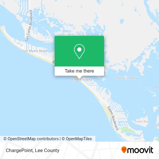
See ChargePoint, Fort Myers Beach, on the map
Public Transit to ChargePoint in Fort Myers Beach
Wondering how to get to ChargePoint in Fort Myers Beach? Moovit helps you find the best way to get to ChargePoint with step-by-step directions from the nearest public transit station.
Moovit provides free maps and live directions to help you navigate through your city. View schedules, routes, timetables, and find out how long does it take to get to ChargePoint in real time.
Looking for the nearest stop or station to ChargePoint? Check out this list of stops closest to your destination: Fmb Publix - Estero Blvd @ Sanders Dr.
Bus: 410, 490.
Want to see if there’s another route that gets you there at an earlier time? Moovit helps you find alternative routes or times. Get directions from and directions to ChargePoint easily from the Moovit App or Website.
We make riding to ChargePoint easy, which is why over 1.5 million users, including users in Fort Myers Beach, trust Moovit as the best app for public transit. You don’t need to download an individual bus app or train app, Moovit is your all-in-one transit app that helps you find the best bus time or train time available.
For information on prices of bus, costs and ride fares to ChargePoint, please check the Moovit app.
Use the app to navigate to popular places including to the airport, hospital, stadium, grocery store, mall, coffee shop, school, college, and university.
ChargePoint Address: 4650 Estero Blvd Fort Myers Beach, FL 33931 street in Fort Myers Beach
- Fort Myers Beach Yoga,
- Beach Camera Icon,
- Villa del Mar Condominium Association,
- Publix Super Markets,
- Seaside Resort (Seaside an All Hotel Fort Myers Beach),
- Credit Union 1,
- Appliance Refinishing & Repair,
- Hawgwild Fishing Charters,
- Island Fever Fishing Charters,
- Paradise Charters (Fishing the Flats Charters),
- Nature One,
- Snook Bight Marina,
- Kahlua,
- The Junkanoo Social Networks,
- Fresh Catch Bistro,
- Bayfront Bistro (Bayfront Transition),
- Bay Shore Cafe,
- Key West Ct,
- Fort Myers Beach Homes,
- Paradise Island Resort
Places Near ChargePoint (Fort Myers Beach)
- Amazon Warehouse Rsw5,
- I-75 & Colonial (Exit 136), Fort Myers,
- I-75 & MLK (Exit 138), Fort Myers,
- Seminole Casino Hotel Immokalee,
- Lehigh Acres, FL, Lehigh Acres,
- Miromar Outlets, Estero,
- US-41, Fort Myers,
- Pelican Landing Beach Shuttle, Bonita Springs,
- Bonita Bay Private Beach Club, Bonita Springs,
- Bonita Springs, FL, Bonita Springs,
- Ft Myers Airport RSW,
- Matlacha Nude Beach, Matlacha Isles-Matlacha Shores,
- U.S.-41 / Colonial Blvd. Intersection, Fort Myers,
- Lee County Tax Collector, Cape Coral,
- Edison Mall, Fort Myers,
- Rosa Parks Transportation Center, Fort Myers,
- Walmart Supercenter, Fort Myers,
- Flixbus, Fort Myers,
- Bonita Beach, Bonita Springs,
- All About U Naples Escorts, Pine Ridge
How to get to popular places in Lee County with public transit
Get around Fort Myers Beach by public transit!
Traveling around Fort Myers Beach has never been so easy. See step by step directions as you travel to any attraction, street or major public transit station. View bus and train schedules, arrival times, service alerts and detailed routes on a map, so you know exactly how to get to anywhere in Fort Myers Beach.
When traveling to any destination around Fort Myers Beach use Moovit's Live Directions with Get Off Notifications to know exactly where and how far to walk, how long to wait for your line, and how many stops are left. Moovit will alert you when it's time to get off — no need to constantly re-check whether yours is the next stop.
Wondering how to use public transit in Fort Myers Beach or how to pay for public transit in Fort Myers Beach? Moovit public transit app can help you navigate your way with public transit easily, and at minimum cost. It includes public transit fees, ticket prices, and costs. Looking for a map of Fort Myers Beach public transit lines? Moovit public transit app shows all public transit maps in Fort Myers Beach with all bus routes and stops on an interactive map.
Lee County has 1 transit type(s), including: bus, operated by several transit agencies, including LeeTran, CAT and FlixBus-us