How to get to ChargePoint by bus?
Click on the bus route to see step by step directions with maps, line arrival times and updated time schedules.
From Riverwalk Fort Lauderdale, Inc., Fort Lauderdale
47 minFrom B Ocean Resort, Fort Lauderdale, Fort Lauderdale
54 minFrom Broward College-Central, Davie
46 minFrom Broward General Hospital, Fort Lauderdale
43 minFrom The Westin Fort Lauderdale, Fort Lauderdale
70 minFrom Broward Convention Center, Fort Lauderdale
50 minFrom Seminole Hard Rock Hotel & Casino Hollywood, Davie
35 minFrom Fort Lauderdale Marriott Harbor Beach Resort & Spa, Fort Lauderdale
58 minFrom Holy Cross Hospital, Fort Lauderdale
65 minFrom Dania Pointe, Hollywood
90 min
Bus stops near ChargePoint in Plantation
Train station near ChargePoint in Plantation
- Fort Lauderdale Station, 63 min walk,VIEW
Bus lines to ChargePoint in Plantation
What are the closest stations to ChargePoint?
The closest stations to ChargePoint are:
- US 441/Sunrise Boulevard is 229 yards away, 3 min walk.
- Sunrise Boulevard/US 441 - (Route 36 only) is 296 yards away, 4 min walk.
- Fort Lauderdale Station is 5297 yards away, 63 min walk.
Which bus lines stop near ChargePoint?
These bus lines stop near ChargePoint: 18, 36, 81.
What’s the nearest bus station to ChargePoint in Plantation?
The nearest bus station to ChargePoint in Plantation is US 441/Sunrise Boulevard. It’s a 3 min walk away.
What time is the first train to ChargePoint in Plantation?
The TRIRAIL is the first train that goes to ChargePoint in Plantation. It stops nearby at 4:31 AM.
What time is the last train to ChargePoint in Plantation?
The FLORIDIAN is the last train that goes to ChargePoint in Plantation. It stops nearby at 5:18 PM.
What time is the first bus to ChargePoint in Plantation?
The 18 is the first bus that goes to ChargePoint in Plantation. It stops nearby at 5:01 AM.
What time is the last bus to ChargePoint in Plantation?
The 18 is the last bus that goes to ChargePoint in Plantation. It stops nearby at 12:57 AM.
See ChargePoint, Plantation, on the map
Public Transit to ChargePoint in Plantation
Wondering how to get to ChargePoint in Plantation? Moovit helps you find the best way to get to ChargePoint with step-by-step directions from the nearest public transit station.
Moovit provides free maps and live directions to help you navigate through your city. View schedules, routes, timetables, and find out how long does it take to get to ChargePoint in real time.
Looking for the nearest stop or station to ChargePoint? Check out this list of stops closest to your destination: US 441/Sunrise Boulevard; Sunrise Boulevard/US 441 - (Route 36 only); Fort Lauderdale Station.
Bus: 18, 36, 81.Train: TRIRAIL, FLORIDIAN, SILVER METEOR.
Want to see if there’s another route that gets you there at an earlier time? Moovit helps you find alternative routes or times. Get directions from and directions to ChargePoint easily from the Moovit App or Website.
We make riding to ChargePoint easy, which is why over 1.5 million users, including users in Plantation, trust Moovit as the best app for public transit. You don’t need to download an individual bus app or train app, Moovit is your all-in-one transit app that helps you find the best bus time or train time available.
For information on prices of bus, costs and ride fares to ChargePoint, please check the Moovit app.
Use the app to navigate to popular places including to the airport, hospital, stadium, grocery store, mall, coffee shop, school, college, and university.
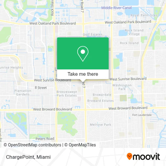
ChargePoint Address: 925 N State Road 7 Fort Lauderdale, FL 33317 street in Plantation
- State Road 7 & West Sunrise Boulevard,
- W Sunrise Blvd & 441,
- State Road 7 & West Sunrise Boulevard,
- Central Broward Regional Park,
- Lauderhill Central Park Library,
- Naples, Florida,
- Lauderhill Mall Terminal - (Bay 1 - Rt40),
- T-Mobile,
- E-Z Cuts Barbers,
- Uncle Bucks Lauderhill,
- W Sunrise Blvd / NW 47th Ave,
- Lauderhill Mall,
- Metro Plus,
- Goodwill - Lauderhill,
- Swap Shop,
- State Road 7 & Northwest 16th Street,
- Plantation City of,
- City of Plantation,
- Florida Turnpike Sunrise Blvd. Toll Plaza,
- Swap Shop Drive In
Places Near ChargePoint (Plantation)
- Miami Design District, Miami,
- Little Havana, Miami,
- Brickell City Centre, Miami,
- Keiser University Flagship Campus, West Palm Beach,
- Miami VA Hospital, Miami,
- Bayside Marketplace, Miami,
- Zoo Miami, Miami,
- Dolphin Mall Bus, Miami,
- Port of Miami Cruise Terminal, Miami,
- Miami-Dade County Courthouse, Miami,
- Aventura Mall, Miami Beach,
- Wynwood, Miami,
- Sawgrass Mall, Miami,
- Richard E. Gerstein Justice Building, Miami,
- Hard Rock Stadium, Miami Gardens,
- Dolphin Mall, Miami,
- Miami Freedom Park, Miami,
- Aventura Mall, Miami,
- Marlins Park, Miami,
- Sawgrass mall ( FL ), Miami Beach
How to get to popular places in Miami with public transit
Get around Plantation by public transit!
Traveling around Plantation has never been so easy. See step by step directions as you travel to any attraction, street or major public transit station. View bus and train schedules, arrival times, service alerts and detailed routes on a map, so you know exactly how to get to anywhere in Plantation.
When traveling to any destination around Plantation use Moovit's Live Directions with Get Off Notifications to know exactly where and how far to walk, how long to wait for your line, and how many stops are left. Moovit will alert you when it's time to get off — no need to constantly re-check whether yours is the next stop.
Wondering how to use public transit in Plantation or how to pay for public transit in Plantation? Moovit public transit app can help you navigate your way with public transit easily, and at minimum cost. It includes public transit fees, ticket prices, and costs. Looking for a map of Plantation public transit lines? Moovit public transit app shows all public transit maps in Plantation with all Bus, Train, Light Rail and Ferry routes and stops on an interactive map.
Miami has 4 transit type(s), including: Bus, Train, Light Rail and Ferry, operated by several transit agencies, including Broward County Transit, Miami-Dade Transit, Metrorail, Palm Tran, Tri-Rail, Brightline, MARTY, City of Homestead Trolley, Key West Transit, Treasure Coast Connector, GoLine IRT, Amtrak, Greyhound-us, FlixBus-us and Aventura Express Shuttle Bus