How to get to ChargePoint by bus?
Click on the bus route to see step by step directions with maps, line arrival times and updated time schedules.
From Keiser University Flagship Campus, West Palm Beach
51 minFrom Palm Beach County Courthouse, Court Room 4C, West Palm Beach
48 minFrom St. Mary's Medical Center, West Palm Beach
44 minFrom Tri-Rail-Mangonia Park Station, West Palm Beach
46 minFrom Tri-Rail-West Palm Beach Station, West Palm Beach
52 minFrom Palm Beach County Courthouse Jurors Assembly Room, West Palm Beach
49 minFrom I-95, West Palm Beach
50 minFrom Good Samaritan Hospital, West Palm Beach
46 minFrom William T. Dwyer High School, Jupiter
66 minFrom Singer Island, Riviera Beach
48 min
Bus stop near ChargePoint in Riviera Beach
- NORTHLAKE BLVD at SUNRISE DR, 2 min walk,VIEW
Bus lines to ChargePoint in Riviera Beach
- 33, Rt 33 Northbound,VIEW
What are the closest stations to ChargePoint?
The closest stations to ChargePoint are:
- NORTHLAKE BLVD at SUNRISE DR is 122 yards away, 2 min walk.
Which bus lines stop near ChargePoint?
These bus lines stop near ChargePoint: 3, 33.
What’s the nearest bus station to ChargePoint in Riviera Beach?
The nearest bus station to ChargePoint in Riviera Beach is NORTHLAKE BLVD at SUNRISE DR. It’s a 2 min walk away.
What time is the first bus to ChargePoint in Riviera Beach?
The 33 is the first bus that goes to ChargePoint in Riviera Beach. It stops nearby at 6:29 AM.
What time is the last bus to ChargePoint in Riviera Beach?
The 33 is the last bus that goes to ChargePoint in Riviera Beach. It stops nearby at 9:29 PM.
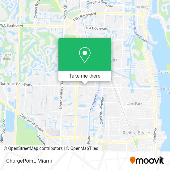
See ChargePoint, Riviera Beach, on the map
Public Transit to ChargePoint in Riviera Beach
Wondering how to get to ChargePoint in Riviera Beach? Moovit helps you find the best way to get to ChargePoint with step-by-step directions from the nearest public transit station.
Moovit provides free maps and live directions to help you navigate through your city. View schedules, routes, timetables, and find out how long does it take to get to ChargePoint in real time.
Looking for the nearest stop or station to ChargePoint? Check out this list of stops closest to your destination: NORTHLAKE BLVD at SUNRISE DR.
Bus: 3, 33.
Want to see if there’s another route that gets you there at an earlier time? Moovit helps you find alternative routes or times. Get directions from and directions to ChargePoint easily from the Moovit App or Website.
We make riding to ChargePoint easy, which is why over 1.5 million users, including users in Riviera Beach, trust Moovit as the best app for public transit. You don’t need to download an individual bus app or train app, Moovit is your all-in-one transit app that helps you find the best bus time or train time available.
For information on prices of bus, costs and ride fares to ChargePoint, please check the Moovit app.
Use the app to navigate to popular places including to the airport, hospital, stadium, grocery store, mall, coffee shop, school, college, and university.
ChargePoint Address: 3703 Northlake Blvd West Palm Beach, FL 33403 street in Riviera Beach
- Napleton's North Palm RAM,
- Napleton's North Palm Napleton Fleet Group DODGE,
- Halloween Express,
- Mavis Discount Tire,
- Volkswagen of North Palm Beach Parts Department,
- TACO BELL,
- Simply Sweet Affairs,
- Laser Professionals,
- Yudy's Queen Nails,
- STARBUCKS,
- Curaleaf - Palm Beach Gardens - Now Open,
- Cosmocouture Hair Salon,
- Ezra Locksmith,
- Storquest Self Storage,
- Diamond Behavioral Health,
- Cornerstone Counseling,
- Carl Campbell Attorney,
- Betsy Michelena LCSW Cap,
- Brisk Rheem Air Conditioners,
- Claudia E Russell LCSW
Places Near ChargePoint (Riviera Beach)
- Little Havana, Miami,
- Wynwood, Miami,
- Brickell City Centre, Miami,
- Aventura Mall, Miami Beach,
- Sawgrass mall ( FL ), Miami Beach,
- Miami-Dade County Courthouse, Miami,
- Keiser University Flagship Campus, West Palm Beach,
- Zoo Miami, Miami,
- Miami Design District, Miami,
- Richard E. Gerstein Justice Building, Miami,
- Port of Miami Cruise Terminal, Miami,
- Bayside Marketplace, Miami,
- Marlins Park, Miami,
- Aventura Mall, Miami,
- Miami Freedom Park, Miami,
- Sawgrass Mall, Miami,
- Dolphin Mall, Miami,
- Dolphin Mall Bus, Miami,
- Hard Rock Stadium, Miami Gardens,
- Miami VA Hospital, Miami
How to get to popular places in Miami with public transit
Get around Riviera Beach by public transit!
Traveling around Riviera Beach has never been so easy. See step by step directions as you travel to any attraction, street or major public transit station. View bus and train schedules, arrival times, service alerts and detailed routes on a map, so you know exactly how to get to anywhere in Riviera Beach.
When traveling to any destination around Riviera Beach use Moovit's Live Directions with Get Off Notifications to know exactly where and how far to walk, how long to wait for your line, and how many stops are left. Moovit will alert you when it's time to get off — no need to constantly re-check whether yours is the next stop.
Wondering how to use public transit in Riviera Beach or how to pay for public transit in Riviera Beach? Moovit public transit app can help you navigate your way with public transit easily, and at minimum cost. It includes public transit fees, ticket prices, and costs. Looking for a map of Riviera Beach public transit lines? Moovit public transit app shows all public transit maps in Riviera Beach with all Bus, Train, Light Rail and Ferry routes and stops on an interactive map.
Miami has 4 transit type(s), including: Bus, Train, Light Rail and Ferry, operated by several transit agencies, including Broward County Transit, Miami-Dade Transit, Metrorail, Palm Tran, Tri-Rail, Brightline, MARTY, City of Homestead Trolley, Key West Transit, Treasure Coast Connector, GoLine IRT, Amtrak, Greyhound-us, FlixBus-us and Aventura Express Shuttle Bus