How to get to ChargePoint by bus?
Click on the bus route to see step by step directions with maps, line arrival times and updated time schedules.
From El Guanaco Salvadorian Restaurant, Ceres
52 minFrom Hughson, CA, Hughson
66 minFrom Nor-Cal Painting, Ceres
53 minFrom Luxury Spa and Nails, Ceres
56 minFrom RJ Machining, Ceres
64 minFrom Roeding Rd Building 2535, Ceres
54 minFrom La Placita Michoacan, Ceres
52 minFrom Charles F Voss, Hughson
79 minFrom Certify Central Valley Sterile Processing Program, Ceres
53 min
Bus stops near ChargePoint in Turlock
Bus lines to ChargePoint in Turlock
What are the closest stations to ChargePoint?
The closest stations to ChargePoint are:
- Countryside & Shetland is 1295 yards away, 16 min walk.
- W Monte Vista Ave & Countryside Dr is 1379 yards away, 17 min walk.
- Countryside & Monte Vista Crossings is 1835 yards away, 22 min walk.
- Golden State & Monte Vista is 1994 yards away, 24 min walk.
Which bus lines stop near ChargePoint?
These bus lines stop near ChargePoint: 1, 29T.
What time is the first bus to ChargePoint in Turlock?
The 10 is the first bus that goes to ChargePoint in Turlock. It stops nearby at 5:45 AM.
What time is the last bus to ChargePoint in Turlock?
The 10 is the last bus that goes to ChargePoint in Turlock. It stops nearby at 10:03 PM.
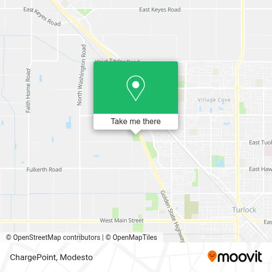
See ChargePoint, Turlock, on the map
Public Transit to ChargePoint in Turlock
Wondering how to get to ChargePoint in Turlock? Moovit helps you find the best way to get to ChargePoint with step-by-step directions from the nearest public transit station.
Moovit provides free maps and live directions to help you navigate through your city. View schedules, routes, timetables, and find out how long does it take to get to ChargePoint in real time.
Looking for the nearest stop or station to ChargePoint? Check out this list of stops closest to your destination: Countryside & Shetland; W Monte Vista Ave & Countryside Dr; Countryside & Monte Vista Crossings; Golden State & Monte Vista.
Bus: 1, 29T, 10, 2, 3.
Want to see if there’s another route that gets you there at an earlier time? Moovit helps you find alternative routes or times. Get directions from and directions to ChargePoint easily from the Moovit App or Website.
We make riding to ChargePoint easy, which is why over 1.5 million users, including users in Turlock, trust Moovit as the best app for public transit. You don’t need to download an individual bus app or train app, Moovit is your all-in-one transit app that helps you find the best bus time or train time available.
For information on prices of bus, costs and ride fares to ChargePoint, please check the Moovit app.
Use the app to navigate to popular places including to the airport, hospital, stadium, grocery store, mall, coffee shop, school, college, and university.
ChargePoint Address: 2400 N Tegner Rd Turlock, CA 95380 street in Turlock
- City of Turlock Pedretti Sports Complex,
- The North Face,
- SKECHERS Warehouse Outlet,
- In-Shape,
- In-Shape Family Fitness,
- Columbia,
- Geostix,
- Ecco,
- HomeGoods,
- Charlotte Tilbury,
- Wetzel's Pretzels,
- The TJX Companies,
- Samsonite,
- Amazon Locker-Cornice,
- Five Below,
- Costco Tire Center,
- Royal Insurance Agency,
- Congs Nails and Spa,
- Petco,
- Liz Garcia - Chase Home Lending Advisor - NMLS ID
Places Near ChargePoint (Turlock)
- Newman CA USA, Newman,
- Modesto Amtrak (MOD),
- Black Oak Casino,
- Patterson,
- Modesto, Ca,
- Kaiser Permanente Modesto Medical Center,
- Ceres CA USA, Ceres,
- DMV,
- Modesto Junior College,
- Costco Wholesale, Turlock,
- Amazon Fulfillment Center,
- Modesto Junior College-East Campus,
- Modesto, ca,
- Modesto Junior College - West Campus, Modesto,
- Turlock, CA, Turlock,
- Tesla,
- Highway 99 South -Traffic,
- Walmart,
- Salida, Ca, Salida,
- Vintage Faire Mall
How to get to popular places in Modesto with public transit
Get around Turlock by public transit!
Traveling around Turlock has never been so easy. See step by step directions as you travel to any attraction, street or major public transit station. View bus and train schedules, arrival times, service alerts and detailed routes on a map, so you know exactly how to get to anywhere in Turlock.
When traveling to any destination around Turlock use Moovit's Live Directions with Get Off Notifications to know exactly where and how far to walk, how long to wait for your line, and how many stops are left. Moovit will alert you when it's time to get off — no need to constantly re-check whether yours is the next stop.
Wondering how to use public transit in Turlock or how to pay for public transit in Turlock? Moovit public transit app can help you navigate your way with public transit easily, and at minimum cost. It includes public transit fees, ticket prices, and costs. Looking for a map of Turlock public transit lines? Moovit public transit app shows all public transit maps in Turlock with all bus routes and stops on an interactive map.
Modesto has 1 transit type(s), including: bus, operated by several transit agencies, including The S, Turlock Transit, Greyhound-us and FlixBus-us