Directions to ChargePoint (Portland, ME) with public transportation
The following transit lines have routes that pass near ChargePoint
 Bus: BRZ, FLIXBUS N2615.
- Train: DOWNEASTER.
How to get to ChargePoint by bus?
Click on the bus route to see step by step directions with maps, line arrival times and updated time schedules.
How to get to ChargePoint by train?
Click on the train route to see step by step directions with maps, line arrival times and updated time schedules.
Bus stops near ChargePoint in Portland, ME
Train station near ChargePoint in Portland, ME
- Brunswick Amtrak Station, 46 min walk,VIEW
Bus lines to ChargePoint in Portland, ME
What are the closest stations to ChargePoint?
The closest stations to ChargePoint are:
- Brunswick Park & Ride is 122 yards away, 2 min walk.
- Brunswick Station (Maine) is 756 yards away, 9 min walk.
- Brunswick Amtrak Station is 3958 yards away, 46 min walk.
Which bus line stops near ChargePoint?
BRZ (Thompson's Point→Brunswick Train Station)
Which train line stops near ChargePoint?
DOWNEASTER (Boston→Brunswick Amtrak Station)
What’s the nearest bus station to ChargePoint in Portland, ME?
The nearest bus station to ChargePoint in Portland, ME is Brunswick Park & Ride. It’s a 2 min walk away.
What time is the first train to ChargePoint in Portland, ME?
The DOWNEASTER is the first train that goes to ChargePoint in Portland, ME. It stops nearby at 4:30 AM.
What time is the last train to ChargePoint in Portland, ME?
The DOWNEASTER is the last train that goes to ChargePoint in Portland, ME. It stops nearby at 1:45 AM.
What time is the first bus to ChargePoint in Portland, ME?
The BRZ is the first bus that goes to ChargePoint in Portland, ME. It stops nearby at 5:45 AM.
What time is the last bus to ChargePoint in Portland, ME?
The FLIXBUS N2615 is the last bus that goes to ChargePoint in Portland, ME. It stops nearby at 7:50 AM.
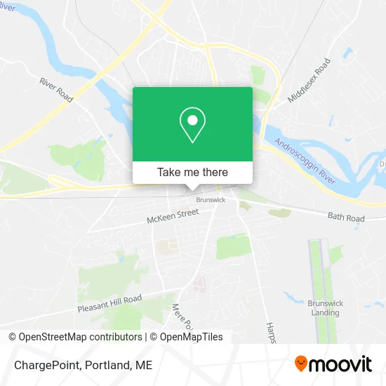
See ChargePoint, Portland, ME, on the map
Public Transit to ChargePoint in Portland, ME
Wondering how to get to ChargePoint in Portland, ME? Moovit helps you find the best way to get to ChargePoint with step-by-step directions from the nearest public transit station.
Moovit provides free maps and live directions to help you navigate through your city. View schedules, routes, timetables, and find out how long does it take to get to ChargePoint in real time.
Looking for the nearest stop or station to ChargePoint? Check out this list of stops closest to your destination: Brunswick Park & Ride; Brunswick Station (Maine); Brunswick Amtrak Station.
Bus: BRZ, FLIXBUS N2615.Train: DOWNEASTER.
Want to see if there’s another route that gets you there at an earlier time? Moovit helps you find alternative routes or times. Get directions from and directions to ChargePoint easily from the Moovit App or Website.
We make riding to ChargePoint easy, which is why over 1.5 million users, including users in Portland, ME, trust Moovit as the best app for public transit. You don’t need to download an individual bus app or train app, Moovit is your all-in-one transit app that helps you find the best bus time or train time available.
For information on prices of bus and train, costs and ride fares to ChargePoint, please check the Moovit app.
Use the app to navigate to popular places including to the airport, hospital, stadium, grocery store, mall, coffee shop, school, college, and university.
ChargePoint Address: Cedar St Brunswick, ME 04011 street in Portland, ME
- Flanagan Painting,
- Fat Puppy Fusion,
- True Value,
- J.H. Birkett, CPA,
- Catlin Edgar S III Attorney,
- Maine State Law,
- Coast & Country Appraisals,
- Rentex,
- Coldwell Banker,
- Catherine Worthington,
- Cunningham John A Attorney,
- Coinstar - Bitcoin ATM,
- Atlantic FCU,
- April Caron at Edward Jones,
- Maine-Ly Beef Management,
- US Navy Recruiting Office,
- Gentle Dental,
- Maine Beancounters,
- Orthopedic Associates,
- Brunswick Station
Places Near ChargePoint (Portland, ME)
- Exit 45 Park And Ride, South Portland,
- Cape Elizabeth, ME, Cape Elizabeth,
- Maine Medical Center,
- Clarion Hotel Portland,
- The Old Port,
- Walmart,
- Mercy Hospital - Fore River Campus,
- Cross Insurance Arena,
- Fort Gorges,
- Fort Williams Park, Cape Elizabeth,
- L. L. Bean Outlet,
- On a bus to Kennebunkport,
- Portland International Jetport (PWM) (Portland International Jetport),
- Jewell Island,
- Portland Transportation Center,
- ZzZzZzZzZzZ, Westbrook,
- Casco Bay Ferry Terminal,
- Southern Maine Community College, South Portland,
- Walmart Scarborough Supercenter,
- House Island
How to get to popular places in Portland, ME with public transit
Get around Portland, ME by public transit!
Traveling around Portland, ME has never been so easy. See step by step directions as you travel to any attraction, street or major public transit station. View bus and train schedules, arrival times, service alerts and detailed routes on a map, so you know exactly how to get to anywhere in Portland, ME.
When traveling to any destination around Portland, ME use Moovit's Live Directions with Get Off Notifications to know exactly where and how far to walk, how long to wait for your line, and how many stops are left. Moovit will alert you when it's time to get off — no need to constantly re-check whether yours is the next stop.
Wondering how to use public transit in Portland, ME or how to pay for public transit in Portland, ME? Moovit public transit app can help you navigate your way with public transit easily, and at minimum cost. It includes public transit fees, ticket prices, and costs. Looking for a map of Portland, ME public transit lines? Moovit public transit app shows all public transit maps in Portland, ME with all Bus, Train and Ferry routes and stops on an interactive map.
Portland, ME has 3 transit type(s), including: Bus, Train and Ferry, operated by several transit agencies, including Greater Portland Metro, City of South Portland, Biddeford Saco Old Orchard Beach Transit, Casco Bay Lines, Amtrak, Greyhound-us and FlixBus-us