How to get to ChargePoint by bus?
Click on the bus route to see step by step directions with maps, line arrival times and updated time schedules.
From Lake Fairfax Park, Fairfax County
84 minFrom Centreville, VA, Fairfax County
63 minFrom Ashby Ponds, Loudoun County
97 minFrom Fairfax County Government Center, Fairfax County
72 minFrom Hollywood Casino at Charles Town Races, Fairfax County
78 minFrom Spa World, Fairfax County
67 minFrom Arabx Com Inc, Fairfax County
102 minFrom Dulles Expo Center, Fairfax County
66 minFrom Fair Oaks Mall, Fairfax County
86 minFrom Sterling VA USA, Loudoun County
54 min
Bus stop near ChargePoint in Fairfax County
- Sunrise Valley @ Dulles Town Blvd, 2 min walk,VIEW
Metro station near ChargePoint in Fairfax County
- Herndon, 41 min walk,VIEW
Bus lines to ChargePoint in Fairfax County
- 983, 983 Air And Space Museum,VIEW
What are the closest stations to ChargePoint?
The closest stations to ChargePoint are:
- Sunrise Valley @ Dulles Town Blvd is 112 yards away, 2 min walk.
- Herndon is 3459 yards away, 41 min walk.
Which bus lines stop near ChargePoint?
These bus lines stop near ChargePoint: 321, 901, 937, 951, 983.
What’s the nearest bus station to ChargePoint in Fairfax County?
The nearest bus station to ChargePoint in Fairfax County is Sunrise Valley @ Dulles Town Blvd. It’s a 2 min walk away.
What time is the first metro to ChargePoint in Fairfax County?
The SILVER is the first metro that goes to ChargePoint in Fairfax County. It stops nearby at 5:04 AM.
What time is the last metro to ChargePoint in Fairfax County?
The SILVER is the last metro that goes to ChargePoint in Fairfax County. It stops nearby at 12:58 AM.
What time is the first bus to ChargePoint in Fairfax County?
The 983 is the first bus that goes to ChargePoint in Fairfax County. It stops nearby at 5:46 AM.
What time is the last bus to ChargePoint in Fairfax County?
The 983 is the last bus that goes to ChargePoint in Fairfax County. It stops nearby at 7:19 PM.
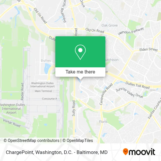
See ChargePoint, Fairfax County, on the map
Public Transit to ChargePoint in Fairfax County
Wondering how to get to ChargePoint in Fairfax County? Moovit helps you find the best way to get to ChargePoint with step-by-step directions from the nearest public transit station.
Moovit provides free maps and live directions to help you navigate through your city. View schedules, routes, timetables, and find out how long does it take to get to ChargePoint in real time.
Looking for the nearest stop or station to ChargePoint? Check out this list of stops closest to your destination: Sunrise Valley @ Dulles Town Blvd; Herndon.
Bus: 321, 901, 937, 951, 983.Metro: SILVER.
Want to see if there’s another route that gets you there at an earlier time? Moovit helps you find alternative routes or times. Get directions from and directions to ChargePoint easily from the Moovit App or Website.
We make riding to ChargePoint easy, which is why over 1.5 million users, including users in Fairfax County, trust Moovit as the best app for public transit. You don’t need to download an individual bus app or train app, Moovit is your all-in-one transit app that helps you find the best bus time or train time available.
For information on prices of bus and metro, costs and ride fares to ChargePoint, please check the Moovit app.
Use the app to navigate to popular places including to the airport, hospital, stadium, grocery store, mall, coffee shop, school, college, and university.
ChargePoint Address: 13820 Dulles Corner Park Herndon, VA 20171 street in Fairfax County
- The Westin Washington Dulles Airport Herndon,
- Sunrise Valley Dr and Dulles,
- Blink Charging,
- Mariner,
- Quntech,
- Aquila Software,
- Acano Federal,
- Dulles Corner Baseball Field,
- COURTYARD by Marriott Dulles Airport Herndon,
- Hyatt Place Herndon / Dulles Airport - East,
- Staybridge Suites Herndon-Dulles,
- The Courts at Dulles,
- Presidents Park Parking,
- Yasabe, Inc,
- FedEx,
- Idirect,
- Sonesta es Suites Dulles Airport,
- Stanley Martin Homes at Liberty Park,
- RKB Dulles Tech,
- Coppermine Crossing
Places Near ChargePoint (Fairfax County)
- Sibley Memorial Hospital, Washington,
- Pennsylvania Ave NW (3rd st and pennsylvania), Washington,
- Washington National Cathedral, Washington,
- Georgetown, Washington,
- Warner Theatre, Washington,
- National Theatre, Washington,
- Capital One Arena, Washington,
- Amazon Hq2, Arlington County,
- The Anthem, Washington,
- National Museum of African American History and Culture, Washington,
- National Zoo, Washington,
- Rock Creek Tennis Center, Washington,
- Basilica of the National Shrine, Washington,
- Museum Of The Bible, Washington,
- Washington DC VA Medical Center, Washington,
- Westfield Montgomery Mall, Montgomery County,
- Camden Yards, Baltimore,
- Marriott Marquis Washington, DC, Washington,
- PG Mall, Prince George's County,
- M&T Bank Stadium, Baltimore
How to get to popular places in Washington, D.C. - Baltimore, MD with public transit
Get around Fairfax County by public transit!
Traveling around Fairfax County has never been so easy. See step by step directions as you travel to any attraction, street or major public transit station. View bus and train schedules, arrival times, service alerts and detailed routes on a map, so you know exactly how to get to anywhere in Fairfax County.
When traveling to any destination around Fairfax County use Moovit's Live Directions with Get Off Notifications to know exactly where and how far to walk, how long to wait for your line, and how many stops are left. Moovit will alert you when it's time to get off — no need to constantly re-check whether yours is the next stop.
Wondering how to use public transit in Fairfax County or how to pay for public transit in Fairfax County? Moovit public transit app can help you navigate your way with public transit easily, and at minimum cost. It includes public transit fees, ticket prices, and costs. Looking for a map of Fairfax County public transit lines? Moovit public transit app shows all public transit maps in Fairfax County with all Bus, Train, Metro, Light Rail and Ferry routes and stops on an interactive map.
Washington, D.C. - Baltimore, MD has 5 transit type(s), including: Bus, Train, Metro, Light Rail and Ferry, operated by several transit agencies, including WMATA, Montgomery County Ride On, Fairfax Connector, TheBus, PRTC, DASH - Alexandria, Arlington Transit (ART), RTA of Central Maryland, MDOT MTA, MDOT MTA Light RailLink, MDOT MTA Commuter Bus, MDOT MTA Local Bus, FXBGO!, Virginia Railway Express (VRE) and MARC