Directions to ChargePoint (Frederick) with public transportation
The following transit lines have routes that pass near ChargePoint
How to get to ChargePoint by bus?
Click on the bus route to see step by step directions with maps, line arrival times and updated time schedules.
From Montgomery Village, Maryland, Montgomery County
115 minFrom I-270 Exit 10 (Clopper Rd. / West Diamond Ave.), Montgomery County
99 minFrom Montgomery County Fairgrounds, Montgomery County
132 minFrom Kaiser Permanente - Gaithersburg Medical Center, Montgomery County
134 minFrom Germantown, Maryland, Montgomery County
150 minFrom Astrazeneca HQ, Montgomery County
110 minFrom Walmart Supercenter, Montgomery County
157 minFrom Clarksburg Premium Outlets, Montgomery County
329 minFrom Clarksburg Premium Outlets, Montgomery County
154 min
Bus stops near ChargePoint in Frederick
Bus lines to ChargePoint in Frederick
What are the closest stations to ChargePoint?
The closest stations to ChargePoint are:
- Waterside Drive at Village Square Road (Worman's Mill) is 502 yards away, 6 min walk.
- Mill Pond Road at Dales is 1302 yards away, 16 min walk.
- Wal-Mart (Frederick Trading Center) is 1509 yards away, 18 min walk.
Which bus line stops near ChargePoint?
515 (515/7 North Frederick Park & Ride)
What’s the nearest bus station to ChargePoint in Frederick?
The nearest bus station to ChargePoint in Frederick is Waterside Drive at Village Square Road (Worman's Mill). It’s a 6 min walk away.
What time is the first bus to ChargePoint in Frederick?
The WALKERSVILLE MEET-THE-MARC SHUTTLE is the first bus that goes to ChargePoint in Frederick. It stops nearby at 5:33 AM.
What time is the last bus to ChargePoint in Frederick?
The 65 is the last bus that goes to ChargePoint in Frederick. It stops nearby at 9:58 PM.
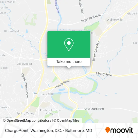
See ChargePoint, Frederick, on the map
Public Transit to ChargePoint in Frederick
Wondering how to get to ChargePoint in Frederick? Moovit helps you find the best way to get to ChargePoint with step-by-step directions from the nearest public transit station.
Moovit provides free maps and live directions to help you navigate through your city. View schedules, routes, timetables, and find out how long does it take to get to ChargePoint in real time.
Looking for the nearest stop or station to ChargePoint? Check out this list of stops closest to your destination: Waterside Drive at Village Square Road (Worman's Mill); Mill Pond Road at Dales; Wal-Mart (Frederick Trading Center).
Bus: 515, NORTH FREDERICK SHUTTLE, WALKERSVILLE MEET-THE-MARC SHUTTLE, EMMITSBURG THURMONT SHUTTLE, 65.
Want to see if there’s another route that gets you there at an earlier time? Moovit helps you find alternative routes or times. Get directions from and directions to ChargePoint easily from the Moovit App or Website.
We make riding to ChargePoint easy, which is why over 1.5 million users, including users in Frederick, trust Moovit as the best app for public transit. You don’t need to download an individual bus app or train app, Moovit is your all-in-one transit app that helps you find the best bus time or train time available.
For information on prices of bus, costs and ride fares to ChargePoint, please check the Moovit app.
Use the app to navigate to popular places including to the airport, hospital, stadium, grocery store, mall, coffee shop, school, college, and university.
ChargePoint Address: 2250 Bear Den Rd Frederick, MD 21701 street in Frederick
- Elite Mobile Detail,
- Relm Transportation,
- Snack Boutique,
- The Village 55+ Apartments at Worman's Mill,
- Ricci Restaurant,
- Sweethaus Treats,
- Quick Wildlife Control,
- Park Place Pals,
- Excalibur Sharpening Service,
- Squeezinart,
- Charley Packard Square Dancing,
- Lacy Ames- FWRFC P,
- Park Place,
- Mavis Discount Tire,
- Hill Manufacturing,
- First National Bank ATM,
- Secu ATM,
- Coinstar - Bitcoin ATM,
- Skilled Plumbing Service,
- Onepursuing Fitness
Places Near ChargePoint (Frederick)
- PG Mall, Prince George's County,
- Camden Yards, Baltimore,
- National Zoo, Washington,
- Rock Creek Tennis Center, Washington,
- Washington National Cathedral, Washington,
- Pennsylvania Ave NW (3rd st and pennsylvania), Washington,
- Museum Of The Bible, Washington,
- The Anthem, Washington,
- Washington DC VA Medical Center, Washington,
- M&T Bank Stadium, Baltimore,
- Georgetown, Washington,
- Capital One Arena, Washington,
- Warner Theatre, Washington,
- Amazon Hq2, Arlington County,
- National Museum of African American History and Culture, Washington,
- Sibley Memorial Hospital, Washington,
- Marriott Marquis Washington, DC, Washington,
- Basilica of the National Shrine, Washington,
- Westfield Montgomery Mall, Montgomery County,
- National Mall, Washington
How to get to popular places in Washington, D.C. - Baltimore, MD with public transit
Get around Frederick by public transit!
Traveling around Frederick has never been so easy. See step by step directions as you travel to any attraction, street or major public transit station. View bus and train schedules, arrival times, service alerts and detailed routes on a map, so you know exactly how to get to anywhere in Frederick.
When traveling to any destination around Frederick use Moovit's Live Directions with Get Off Notifications to know exactly where and how far to walk, how long to wait for your line, and how many stops are left. Moovit will alert you when it's time to get off — no need to constantly re-check whether yours is the next stop.
Wondering how to use public transit in Frederick or how to pay for public transit in Frederick? Moovit public transit app can help you navigate your way with public transit easily, and at minimum cost. It includes public transit fees, ticket prices, and costs. Looking for a map of Frederick public transit lines? Moovit public transit app shows all public transit maps in Frederick with all Bus, Train, Metro, Light Rail and Ferry routes and stops on an interactive map.
Washington, D.C. - Baltimore, MD has 5 transit type(s), including: Bus, Train, Metro, Light Rail and Ferry, operated by several transit agencies, including WMATA, Montgomery County Ride On, Fairfax Connector, TheBus, PRTC, DASH - Alexandria, Arlington Transit (ART), RTA of Central Maryland, MDOT MTA, MDOT MTA Light RailLink, MDOT MTA Commuter Bus, MDOT MTA Local Bus, FXBGO!, Virginia Railway Express (VRE) and MARC