How to get to ChargePoint by bus?
Click on the bus route to see step by step directions with maps, line arrival times and updated time schedules.
From Centreville, VA, Fairfax County
67 minFrom Fairfax County Government Center, Fairfax County
63 minFrom Northern Virginia Community College - Loudoun Campus, Loudoun County
52 minFrom Chantilly, VA, Fairfax County
30 minFrom National Reconnaissance Office, Fairfax County
41 minFrom Fair Oaks Mall, Fairfax County
58 minFrom Dulles Expo Center, Fairfax County
54 minFrom Oakton, Virginia, Fairfax County
83 minFrom Spa World, Fairfax County
71 minFrom Sterling VA USA, Loudoun County
58 min
Bus stops near ChargePoint in Fairfax County
Metro station near ChargePoint in Fairfax County
- Reston Town Center, 27 min walk,VIEW
Bus lines to ChargePoint in Fairfax County
What are the closest stations to ChargePoint?
The closest stations to ChargePoint are:
- Thomas Jefferson Dr @ Jefferson Com is 4 yards away, 1 min walk.
- Sunrise Valley @ Wood Oak Dr W is 144 yards away, 2 min walk.
- Centreville Rd @ Woodland Park Rd is 540 yards away, 7 min walk.
- Reston Town Center is 2240 yards away, 27 min walk.
Which bus lines stop near ChargePoint?
These bus lines stop near ChargePoint: 901, 950.
What’s the nearest metro station to ChargePoint in Fairfax County?
The nearest metro station to ChargePoint in Fairfax County is Reston Town Center. It’s a 27 min walk away.
What’s the nearest bus station to ChargePoint in Fairfax County?
The nearest bus station to ChargePoint in Fairfax County is Thomas Jefferson Dr @ Jefferson Com. It’s a 1 min walk away.
What time is the first metro to ChargePoint in Fairfax County?
The SILVER is the first metro that goes to ChargePoint in Fairfax County. It stops nearby at 5:04 AM.
What time is the last metro to ChargePoint in Fairfax County?
The SILVER is the last metro that goes to ChargePoint in Fairfax County. It stops nearby at 12:58 AM.
What time is the first bus to ChargePoint in Fairfax County?
The 950 is the first bus that goes to ChargePoint in Fairfax County. It stops nearby at 4:15 AM.
What time is the last bus to ChargePoint in Fairfax County?
The 950 is the last bus that goes to ChargePoint in Fairfax County. It stops nearby at 1:22 AM.
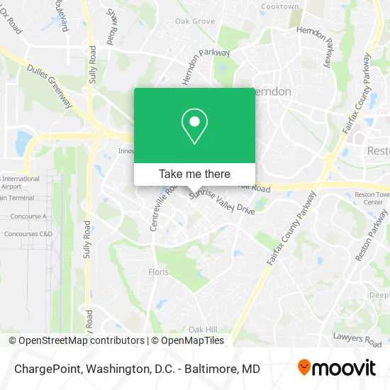
See ChargePoint, Fairfax County, on the map
Public Transit to ChargePoint in Fairfax County
Wondering how to get to ChargePoint in Fairfax County? Moovit helps you find the best way to get to ChargePoint with step-by-step directions from the nearest public transit station.
Moovit provides free maps and live directions to help you navigate through your city. View schedules, routes, timetables, and find out how long does it take to get to ChargePoint in real time.
Looking for the nearest stop or station to ChargePoint? Check out this list of stops closest to your destination: Thomas Jefferson Dr @ Jefferson Com; Sunrise Valley @ Wood Oak Dr W; Centreville Rd @ Woodland Park Rd; Reston Town Center.
Bus: 901, 950, 937, 951, 983.Metro: SILVER.
Want to see if there’s another route that gets you there at an earlier time? Moovit helps you find alternative routes or times. Get directions from and directions to ChargePoint easily from the Moovit App or Website.
We make riding to ChargePoint easy, which is why over 1.5 million users, including users in Fairfax County, trust Moovit as the best app for public transit. You don’t need to download an individual bus app or train app, Moovit is your all-in-one transit app that helps you find the best bus time or train time available.
For information on prices of bus, costs and ride fares to ChargePoint, please check the Moovit app.
Use the app to navigate to popular places including to the airport, hospital, stadium, grocery store, mall, coffee shop, school, college, and university.
ChargePoint Address: 2369 Rolling Fork Cir Herndon, VA 20171 street in Fairfax County
- L2t LLC,
- Chesapeake Contracting Group,
- Blink Charging,
- The Point at Ridgeline,
- PVK Corporation,
- Eugene's,
- Embassy Suites by Hilton Dulles Airport,
- The Jungle,
- Bus stop - Herndon Clock Tower,
- Marty's,
- Ryan Homes,
- Aims India Foundation,
- Divakaari,
- Taco Bamba,
- Cheap Locksmith Herndon,
- Snuggle Lodge,
- Stanley Martin Homes,
- Bridged Design,
- Salem Infotech,
- Falcontek
Places Near ChargePoint (Fairfax County)
- M&T Bank Stadium, Baltimore,
- Amazon Hq2, Arlington County,
- Rock Creek Tennis Center, Washington,
- National Mall, Washington,
- Pennsylvania Ave NW (3rd st and pennsylvania), Washington,
- Sibley Memorial Hospital, Washington,
- National Museum of African American History and Culture, Washington,
- Marriott Marquis Washington, DC, Washington,
- Basilica of the National Shrine, Washington,
- National Zoo, Washington,
- The Anthem, Washington,
- Warner Theatre, Washington,
- Camden Yards, Baltimore,
- PG Mall, Prince George's County,
- Capital One Arena, Washington,
- Washington DC VA Medical Center, Washington,
- Westfield Montgomery Mall, Montgomery County,
- Museum Of The Bible, Washington,
- Georgetown, Washington,
- Washington National Cathedral, Washington
How to get to popular places in Washington, D.C. - Baltimore, MD with public transit
Get around Fairfax County by public transit!
Traveling around Fairfax County has never been so easy. See step by step directions as you travel to any attraction, street or major public transit station. View bus and train schedules, arrival times, service alerts and detailed routes on a map, so you know exactly how to get to anywhere in Fairfax County.
When traveling to any destination around Fairfax County use Moovit's Live Directions with Get Off Notifications to know exactly where and how far to walk, how long to wait for your line, and how many stops are left. Moovit will alert you when it's time to get off — no need to constantly re-check whether yours is the next stop.
Wondering how to use public transit in Fairfax County or how to pay for public transit in Fairfax County? Moovit public transit app can help you navigate your way with public transit easily, and at minimum cost. It includes public transit fees, ticket prices, and costs. Looking for a map of Fairfax County public transit lines? Moovit public transit app shows all public transit maps in Fairfax County with all Bus, Train, Metro, Light Rail and Ferry routes and stops on an interactive map.
Washington, D.C. - Baltimore, MD has 5 transit type(s), including: Bus, Train, Metro, Light Rail and Ferry, operated by several transit agencies, including WMATA, Montgomery County Ride On, Fairfax Connector, TheBus, PRTC, DASH - Alexandria, Arlington Transit (ART), RTA of Central Maryland, MDOT MTA, MDOT MTA Light RailLink, MDOT MTA Commuter Bus, MDOT MTA Local Bus, FXBGO!, Virginia Railway Express (VRE) and MARC