How to get to ChargePoint by bus?
Click on the bus route to see step by step directions with maps, line arrival times and updated time schedules.
From Adventist HealthCare White Oak Medical Center-ER (Adventist White Oak Med Ctr-ER), Montgomery County
83 minFrom IKEA - College Park, Prince George's County
41 minFrom Riderwood Village, Montgomery County
80 minFrom Beltsville, Maryland, Prince George's County
31 minFrom Merriweather Post Pavilion, Howard County
60 minFrom Elkridge, MD, Howard County
59 minFrom Mva - Beltsville, Prince George's County
31 minFrom Lincoln Tech, Howard County
37 minFrom Riderwood Senior Living Community, Montgomery County
80 min
Bus stops near ChargePoint in Prince George's County
Train station near ChargePoint in Prince George's County
- Laurel Marc Sb, 16 min walk,VIEW
Bus lines to ChargePoint in Prince George's County
What are the closest stations to ChargePoint?
The closest stations to ChargePoint are:
- Main Street And Post Office Avenue is 145 yards away, 3 min walk.
- 7th St & Main St is 237 yards away, 4 min walk.
- Laurel (7-Eleven) is 916 yards away, 11 min walk.
- Talbott Av+4 St is 958 yards away, 12 min walk.
- Laurel Marc Sb is 1280 yards away, 16 min walk.
Which bus lines stop near ChargePoint?
These bus lines stop near ChargePoint: 503, P12.
What’s the nearest train station to ChargePoint in Prince George's County?
The nearest train station to ChargePoint in Prince George's County is Laurel Marc Sb. It’s a 16 min walk away.
What’s the nearest bus station to ChargePoint in Prince George's County?
The nearest bus station to ChargePoint in Prince George's County is Main Street And Post Office Avenue. It’s a 3 min walk away.
What time is the first train to ChargePoint in Prince George's County?
The MARC is the first train that goes to ChargePoint in Prince George's County. It stops nearby at 5:28 AM.
What time is the last train to ChargePoint in Prince George's County?
The MARC is the last train that goes to ChargePoint in Prince George's County. It stops nearby at 8:13 PM.
What time is the first bus to ChargePoint in Prince George's County?
The M52 is the first bus that goes to ChargePoint in Prince George's County. It stops nearby at 5:01 AM.
What time is the last bus to ChargePoint in Prince George's County?
The P12 is the last bus that goes to ChargePoint in Prince George's County. It stops nearby at 10:51 PM.
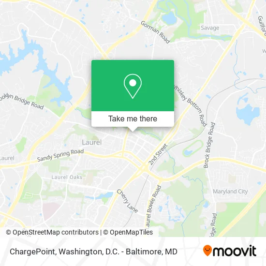
See ChargePoint, Prince George's County, on the map
Public Transit to ChargePoint in Prince George's County
Wondering how to get to ChargePoint in Prince George's County? Moovit helps you find the best way to get to ChargePoint with step-by-step directions from the nearest public transit station.
Moovit provides free maps and live directions to help you navigate through your city. View schedules, routes, timetables, and find out how long does it take to get to ChargePoint in real time.
Looking for the nearest stop or station to ChargePoint? Check out this list of stops closest to your destination: Main Street And Post Office Avenue; 7th St & Main St; Laurel (7-Eleven); Talbott Av+4 St; Laurel Marc Sb.
Bus: 503, P12, 301, GREYHOUND US0325S, M52.Train: MARC.
Want to see if there’s another route that gets you there at an earlier time? Moovit helps you find alternative routes or times. Get directions from and directions to ChargePoint easily from the Moovit App or Website.
We make riding to ChargePoint easy, which is why over 1.5 million users, including users in Prince George's County, trust Moovit as the best app for public transit. You don’t need to download an individual bus app or train app, Moovit is your all-in-one transit app that helps you find the best bus time or train time available.
For information on prices of bus, costs and ride fares to ChargePoint, please check the Moovit app.
Get to ChargePoint with public transit and pay for the ride in the Moovit app. In addition to all info you may need for your trip to ChargePoint, including live directions, real-time arrivals and fare prices, you can also buy public transit passes for your rides. No need for cash or paper tickets to get to ChargePoint - everything you need is accessible in the app with a click of the button.
Use the app to navigate to popular places including to the airport, hospital, stadium, grocery store, mall, coffee shop, school, college, and university.
ChargePoint Address: 699 Main St Laurel, MD 20707 street in Prince George's County
- Opulent Interiors Design,
- Pet Odor Cleaning,
- Vibe Hair Braiding,
- McLean and Tircuit,
- Ladyfingers by Loirelei,
- Acapulco Restaurant & Grill,
- N Shine Wellness Massage &Facial,
- Appliance Repair Bosch Certified,
- Pivot Pt - Laurel MD (Main Street),
- Kevin McGovern,
- The UPS Store,
- Ups,
- Dwight L. Berry, DDS,
- Jacobi Jones - State Farm Insurance Agent,
- Turbo TV Mounting,
- Shiplaurel,
- Elyvation Station,
- Styles by Simone,
- Paw Perfect Care,
- Angie's Hair Salon
Places Near ChargePoint (Prince George's County)
- Washington DC VA Medical Center, Washington,
- Warner Theatre, Washington,
- National Museum of African American History and Culture, Washington,
- Museum Of The Bible, Washington,
- Basilica of the National Shrine, Washington,
- Washington National Cathedral, Washington,
- Capital One Arena, Washington,
- Rock Creek Tennis Center, Washington,
- National Zoo, Washington,
- Amazon Hq2, Arlington County,
- Camden Yards, Baltimore,
- National Mall, Washington,
- PG Mall, Prince George's County,
- Georgetown, Washington,
- Sibley Memorial Hospital, Washington,
- Marriott Marquis Washington, DC, Washington,
- M&T Bank Stadium, Baltimore,
- Westfield Montgomery Mall, Montgomery County,
- Pennsylvania Ave NW (3rd st and pennsylvania), Washington,
- The Anthem, Washington
How to get to popular places in Washington, D.C. - Baltimore, MD with public transit
Get around Prince George's County by public transit!
Traveling around Prince George's County has never been so easy. See step by step directions as you travel to any attraction, street or major public transit station. View bus and train schedules, arrival times, service alerts and detailed routes on a map, so you know exactly how to get to anywhere in Prince George's County.
When traveling to any destination around Prince George's County use Moovit's Live Directions with Get Off Notifications to know exactly where and how far to walk, how long to wait for your line, and how many stops are left. Moovit will alert you when it's time to get off — no need to constantly re-check whether yours is the next stop.
Wondering how to use public transit in Prince George's County or how to pay for public transit in Prince George's County? Moovit public transit app can help you navigate your way with public transit easily, and at minimum cost. It includes public transit fees, ticket prices, and costs. Looking for a map of Prince George's County public transit lines? Moovit public transit app shows all public transit maps in Prince George's County with all Bus, Train, Metro, Light Rail and Ferry routes and stops on an interactive map.
Washington, D.C. - Baltimore, MD has 5 transit type(s), including: Bus, Train, Metro, Light Rail and Ferry, operated by several transit agencies, including WMATA, Montgomery County Ride On, Fairfax Connector, TheBus, PRTC, DASH - Alexandria, Arlington Transit (ART), RTA of Central Maryland, MDOT MTA, MDOT MTA Light RailLink, MDOT MTA Commuter Bus, MDOT MTA Local Bus, FXBGO!, Virginia Railway Express (VRE) and MARC