Directions to ChargePoint (Baltimore County) with public transportation
The following transit lines have routes that pass near ChargePoint
 Bus: 32, 34, 77, CITYLINK PURPLE, 37.
How to get to ChargePoint by bus?
Click on the bus route to see step by step directions with maps, line arrival times and updated time schedules.
From I-695 @ Exit 18 (Liberty Rd/MD 26), Baltimore County
57 minFrom Coppin State University, Baltimore
54 minFrom Baltimore Penn Station, Baltimore
42 minFrom B&O Railroad Museum, Baltimore
52 minFrom Pigtown / Washington Village, Baltimore
64 minFrom Walmart, Baltimore
51 minFrom Pimlico Race Course, Baltimore
78 minFrom The Maryland Zoo In Baltimore, Baltimore
54 minFrom Guinness Open Gate Brewery & Barrel House, Baltimore County
55 minFrom Druid Hill Park, Baltimore
58 min
Bus stops near ChargePoint in Baltimore County
- Rolling Rd & Baltimore National Pike, 8 min walk,VIEW
Bus lines to ChargePoint in Baltimore County
What are the closest stations to ChargePoint?
The closest stations to ChargePoint are:
- Rolling Rd & Baltimore National Pike is 598 yards away, 8 min walk.
Which bus lines stop near ChargePoint?
These bus lines stop near ChargePoint: 32, 34, 77, CITYLINK PURPLE.
What’s the nearest bus station to ChargePoint in Baltimore County?
The nearest bus station to ChargePoint in Baltimore County is Rolling Rd & Baltimore National Pike. It’s a 8 min walk away.
What time is the first bus to ChargePoint in Baltimore County?
The 77 is the first bus that goes to ChargePoint in Baltimore County. It stops nearby at 3:48 AM.
What time is the last bus to ChargePoint in Baltimore County?
The 77 is the last bus that goes to ChargePoint in Baltimore County. It stops nearby at 2:35 AM.
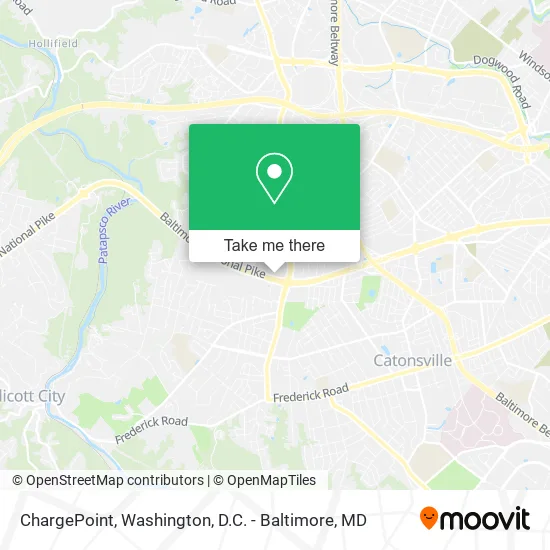
See ChargePoint, Baltimore County, on the map
Public Transit to ChargePoint in Baltimore County
Wondering how to get to ChargePoint in Baltimore County? Moovit helps you find the best way to get to ChargePoint with step-by-step directions from the nearest public transit station.
Moovit provides free maps and live directions to help you navigate through your city. View schedules, routes, timetables, and find out how long does it take to get to ChargePoint in real time.
Looking for the nearest stop or station to ChargePoint? Check out this list of stops closest to your destination: Rolling Rd & Baltimore National Pike.
Bus: 32, 34, 77, CITYLINK PURPLE, 37, 505.
Want to see if there’s another route that gets you there at an earlier time? Moovit helps you find alternative routes or times. Get directions from and directions to ChargePoint easily from the Moovit App or Website.
We make riding to ChargePoint easy, which is why over 1.5 million users, including users in Baltimore County, trust Moovit as the best app for public transit. You don’t need to download an individual bus app or train app, Moovit is your all-in-one transit app that helps you find the best bus time or train time available.
For information on prices of bus, costs and ride fares to ChargePoint, please check the Moovit app.
Use the app to navigate to popular places including to the airport, hospital, stadium, grocery store, mall, coffee shop, school, college, and university.
ChargePoint Address: 6328 Baltimore National Pike Catonsville, MD 21228 street in Baltimore County
- Cleanmax of Maryland,
- BSS Law,,
- Alcohol Detection Systems Ignition Interlock,
- Summit Wellness,
- Foot & Ankle Pain Treatment,
- Bob Evans Restaurant,
- Press For Success Cleaners,
- Hybrid Property Management,
- Mas Magazine,
- B.O.P Real Estate Solutions,
- Paaq Halal Meat & Grocery,
- Allstate Insurance,
- Baltimore Periodontics (Baltimore Periodontics Lasers & Dental Implants),
- Rentwell,
- Home Pro,
- Double T Diner (Double TT Diner),
- Moskowitz Ari L Periodontist,
- Gabrieles Designs in Hair,
- Michael P Parsons MD,
- Tavarsha Timmons - State Farm Insurance Agent
Places Near ChargePoint (Baltimore County)
- Capital One Arena, Washington,
- Georgetown, Washington,
- Washington DC VA Medical Center, Washington,
- Rock Creek Tennis Center, Washington,
- Marriott Marquis Washington, DC, Washington,
- M&T Bank Stadium, Baltimore,
- National Zoo, Washington,
- Washington National Cathedral, Washington,
- The Anthem, Washington,
- Museum Of The Bible, Washington,
- National Mall, Washington,
- Warner Theatre, Washington,
- Sibley Memorial Hospital, Washington,
- National Museum of African American History and Culture, Washington,
- Amazon Hq2, Arlington County,
- Camden Yards, Baltimore,
- Westfield Montgomery Mall, Montgomery County,
- Pennsylvania Ave NW (3rd st and pennsylvania), Washington,
- PG Mall, Prince George's County,
- Basilica of the National Shrine, Washington
How to get to popular places in Washington, D.C. - Baltimore, MD with public transit
Get around Baltimore County by public transit!
Traveling around Baltimore County has never been so easy. See step by step directions as you travel to any attraction, street or major public transit station. View bus and train schedules, arrival times, service alerts and detailed routes on a map, so you know exactly how to get to anywhere in Baltimore County.
When traveling to any destination around Baltimore County use Moovit's Live Directions with Get Off Notifications to know exactly where and how far to walk, how long to wait for your line, and how many stops are left. Moovit will alert you when it's time to get off — no need to constantly re-check whether yours is the next stop.
Wondering how to use public transit in Baltimore County or how to pay for public transit in Baltimore County? Moovit public transit app can help you navigate your way with public transit easily, and at minimum cost. It includes public transit fees, ticket prices, and costs. Looking for a map of Baltimore County public transit lines? Moovit public transit app shows all public transit maps in Baltimore County with all Bus, Train, Metro, Light Rail and Ferry routes and stops on an interactive map.
Washington, D.C. - Baltimore, MD has 5 transit type(s), including: Bus, Train, Metro, Light Rail and Ferry, operated by several transit agencies, including WMATA, Montgomery County Ride On, Fairfax Connector, TheBus, PRTC, DASH - Alexandria, Arlington Transit (ART), RTA of Central Maryland, MDOT MTA, MDOT MTA Light RailLink, MDOT MTA Commuter Bus, MDOT MTA Local Bus, FXBGO!, Virginia Railway Express (VRE) and MARC