How to get to ChargePoint by bus?
Click on the bus route to see step by step directions with maps, line arrival times and updated time schedules.
From PG Mall, Prince George's County
36 minFrom Karma DC Live Music Venue, Washington
55 minFrom Throw Social, Washington
61 minFrom Providence Hospital, Washington
62 minFrom Allstate Insurance Agent: Azqa Goraya, Prince George's County
46 minFrom Arboretum, Washington
55 minFrom Washington Nationals Youth Baseball Academy, Washington
76 minFrom IKEA, Prince George's County
52 minFrom United States National Arboretum, Washington
66 minFrom Other Half Brewing, Washington
61 min
How to get to ChargePoint by metro?
Click on the metro route to see step by step directions with maps, line arrival times and updated time schedules.
Bus stops near ChargePoint in Prince George's County
Train station near ChargePoint in Prince George's County
- New Carrollton Marc Nb, 36 min walk,VIEW
Metro station near ChargePoint in Prince George's County
- Landover Metro Station, 58 min walk,VIEW
Bus lines to ChargePoint in Prince George's County
What are the closest stations to ChargePoint?
The closest stations to ChargePoint are:
- Annapolis Road And Riverdale Road is 139 yards away, 2 min walk.
- Riverdale Rd + Heritage Square Apartments is 277 yards away, 4 min walk.
- New Carrollton Marc Nb is 3049 yards away, 36 min walk.
- Landover Metro Station is 4881 yards away, 58 min walk.
Which bus lines stop near ChargePoint?
These bus lines stop near ChargePoint: P22, P24, P30, P40.
Which metro lines stop near ChargePoint?
These metro lines stop near ChargePoint: ORANGE, SILVER.
What’s the nearest bus station to ChargePoint in Prince George's County?
The nearest bus station to ChargePoint in Prince George's County is Annapolis Road And Riverdale Road. It’s a 2 min walk away.
What time is the first metro to ChargePoint in Prince George's County?
The ORANGE is the first metro that goes to ChargePoint in Prince George's County. It stops nearby at 5:00 AM.
What time is the last metro to ChargePoint in Prince George's County?
The ORANGE is the last metro that goes to ChargePoint in Prince George's County. It stops nearby at 12:36 AM.
What time is the first train to ChargePoint in Prince George's County?
The MARC is the first train that goes to ChargePoint in Prince George's County. It stops nearby at 5:52 AM.
What time is the last train to ChargePoint in Prince George's County?
The MARC is the last train that goes to ChargePoint in Prince George's County. It stops nearby at 10:17 PM.
What time is the first bus to ChargePoint in Prince George's County?
The P30 is the first bus that goes to ChargePoint in Prince George's County. It stops nearby at 4:32 AM.
What time is the last bus to ChargePoint in Prince George's County?
The P30 is the last bus that goes to ChargePoint in Prince George's County. It stops nearby at 2:20 AM.
See ChargePoint, Prince George's County, on the map
Public Transit to ChargePoint in Prince George's County
Wondering how to get to ChargePoint in Prince George's County? Moovit helps you find the best way to get to ChargePoint with step-by-step directions from the nearest public transit station.
Moovit provides free maps and live directions to help you navigate through your city. View schedules, routes, timetables, and find out how long does it take to get to ChargePoint in real time.
Looking for the nearest stop or station to ChargePoint? Check out this list of stops closest to your destination: Annapolis Road And Riverdale Road; Riverdale Rd + Heritage Square Apartments; New Carrollton Marc Nb; Landover Metro Station.
Bus: P22, P24, P30, P40, P20, P21.Train: MARC.Metro: ORANGE, SILVER.
Want to see if there’s another route that gets you there at an earlier time? Moovit helps you find alternative routes or times. Get directions from and directions to ChargePoint easily from the Moovit App or Website.
We make riding to ChargePoint easy, which is why over 1.5 million users, including users in Prince George's County, trust Moovit as the best app for public transit. You don’t need to download an individual bus app or train app, Moovit is your all-in-one transit app that helps you find the best bus time or train time available.
For information on prices of bus and metro, costs and ride fares to ChargePoint, please check the Moovit app.
Use the app to navigate to popular places including to the airport, hospital, stadium, grocery store, mall, coffee shop, school, college, and university.
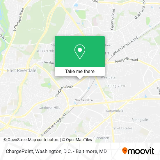
ChargePoint Address: 8100 Annapolis Rd Hyattsville, MD 20784 street in Prince George's County
- K&G Fashion Superstore,
- Annapolis Rd and Riverdale,
- minute clinic,
- United Healthcare,
- Ademiluyi, Femi L DC: Femi L Ademiluyi, DC,
- A1 Full Service Locksmith,
- Cvs Pharmacy,
- Minute Key,
- Amazon Locker-Anemone,
- Coinstar,
- Boom Boom Crab,
- Quick Auto Repair,
- Black Friday Liquid in,
- 24-Hour Speedwash Laundromat,
- Magic Fingers Braiding,
- Forman Mills,
- WING STOP,
- Carrollton Shopping Center,
- Pupuseria la Familiar,
- Lowe's Home Improvement
Places Near ChargePoint (Prince George's County)
- Sibley Memorial Hospital, Washington,
- Georgetown, Washington,
- Basilica of the National Shrine, Washington,
- M&T Bank Stadium, Baltimore,
- National Museum of African American History and Culture, Washington,
- Museum Of The Bible, Washington,
- Washington DC VA Medical Center, Washington,
- Pennsylvania Ave NW (3rd st and pennsylvania), Washington,
- PG Mall, Prince George's County,
- Rock Creek Tennis Center, Washington,
- Washington National Cathedral, Washington,
- National Zoo, Washington,
- Warner Theatre, Washington,
- Capital One Arena, Washington,
- Camden Yards, Baltimore,
- National Mall, Washington,
- Marriott Marquis Washington, DC, Washington,
- The Anthem, Washington,
- Amazon Hq2, Arlington County,
- Westfield Montgomery Mall, Montgomery County
How to get to popular places in Washington, D.C. - Baltimore, MD with public transit
Get around Prince George's County by public transit!
Traveling around Prince George's County has never been so easy. See step by step directions as you travel to any attraction, street or major public transit station. View bus and train schedules, arrival times, service alerts and detailed routes on a map, so you know exactly how to get to anywhere in Prince George's County.
When traveling to any destination around Prince George's County use Moovit's Live Directions with Get Off Notifications to know exactly where and how far to walk, how long to wait for your line, and how many stops are left. Moovit will alert you when it's time to get off — no need to constantly re-check whether yours is the next stop.
Wondering how to use public transit in Prince George's County or how to pay for public transit in Prince George's County? Moovit public transit app can help you navigate your way with public transit easily, and at minimum cost. It includes public transit fees, ticket prices, and costs. Looking for a map of Prince George's County public transit lines? Moovit public transit app shows all public transit maps in Prince George's County with all Bus, Train, Metro, Light Rail and Ferry routes and stops on an interactive map.
Washington, D.C. - Baltimore, MD has 5 transit type(s), including: Bus, Train, Metro, Light Rail and Ferry, operated by several transit agencies, including WMATA, Montgomery County Ride On, Fairfax Connector, TheBus, PRTC, DASH - Alexandria, Arlington Transit (ART), RTA of Central Maryland, MDOT MTA, MDOT MTA Light RailLink, MDOT MTA Commuter Bus, MDOT MTA Local Bus, FXBGO!, Virginia Railway Express (VRE) and MARC