How to get to ChargePoint by bus?
Click on the bus route to see step by step directions with maps, line arrival times and updated time schedules.
From William Hg Fitzgerald Tennis Center, Washington
46 minFrom Citi Open, Washington
47 minFrom Avalon Theatre, Washington
55 minFrom Riderwood Village, Montgomery County
57 minFrom Allstate Insurance Agent: Azqa Goraya, Prince George's County
62 minFrom National Archives at College Park, Prince George's County
79 minFrom Coolidge High School, Washington
59 minFrom Embassy Suites-Bethesda Washington DC, Montgomery County
50 minFrom Montgomery College-Rockville, Montgomery County
50 minFrom Riderwood Senior Living Community, Montgomery County
57 min
How to get to ChargePoint by metro?
Click on the metro route to see step by step directions with maps, line arrival times and updated time schedules.
Bus stops near ChargePoint in Montgomery County
Train station near ChargePoint in Montgomery County
- Garrett Park Marc Eb, 40 min walk,VIEW
Metro station near ChargePoint in Montgomery County
- Wheaton Metro Station, 50 min walk,VIEW
Bus lines to ChargePoint in Montgomery County
What are the closest stations to ChargePoint?
The closest stations to ChargePoint are:
- University Bl+#3333 is 79 yards away, 2 min walk.
- University W Blvd & @3333 is 87 yards away, 2 min walk.
- Newport Mill Rd & Madison St is 775 yards away, 10 min walk.
- Garrett Park Marc Eb is 3406 yards away, 40 min walk.
- Wheaton Metro Station is 4262 yards away, 50 min walk.
Which bus lines stop near ChargePoint?
These bus lines stop near ChargePoint: 34, 4, M22.
Which metro line stops near ChargePoint?
RED (Glenmont)
What’s the nearest bus station to ChargePoint in Montgomery County?
The nearest bus stations to ChargePoint in Montgomery County are University Bl+#3333 and University W Blvd & @3333. The closest one is a 2 min walk away.
What time is the first metro to ChargePoint in Montgomery County?
The RED is the first metro that goes to ChargePoint in Montgomery County. It stops nearby at 5:04 AM.
What time is the last metro to ChargePoint in Montgomery County?
The RED is the last metro that goes to ChargePoint in Montgomery County. It stops nearby at 12:34 AM.
What time is the first train to ChargePoint in Montgomery County?
The MARC is the first train that goes to ChargePoint in Montgomery County. It stops nearby at 5:45 AM.
What time is the last train to ChargePoint in Montgomery County?
The MARC is the last train that goes to ChargePoint in Montgomery County. It stops nearby at 7:45 PM.
What time is the first bus to ChargePoint in Montgomery County?
The 34 is the first bus that goes to ChargePoint in Montgomery County. It stops nearby at 5:04 AM.
What time is the last bus to ChargePoint in Montgomery County?
The 34 is the last bus that goes to ChargePoint in Montgomery County. It stops nearby at 12:57 AM.
See ChargePoint, Montgomery County, on the map
Public Transit to ChargePoint in Montgomery County
Wondering how to get to ChargePoint in Montgomery County? Moovit helps you find the best way to get to ChargePoint with step-by-step directions from the nearest public transit station.
Moovit provides free maps and live directions to help you navigate through your city. View schedules, routes, timetables, and find out how long does it take to get to ChargePoint in real time.
Looking for the nearest stop or station to ChargePoint? Check out this list of stops closest to your destination: University Bl+#3333; University W Blvd & @3333; Newport Mill Rd & Madison St; Garrett Park Marc Eb; Wheaton Metro Station.
Bus: 34, 4, M22, 33.Train: MARC.Metro: RED.
Want to see if there’s another route that gets you there at an earlier time? Moovit helps you find alternative routes or times. Get directions from and directions to ChargePoint easily from the Moovit App or Website.
We make riding to ChargePoint easy, which is why over 1.5 million users, including users in Montgomery County, trust Moovit as the best app for public transit. You don’t need to download an individual bus app or train app, Moovit is your all-in-one transit app that helps you find the best bus time or train time available.
For information on prices of bus and metro, costs and ride fares to ChargePoint, please check the Moovit app.
Use the app to navigate to popular places including to the airport, hospital, stadium, grocery store, mall, coffee shop, school, college, and university.
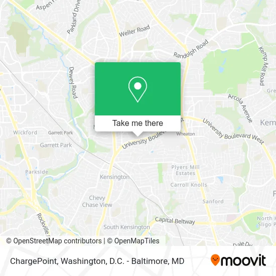
ChargePoint Address: 3333 University Blvd W Kensington, MD 20895 street in Montgomery County
- Masters of the Lawn,
- Appliance Repair Monogram Repair Service,
- Albert Einstein High School,
- Wheaton Spanish Sda Church,
- Enabling Pre-Clinical Quality,
- RMC Sara Construction,
- Amazon Locker-Cub,
- Caminito Amigo Foundation,
- Culture Shock, DC,
- Decompression Therapy Chiropractors,
- Finest Local Painter in Chevy Chase Md,
- Long & Foster Real Estate, Inc,
- Newport Mill Middle School,
- Realty Investments Corporation,
- Brett McCurdy,
- Best Dental Practice,
- American Lock & Key,
- Design Nut,
- ride on bus 34 wheaton,
- Dr. Michael Milgrau
Places Near ChargePoint (Montgomery County)
- M&T Bank Stadium, Baltimore,
- The Anthem, Washington,
- Basilica of the National Shrine, Washington,
- Museum Of The Bible, Washington,
- Amazon Hq2, Arlington County,
- Rock Creek Tennis Center, Washington,
- Washington National Cathedral, Washington,
- National Mall, Washington,
- National Zoo, Washington,
- Capital One Arena, Washington,
- Westfield Montgomery Mall, Montgomery County,
- Marriott Marquis Washington, DC, Washington,
- Washington DC VA Medical Center, Washington,
- Pennsylvania Ave NW (3rd st and pennsylvania), Washington,
- National Museum of African American History and Culture, Washington,
- PG Mall, Prince George's County,
- Warner Theatre, Washington,
- Sibley Memorial Hospital, Washington,
- Camden Yards, Baltimore,
- Georgetown, Washington
How to get to popular places in Washington, D.C. - Baltimore, MD with public transit
Get around Montgomery County by public transit!
Traveling around Montgomery County has never been so easy. See step by step directions as you travel to any attraction, street or major public transit station. View bus and train schedules, arrival times, service alerts and detailed routes on a map, so you know exactly how to get to anywhere in Montgomery County.
When traveling to any destination around Montgomery County use Moovit's Live Directions with Get Off Notifications to know exactly where and how far to walk, how long to wait for your line, and how many stops are left. Moovit will alert you when it's time to get off — no need to constantly re-check whether yours is the next stop.
Wondering how to use public transit in Montgomery County or how to pay for public transit in Montgomery County? Moovit public transit app can help you navigate your way with public transit easily, and at minimum cost. It includes public transit fees, ticket prices, and costs. Looking for a map of Montgomery County public transit lines? Moovit public transit app shows all public transit maps in Montgomery County with all Bus, Train, Metro, Light Rail and Ferry routes and stops on an interactive map.
Washington, D.C. - Baltimore, MD has 5 transit type(s), including: Bus, Train, Metro, Light Rail and Ferry, operated by several transit agencies, including WMATA, Montgomery County Ride On, Fairfax Connector, TheBus, PRTC, DASH - Alexandria, Arlington Transit (ART), RTA of Central Maryland, MDOT MTA, MDOT MTA Light RailLink, MDOT MTA Commuter Bus, MDOT MTA Local Bus, FXBGO!, Virginia Railway Express (VRE) and MARC