How to get to ChargePoint by bus?
Click on the bus route to see step by step directions with maps, line arrival times and updated time schedules.
From Hookers & Blow, Fairfax County
70 minFrom Dulles Discovery, Fairfax County
83 minFrom Northern Virginia Community College - Loudoun Campus, Loudoun County
49 minFrom Amazon Iad28, Fairfax County
73 minFrom Amazon Web Services - IAD21, Fairfax County
98 minFrom Leesburg Corner Premium Outlet, Loudoun County
25 minFrom Reston Town Center, Fairfax County
86 minFrom Sterling VA USA, Loudoun County
68 min
Bus stops near ChargePoint in Loudoun County
Bus lines to ChargePoint in Loudoun County
What are the closest stations to ChargePoint?
The closest stations to ChargePoint are:
- Riverside Pkwy & Pickens Manor La is 708 yards away, 9 min walk.
- Lansdowne Hospital - Cb is 1016 yards away, 13 min walk.
Which bus lines stop near ChargePoint?
These bus lines stop near ChargePoint: 331, 70.
What’s the nearest bus station to ChargePoint in Loudoun County?
The nearest bus station to ChargePoint in Loudoun County is Riverside Pkwy & Pickens Manor La. It’s a 9 min walk away.
What time is the first bus to ChargePoint in Loudoun County?
The 181 is the first bus that goes to ChargePoint in Loudoun County. It stops nearby at 6:50 AM.
What time is the last bus to ChargePoint in Loudoun County?
The 70 is the last bus that goes to ChargePoint in Loudoun County. It stops nearby at 9:36 PM.
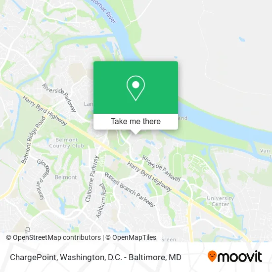
See ChargePoint, Loudoun County, on the map
Public Transit to ChargePoint in Loudoun County
Wondering how to get to ChargePoint in Loudoun County? Moovit helps you find the best way to get to ChargePoint with step-by-step directions from the nearest public transit station.
Moovit provides free maps and live directions to help you navigate through your city. View schedules, routes, timetables, and find out how long does it take to get to ChargePoint in real time.
Looking for the nearest stop or station to ChargePoint? Check out this list of stops closest to your destination: Riverside Pkwy & Pickens Manor La; Lansdowne Hospital - Cb.
Bus: 331, 70, 181, 581.
Want to see if there’s another route that gets you there at an earlier time? Moovit helps you find alternative routes or times. Get directions from and directions to ChargePoint easily from the Moovit App or Website.
We make riding to ChargePoint easy, which is why over 1.5 million users, including users in Loudoun County, trust Moovit as the best app for public transit. You don’t need to download an individual bus app or train app, Moovit is your all-in-one transit app that helps you find the best bus time or train time available.
For information on prices of bus and metro, costs and ride fares to ChargePoint, please check the Moovit app.
Use the app to navigate to popular places including to the airport, hospital, stadium, grocery store, mall, coffee shop, school, college, and university.
ChargePoint Address: 44330 Woodridge Pkwy Leesburg, VA 20176 street in Loudoun County
- Iridium Communications (Iridium Master Control Facility),
- Hhmi-Ashburn,
- Andrew,
- Comsearch,
- Vidrio Technologies LL,
- Hackenberg Virginia M MD Facog,
- Janelia Farm,
- Carriage House,
- Senior Helpers of Leesburg,
- WesBanco,
- Eagle's Flight of America,
- Melissa Hebert, FNP-BC,
- Claros & Wolverton Tax,
- Davita Dialysis Center,
- Prosthetic Care Facility of Virginia,
- Peak Performance Massage & Recovery,
- Janelia Research Campus ,
- Janelia Research Campus,
- Cynthia Thurlow NP,
- Bob's
Places Near ChargePoint (Loudoun County)
- Pennsylvania Ave NW (3rd st and pennsylvania), Washington,
- Georgetown, Washington,
- PG Mall, Prince George's County,
- The Anthem, Washington,
- National Museum of African American History and Culture, Washington,
- Basilica of the National Shrine, Washington,
- Washington DC VA Medical Center, Washington,
- Washington National Cathedral, Washington,
- Sibley Memorial Hospital, Washington,
- Capital One Arena, Washington,
- Westfield Montgomery Mall, Montgomery County,
- National Zoo, Washington,
- Rock Creek Tennis Center, Washington,
- Amazon Hq2, Arlington County,
- National Mall, Washington,
- Warner Theatre, Washington,
- Camden Yards, Baltimore,
- Museum Of The Bible, Washington,
- Marriott Marquis Washington, DC, Washington,
- M&T Bank Stadium, Baltimore
How to get to popular places in Washington, D.C. - Baltimore, MD with public transit
Get around Loudoun County by public transit!
Traveling around Loudoun County has never been so easy. See step by step directions as you travel to any attraction, street or major public transit station. View bus and train schedules, arrival times, service alerts and detailed routes on a map, so you know exactly how to get to anywhere in Loudoun County.
When traveling to any destination around Loudoun County use Moovit's Live Directions with Get Off Notifications to know exactly where and how far to walk, how long to wait for your line, and how many stops are left. Moovit will alert you when it's time to get off — no need to constantly re-check whether yours is the next stop.
Wondering how to use public transit in Loudoun County or how to pay for public transit in Loudoun County? Moovit public transit app can help you navigate your way with public transit easily, and at minimum cost. It includes public transit fees, ticket prices, and costs. Looking for a map of Loudoun County public transit lines? Moovit public transit app shows all public transit maps in Loudoun County with all Bus, Train, Metro, Light Rail and Ferry routes and stops on an interactive map.
Washington, D.C. - Baltimore, MD has 5 transit type(s), including: Bus, Train, Metro, Light Rail and Ferry, operated by several transit agencies, including WMATA, Montgomery County Ride On, Fairfax Connector, TheBus, PRTC, DASH - Alexandria, Arlington Transit (ART), RTA of Central Maryland, MDOT MTA, MDOT MTA Light RailLink, MDOT MTA Commuter Bus, MDOT MTA Local Bus, FXBGO!, Virginia Railway Express (VRE) and MARC