How to get to ChargePoint by bus?
Click on the bus route to see step by step directions with maps, line arrival times and updated time schedules.
From AC Hotel by Marriott Washington DC Downtown (AC Hotel Washington DC Downtown), Washington
101 minFrom Marriott Marquis Washington, DC, Washington
93 minFrom Moxy-Washington DC (Moxy Hotels), Washington
90 minFrom John A. Wilson Building - DC Government, Washington
92 minFrom Us Capitol, Washington
147 minFrom Embassy Suites by Hilton Washington DC Convention Center, Washington
90 minFrom The Mayflower Hotel, Autograph Collection, Washington
101 minFrom Apple Carnegie Library, Washington
94 minFrom The Mayflower Hotel Autograph Collection Washington, Washington
100 minFrom Kaiser Permanente - Capitol Hill Medical Center, Washington
132 min
How to get to ChargePoint by train?
Click on the train route to see step by step directions with maps, line arrival times and updated time schedules.
From Marriott Marquis Washington, DC, Washington
71 minFrom Moxy-Washington DC (Moxy Hotels), Washington
72 minFrom John A. Wilson Building - DC Government, Washington
70 minFrom Us Capitol, Washington
61 minFrom Embassy Suites by Hilton Washington DC Convention Center, Washington
71 minFrom Apple Carnegie Library, Washington
68 minFrom Kaiser Permanente - Capitol Hill Medical Center, Washington
55 min
How to get to ChargePoint by metro?
Click on the metro route to see step by step directions with maps, line arrival times and updated time schedules.
From AC Hotel by Marriott Washington DC Downtown (AC Hotel Washington DC Downtown), Washington
45 minFrom Marriott Marquis Washington, DC, Washington
45 minFrom Moxy-Washington DC (Moxy Hotels), Washington
47 minFrom John A. Wilson Building - DC Government, Washington
47 minFrom Us Capitol, Washington
57 minFrom Embassy Suites by Hilton Washington DC Convention Center, Washington
47 minFrom The Mayflower Hotel, Autograph Collection, Washington
45 minFrom Apple Carnegie Library, Washington
42 minFrom The Mayflower Hotel Autograph Collection Washington, Washington
44 minFrom Kaiser Permanente - Capitol Hill Medical Center, Washington
52 min
Bus stops near ChargePoint in Alexandria
Metro station near ChargePoint in Alexandria
- Braddock Rd - North Side Braddock Rd. at West St., 16 min walk,VIEW
Train station near ChargePoint in Alexandria
- Alexandria, 31 min walk,VIEW
Bus lines to ChargePoint in Alexandria
What are the closest stations to ChargePoint?
The closest stations to ChargePoint are:
- Montgomery St + N Pitt St is 42 yards away, 2 min walk.
- N Pitt St + First St is 47 yards away, 2 min walk.
- N Washington St+Montgomery St is 337 yards away, 5 min walk.
- Braddock Rd - North Side Braddock Rd. at West St. is 1299 yards away, 16 min walk.
- Alexandria is 2602 yards away, 31 min walk.
Which bus lines stop near ChargePoint?
These bus lines stop near ChargePoint: 30, 31, 34, A12, A1X.
Which train lines stop near ChargePoint?
These train lines stop near ChargePoint: MANASSAS LINE, PALMETTO.
Which metro lines stop near ChargePoint?
These metro lines stop near ChargePoint: BLUE, YELLOW.
What’s the nearest metro station to ChargePoint in Alexandria?
The nearest metro station to ChargePoint in Alexandria is Braddock Rd - North Side Braddock Rd. at West St.. It’s a 16 min walk away.
What’s the nearest bus station to ChargePoint in Alexandria?
The nearest bus stations to ChargePoint in Alexandria are Montgomery St + N Pitt St and N Pitt St + First St. The closest one is a 2 min walk away.
What time is the first metro to ChargePoint in Alexandria?
The YELLOW is the first metro that goes to ChargePoint in Alexandria. It stops nearby at 5:02 AM.
What time is the last metro to ChargePoint in Alexandria?
The YELLOW is the last metro that goes to ChargePoint in Alexandria. It stops nearby at 12:37 AM.
What time is the first train to ChargePoint in Alexandria?
The SILVER METEOR is the first train that goes to ChargePoint in Alexandria. It stops nearby at 5:54 AM.
What time is the last train to ChargePoint in Alexandria?
The SILVER METEOR is the last train that goes to ChargePoint in Alexandria. It stops nearby at 5:54 AM.
What time is the first bus to ChargePoint in Alexandria?
The 30 is the first bus that goes to ChargePoint in Alexandria. It stops nearby at 4:48 AM.
What time is the last bus to ChargePoint in Alexandria?
The 30 is the last bus that goes to ChargePoint in Alexandria. It stops nearby at 1:57 AM.
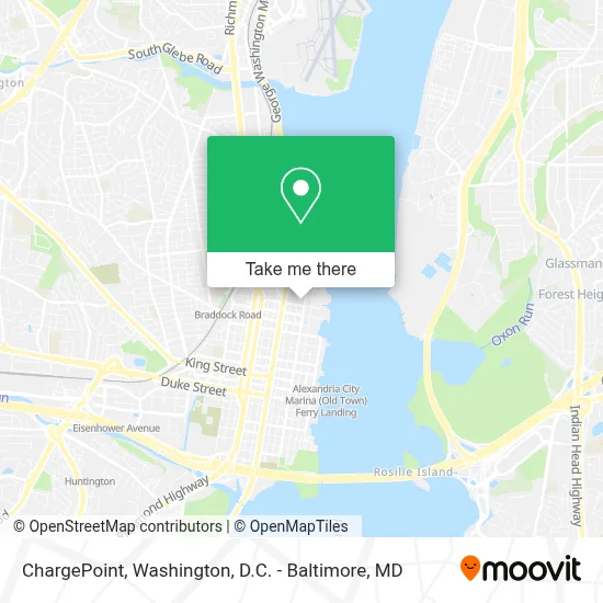
See ChargePoint, Alexandria, on the map
Public Transit to ChargePoint in Alexandria
Wondering how to get to ChargePoint in Alexandria? Moovit helps you find the best way to get to ChargePoint with step-by-step directions from the nearest public transit station.
Moovit provides free maps and live directions to help you navigate through your city. View schedules, routes, timetables, and find out how long does it take to get to ChargePoint in real time.
Looking for the nearest stop or station to ChargePoint? Check out this list of stops closest to your destination: Montgomery St + N Pitt St; N Pitt St + First St; N Washington St+Montgomery St; Braddock Rd - North Side Braddock Rd. at West St.; Alexandria.
Bus: 30, 31, 34, A12, A1X, F19.Train: MANASSAS LINE, PALMETTO, CARDINAL, CAROLINIAN, CRESCENT, FLORIDIAN, NORTHEAST REGIONAL.Metro: BLUE, YELLOW.
Want to see if there’s another route that gets you there at an earlier time? Moovit helps you find alternative routes or times. Get directions from and directions to ChargePoint easily from the Moovit App or Website.
We make riding to ChargePoint easy, which is why over 1.5 million users, including users in Alexandria, trust Moovit as the best app for public transit. You don’t need to download an individual bus app or train app, Moovit is your all-in-one transit app that helps you find the best bus time or train time available.
For information on prices of bus, metro and train, costs and ride fares to ChargePoint, please check the Moovit app.
Use the app to navigate to popular places including to the airport, hospital, stadium, grocery store, mall, coffee shop, school, college, and university.
ChargePoint Address: 525 Montgomery St Alexandria, VA 22314 street in Alexandria
- Vacustage,
- Nga,
- MyEyeDr.,
- A.Lounge+Bar,
- Sheraton Suites Old Town Alexandria,
- Sheraton Suites Alexandria Old Town,
- 801 N St Asaph St,
- 1025 N Royal St Garage,
- Harris Teeter,
- Shell Service Center,
- Canal Center Plaza (Colonial Parking Station 523),
- Oronoco Bay Park,
- Trader Joe's,
- Alexandria Black History Museum,
- The Goddard School,
- Blink Charging,
- Founders Park,
- Canal Center Plaza Shuttle,
- Pendleton Park Apts,
- Gadsby's Tavern
Places Near ChargePoint (Alexandria)
- National Theatre, Washington,
- M&T Bank Stadium, Baltimore,
- Museum Of The Bible, Washington,
- Camden Yards, Baltimore,
- Washington DC VA Medical Center, Washington,
- PG Mall, Prince George's County,
- Capital One Arena, Washington,
- Basilica of the National Shrine, Washington,
- Marriott Marquis Washington, DC, Washington,
- Rock Creek Tennis Center, Washington,
- Warner Theatre, Washington,
- Washington National Cathedral, Washington,
- The Anthem, Washington,
- Sibley Memorial Hospital, Washington,
- Amazon Hq2, Arlington County,
- National Museum of African American History and Culture, Washington,
- Georgetown, Washington,
- National Zoo, Washington,
- Westfield Montgomery Mall, Montgomery County,
- Pennsylvania Ave NW (3rd st and pennsylvania), Washington
How to get to popular places in Washington, D.C. - Baltimore, MD with public transit
Get around Alexandria by public transit!
Traveling around Alexandria has never been so easy. See step by step directions as you travel to any attraction, street or major public transit station. View bus and train schedules, arrival times, service alerts and detailed routes on a map, so you know exactly how to get to anywhere in Alexandria.
When traveling to any destination around Alexandria use Moovit's Live Directions with Get Off Notifications to know exactly where and how far to walk, how long to wait for your line, and how many stops are left. Moovit will alert you when it's time to get off — no need to constantly re-check whether yours is the next stop.
Wondering how to use public transit in Alexandria or how to pay for public transit in Alexandria? Moovit public transit app can help you navigate your way with public transit easily, and at minimum cost. It includes public transit fees, ticket prices, and costs. Looking for a map of Alexandria public transit lines? Moovit public transit app shows all public transit maps in Alexandria with all Bus, Train, Metro, Light Rail and Ferry routes and stops on an interactive map.
Washington, D.C. - Baltimore, MD has 5 transit type(s), including: Bus, Train, Metro, Light Rail and Ferry, operated by several transit agencies, including WMATA, Montgomery County Ride On, Fairfax Connector, TheBus, PRTC, DASH - Alexandria, Arlington Transit (ART), RTA of Central Maryland, MDOT MTA, MDOT MTA Light RailLink, MDOT MTA Commuter Bus, MDOT MTA Local Bus, FXBGO!, Virginia Railway Express (VRE) and MARC