How to get to Che Chaplin Aguascalientes by bus?
Click on the bus route to see step by step directions with maps, line arrival times and updated time schedules.
From Soriana Plaza San Marcos
22 minFrom Aguascalientes
49 minFrom Profuturo Afore
45 minFrom El Puertecito de la Virgen
57 minFrom Hacienda De Pabellon De Hidalgo
67 minFrom Refaccionaria Esquivel
41 minFrom Delegación Insurgentes
49 minFrom Instituto Catastral del Estado
38 minFrom Fraccionamiento México
52 minFrom Chichimeco 119
43 min
Bus stops near Che Chaplin Aguascalientes
Bus lines to Che Chaplin Aguascalientes
What are the closest stations to Che Chaplin Aguascalientes?
The closest stations to Che Chaplin Aguascalientes are:
- Licenciado Miguel De La Madrid, 998 is 19 meters away, 1 min walk.
- Avenida Paseo De Las Maravillas, 300 is 344 meters away, 5 min walk.
Which bus lines stop near Che Chaplin Aguascalientes?
These bus lines stop near Che Chaplin Aguascalientes: RUTA 11, RUTA 33.
What’s the nearest bus station to Che Chaplin Aguascalientes?
The nearest bus station to Che Chaplin Aguascalientes is Licenciado Miguel De La Madrid, 998. It’s a 1 min walk away.
What time is the first bus to Che Chaplin Aguascalientes?
The RUTA 04 is the first bus that goes to Che Chaplin Aguascalientes. It stops nearby at 6:06 AM.
What time is the last bus to Che Chaplin Aguascalientes?
The RUTA 33 is the last bus that goes to Che Chaplin Aguascalientes. It stops nearby at 10:11 PM.
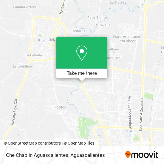
See Che Chaplin Aguascalientes on the map
Public Transportation to Che Chaplin Aguascalientes
Wondering how to get to Che Chaplin Aguascalientes? Moovit helps you find the best way to get to Che Chaplin Aguascalientes with step-by-step directions from the nearest public transit station.
Moovit provides free maps and live directions to help you navigate through your city. View schedules, routes, timetables, and find out how long does it take to get to Che Chaplin Aguascalientes in real time.
Looking for the nearest stop or station to Che Chaplin Aguascalientes? Check out this list of stops closest to your destination: Licenciado Miguel De La Madrid; Avenida Paseo De Las Maravillas.
Bus: RUTA 11, RUTA 33, RUTA 04, RUTA 38.
Want to see if there’s another route that gets you there at an earlier time? Moovit helps you find alternative routes or times. Get directions from and directions to Che Chaplin Aguascalientes easily from the Moovit App or Website.
We make riding to Che Chaplin Aguascalientes easy, which is why over 1.5 million users, including users in Aguascalientes, trust Moovit as the best app for public transit. You don’t need to download an individual bus app or train app, Moovit is your all-in-one transit app that helps you find the best bus time or train time available.
For information on prices of bus, costs and ride fares to Che Chaplin Aguascalientes, please check the Moovit app.
Use the app to navigate to popular places including to the airport, hospital, stadium, grocery store, mall, coffee shop, school, college, and university.
Che Chaplin Aguascalientes Address: Boulevard Lic. Miguel de la Madrid Hurtado 942, Corral de Barrancos, 20900 Jesús María, Aguascalien street in Aguascalientes
- Artés Cirugía Oral y Maxilofacial Aguascalientes,
- Pig Bull Restaurante & Bar,
- Oxxo Gas Suc. Corrales Agu,
- Mr Money Car Wash,
- Cremeria La Pastora,
- Paseo de los Chicahuales 2790,
- Autobaño Neomatica,
- Jennifer Hernández Beauty Studio,
- Condominio Villa Palmira,
- Bule Bule Food Truck,
- Golf Shot,
- Lavatop Carwash,
- Pp El Torocantina Maravillas,
- Colegio de Contadores Públicos de Aguascalientes, A.C.,
- Terrazzo,
- Colegio de Ingenieros Civiles de Aguascalientes,
- Tavola Pasta House,
- Odontologia Estetica Avanzada,
- El Llano,
- Café del Codo
Places Near Che Chaplin Aguascalientes
- Centro Comercial Altaria, Aguascalientes,
- Nuevo Hospital Hidalgo, Aguascalientes,
- Parque Las Tres Centurias, Aguascalientes,
- ESPACIOS, Aguascalientes,
- Jesús María, Aguascalientes,
- Universidad Autónoma de Aguascalientes, Aguascalientes,
- Terminal De Combis, Aguascalientes,
- Blvd. Luis Donaldo Colosio, Aguascalientes,
- Aeropuerto de Aguascalientes S.A. de C.V., Aguascalientes,
- Isla San Marcos, Aguascalientes,
- Central De Autobuses, Aguascalientes,
- Villas de Nuestra Señora de la Asunción, Aguascalientes,
- La Isla San Marcos, Aguascalientes,
- Centro, Aguascalientes,
- Hospital Imss No. 3, Aguascalientes,
- clinica 3 uaa, Aguascalientes,
- Agropecuario, Aguascalientes,
- Villasuncion, Aguascalientes,
- Imss Clinica 1, Aguascalientes,
- Ciudad industrial, Aguascalientes
How to get to popular places in Aguascalientes with public transit
Get around Aguascalientes by public transit!
Traveling around Aguascalientes has never been so easy. See step by step directions as you travel to any attraction, street or major public transit station. View bus and train schedules, arrival times, service alerts and detailed routes on a map, so you know exactly how to get to anywhere in Aguascalientes.
When traveling to any destination around Aguascalientes use Moovit's Live Directions with Get Off Notifications to know exactly where and how far to walk, how long to wait for your line, and how many stops are left. Moovit will alert you when it's time to get off — no need to constantly re-check whether yours is the next stop.
Wondering how to use public transit in Aguascalientes or how to pay for public transit in Aguascalientes? Moovit public transit app can help you navigate your way with public transit easily, and at minimum cost. It includes public transit fees, ticket prices, and costs. Looking for a map of Aguascalientes public transit lines? Moovit public transit app shows all public transit maps in Aguascalientes with all bus routes and stops on an interactive map.
Aguascalientes has 1 transit type(s), including: bus, operated by several transit agencies, including Coordinación General de Movilidad