Directions to Cheap Locksmith Near Me Now (Baltimore) with public transportation
The following transit lines have routes that pass near Cheap Locksmith Near Me Now
 Bus: 30, CITYLINK RED, 52, 33.
How to get to Cheap Locksmith Near Me Now by bus?
Click on the bus route to see step by step directions with maps, line arrival times and updated time schedules.
From Port of Baltimore - Cruise Maryland Terminal, Baltimore
63 minFrom Camden Yards, Baltimore
41 minFrom Baltimore Greyhound Station, Baltimore
50 minFrom Baltimore Convention Center, Baltimore
40 minFrom I-70 at Security Blvd Baltimore City Lot Park & Ride, Baltimore
67 minFrom Pimlico Race Course, Baltimore
37 minFrom Pigtown / Washington Village, Baltimore
48 minFrom Medstar Franklin Square Medical Center, Baltimore County
56 minFrom Light Rail-Timonium Fairgrounds, Baltimore County
47 minFrom Baltimore Arena, Baltimore
36 min
Bus stops near Cheap Locksmith Near Me Now in Baltimore
Light Rail stations near Cheap Locksmith Near Me Now in Baltimore
- Cold Spring Lane, 20 min walk,VIEW
Bus lines to Cheap Locksmith Near Me Now in Baltimore
What are the closest stations to Cheap Locksmith Near Me Now?
The closest stations to Cheap Locksmith Near Me Now are:
- York Rd & Lortz Ln Opp Nb is 120 yards away, 2 min walk.
- Northern Pkwy & York Rd FS Wb is 538 yards away, 7 min walk.
- Cold Spring Lane is 1718 yards away, 20 min walk.
Which bus lines stop near Cheap Locksmith Near Me Now?
These bus lines stop near Cheap Locksmith Near Me Now: 30, CITYLINK RED.
What’s the nearest light rail station to Cheap Locksmith Near Me Now in Baltimore?
The nearest light rail station to Cheap Locksmith Near Me Now in Baltimore is Cold Spring Lane. It’s a 20 min walk away.
What’s the nearest bus station to Cheap Locksmith Near Me Now in Baltimore?
The nearest bus station to Cheap Locksmith Near Me Now in Baltimore is York Rd & Lortz Ln Opp Nb. It’s a 2 min walk away.
What time is the first light rail to Cheap Locksmith Near Me Now in Baltimore?
The LIGHT RAILLINK is the first light rail that goes to Cheap Locksmith Near Me Now in Baltimore. It stops nearby at 4:28 AM.
What time is the last light rail to Cheap Locksmith Near Me Now in Baltimore?
The LIGHT RAILLINK is the last light rail that goes to Cheap Locksmith Near Me Now in Baltimore. It stops nearby at 1:09 AM.
What time is the first bus to Cheap Locksmith Near Me Now in Baltimore?
The CITYLINK RED is the first bus that goes to Cheap Locksmith Near Me Now in Baltimore. It stops nearby at 3:00 AM.
What time is the last bus to Cheap Locksmith Near Me Now in Baltimore?
The CITYLINK RED is the last bus that goes to Cheap Locksmith Near Me Now in Baltimore. It stops nearby at 3:03 AM.
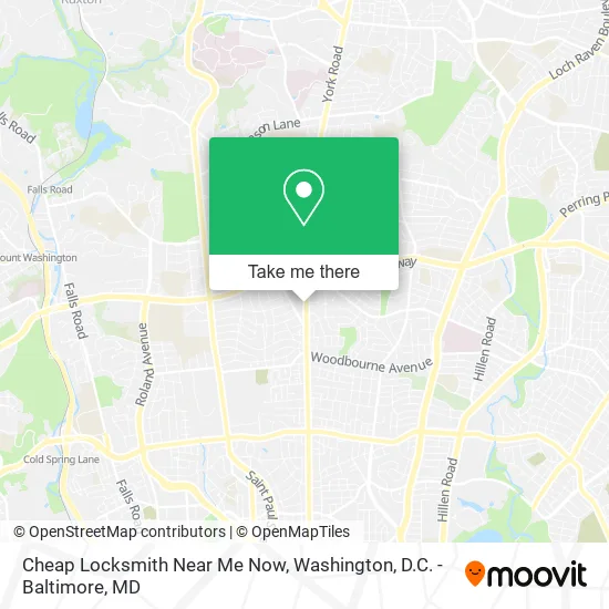
See Cheap Locksmith Near Me Now, Baltimore, on the map
Public Transit to Cheap Locksmith Near Me Now in Baltimore
Wondering how to get to Cheap Locksmith Near Me Now in Baltimore? Moovit helps you find the best way to get to Cheap Locksmith Near Me Now with step-by-step directions from the nearest public transit station.
Moovit provides free maps and live directions to help you navigate through your city. View schedules, routes, timetables, and find out how long does it take to get to Cheap Locksmith Near Me Now in real time.
Looking for the nearest stop or station to Cheap Locksmith Near Me Now? Check out this list of stops closest to your destination: York Rd & Lortz Ln Opp Nb; Northern Pkwy & York Rd FS Wb; Cold Spring Lane.
Bus: 30, CITYLINK RED, 52, 33.
Want to see if there’s another route that gets you there at an earlier time? Moovit helps you find alternative routes or times. Get directions from and directions to Cheap Locksmith Near Me Now easily from the Moovit App or Website.
We make riding to Cheap Locksmith Near Me Now easy, which is why over 1.5 million users, including users in Baltimore, trust Moovit as the best app for public transit. You don’t need to download an individual bus app or train app, Moovit is your all-in-one transit app that helps you find the best bus time or train time available.
For information on prices of bus and light rail, costs and ride fares to Cheap Locksmith Near Me Now, please check the Moovit app.
Use the app to navigate to popular places including to the airport, hospital, stadium, grocery store, mall, coffee shop, school, college, and university.
Cheap Locksmith Near Me Now Address: 5810 York Rd Baltimore, MD 21212 street in Baltimore
- The Music Workshop,
- The Studio Student Portal,
- Avvys Daycare Center,
- Gateway Driving School,
- Growth Agency,
- Murder Mystery Event,
- Wee Oroukes Pub,
- Clair Services,
- Diamond Property Preservation,
- Deep Clean Carpet Cleaning Carpet Cleaning,
- Progressive Faith Ministries,
- Gilman School,
- Amazon Locker-Amonastro,
- Maryland Local Connect,
- Flava Barber Shop & Salon,
- J & S Enterprise Auto Sales,
- Akestak Concepts,
- Ken's Auto Sales,
- Govans Elementary,
- Gatehouse Interiors
Places Near Cheap Locksmith Near Me Now (Baltimore)
- M&T Bank Stadium, Baltimore,
- The Anthem, Washington,
- Basilica of the National Shrine, Washington,
- Museum Of The Bible, Washington,
- Amazon Hq2, Arlington County,
- Rock Creek Tennis Center, Washington,
- Washington National Cathedral, Washington,
- National Mall, Washington,
- National Zoo, Washington,
- Capital One Arena, Washington,
- Westfield Montgomery Mall, Montgomery County,
- Marriott Marquis Washington, DC, Washington,
- Washington DC VA Medical Center, Washington,
- Pennsylvania Ave NW (3rd st and pennsylvania), Washington,
- National Museum of African American History and Culture, Washington,
- PG Mall, Prince George's County,
- Warner Theatre, Washington,
- Sibley Memorial Hospital, Washington,
- Camden Yards, Baltimore,
- Georgetown, Washington
How to get to popular places in Washington, D.C. - Baltimore, MD with public transit
Get around Baltimore by public transit!
Traveling around Baltimore has never been so easy. See step by step directions as you travel to any attraction, street or major public transit station. View bus and train schedules, arrival times, service alerts and detailed routes on a map, so you know exactly how to get to anywhere in Baltimore.
When traveling to any destination around Baltimore use Moovit's Live Directions with Get Off Notifications to know exactly where and how far to walk, how long to wait for your line, and how many stops are left. Moovit will alert you when it's time to get off — no need to constantly re-check whether yours is the next stop.
Wondering how to use public transit in Baltimore or how to pay for public transit in Baltimore? Moovit public transit app can help you navigate your way with public transit easily, and at minimum cost. It includes public transit fees, ticket prices, and costs. Looking for a map of Baltimore public transit lines? Moovit public transit app shows all public transit maps in Baltimore with all Bus, Train, Metro, Light Rail and Ferry routes and stops on an interactive map.
Washington, D.C. - Baltimore, MD has 5 transit type(s), including: Bus, Train, Metro, Light Rail and Ferry, operated by several transit agencies, including WMATA, Montgomery County Ride On, Fairfax Connector, TheBus, PRTC, DASH - Alexandria, Arlington Transit (ART), RTA of Central Maryland, MDOT MTA, MDOT MTA Light RailLink, MDOT MTA Commuter Bus, MDOT MTA Local Bus, FXBGO!, Virginia Railway Express (VRE) and MARC