How to get to Checkmate by bus?
Click on the bus route to see step by step directions with maps, line arrival times and updated time schedules.
From College Point, NY, Queens
78 minFrom Radio Hotel, Manhattan
69 minFrom Broadway and 168th St, Manhattan
74 minFrom Queens Center Mall, Queens
39 minFrom George Washington Bridge Bus Station, Manhattan
80 minFrom 227 Madison Street, Manhattan
49 minFrom MTA X80 - Manhattan to Randall's Island, Manhattan
45 minFrom Flushing Meadows-Corona Park, Queens
60 minFrom Newport Mall, Jersey City
61 min
How to get to Checkmate by train?
Click on the train route to see step by step directions with maps, line arrival times and updated time schedules.
How to get to Checkmate by subway?
Click on the subway route to see step by step directions with maps, line arrival times and updated time schedules.
From Radio Hotel, Manhattan
55 minFrom Broadway and 168th St, Manhattan
48 minFrom Queens Center Mall, Queens
37 minFrom George Washington Bridge Bus Station, Manhattan
53 minFrom 227 Madison Street, Manhattan
43 minFrom MTA X80 - Manhattan to Randall's Island, Manhattan
24 minFrom Flushing Meadows-Corona Park, Queens
63 min
Bus stops near Checkmate in Manhattan
Subway station near Checkmate in Manhattan
- Lexington Av/59 St, 7 min walk,VIEW
Cable Car station near Checkmate in Manhattan
- Manhattan Tram Station, 15 min walk,VIEW
Bus lines to Checkmate in Manhattan
What are the closest stations to Checkmate?
The closest stations to Checkmate are:
- York Av/E 60 St is 39 yards away, 1 min walk.
- 1 Av/E 60 St is 200 yards away, 3 min walk.
- 1 Av/E 57 St is 372 yards away, 5 min walk.
- E 57 St/Sutton Pl is 378 yards away, 5 min walk.
- E 60 St/2 Av is 410 yards away, 6 min walk.
- Lexington Av/59 St is 494 yards away, 7 min walk.
- Manhattan Tram Station is 1245 yards away, 15 min walk.
Which bus lines stop near Checkmate?
These bus lines stop near Checkmate: M15, M15-SBS, M31.
Which train lines stop near Checkmate?
These train lines stop near Checkmate: 2, PORT WASHINGTON BRANCH, YEL.
Which subway lines stop near Checkmate?
These subway lines stop near Checkmate: 4, 5, 6, N, R, W.
What’s the nearest subway station to Checkmate in Manhattan?
The nearest subway station to Checkmate in Manhattan is Lexington Av/59 St. It’s a 7 min walk away.
What’s the nearest bus station to Checkmate in Manhattan?
The nearest bus station to Checkmate in Manhattan is York Av/E 60 St. It’s a 1 min walk away.
What’s the nearest cable car station to Checkmate in Manhattan?
The nearest cable car station to Checkmate in Manhattan is Manhattan Tram Station. It’s a 15 min walk away.
What time is the first subway to Checkmate in Manhattan?
The 6 is the first subway that goes to Checkmate in Manhattan. It stops nearby at 3:00 AM.
What time is the last subway to Checkmate in Manhattan?
The N is the last subway that goes to Checkmate in Manhattan. It stops nearby at 4:07 AM.
What time is the first bus to Checkmate in Manhattan?
The Q60 is the first bus that goes to Checkmate in Manhattan. It stops nearby at 3:00 AM.
What time is the last bus to Checkmate in Manhattan?
The Q60 is the last bus that goes to Checkmate in Manhattan. It stops nearby at 3:34 AM.
What time is the first cable car to Checkmate in Manhattan?
The ROOSEVELT ISLAND TRAM is the first cable car that goes to Checkmate in Manhattan. It stops nearby at 5:52 AM.
What time is the last cable car to Checkmate in Manhattan?
The ROOSEVELT ISLAND TRAM is the last cable car that goes to Checkmate in Manhattan. It stops nearby at 2:10 AM.
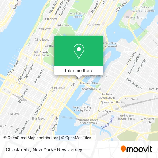
See Checkmate, Manhattan, on the map
Public Transit to Checkmate in Manhattan
Wondering how to get to Checkmate in Manhattan? Moovit helps you find the best way to get to Checkmate with step-by-step directions from the nearest public transit station.
Moovit provides free maps and live directions to help you navigate through your city. View schedules, routes, timetables, and find out how long does it take to get to Checkmate in real time.
Looking for the nearest stop or station to Checkmate? Check out this list of stops closest to your destination: York Av/E 60 St; 1 Av/E 60 St; 1 Av/E 57 St; E 57 St/Sutton Pl; E 60 St/2 Av; Lexington Av/59 St; Manhattan Tram Station.
Bus: M15, M15-SBS, M31, M57.Train: 2, PORT WASHINGTON BRANCH, YEL.Subway: 4, 5, 6, N, R, W.Cable Car: ROOSEVELT ISLAND TRAM.
Want to see if there’s another route that gets you there at an earlier time? Moovit helps you find alternative routes or times. Get directions from and directions to Checkmate easily from the Moovit App or Website.
We make riding to Checkmate easy, which is why over 1.5 million users, including users in Manhattan, trust Moovit as the best app for public transit. You don’t need to download an individual bus app or train app, Moovit is your all-in-one transit app that helps you find the best bus time or train time available.
For information on prices of bus, subway and train, costs and ride fares to Checkmate, please check the Moovit app.
Use the app to navigate to popular places including to the airport, hospital, stadium, grocery store, mall, coffee shop, school, college, and university.
Checkmate Address: 1113 York Ave street in Manhattan
- Motivaldi | Premium Cocktail Shaker Set,
- ,
- Brigadeiro Bar,
- Sutton Club,
- Swimjim Swimming Lessons - Two Sutton Place North,
- FDR Drive - Exit 12 (E. 63rd St / Koch Queensboro Bridge),
- Laz Parking,
- Tennis Pro Shop Nyc,
- Vijat M Photography,
- Tennisinmanhattan,
- Sousa Real Estate,
- Weill Cornell Clinical and Translational Science Center,
- 24 Sycamores Playground,
- Michelle Pelcovitz Ph.D.,
- Irena Ilieva, Ph.D.,
- Tessa Cigler, M.D., M.P.H.,
- Linda T. Vahdat, M.D., M.B.A.,
- Steven Hockstein, Md, Facog,
- John Steven Harrington,
- Joseph Alexander Mailman
Places Near Checkmate (Manhattan)
- 26 Federal Plaza, Manhattan,
- Mountainside Hospital, Glen Ridge,
- qqqq, Manhattan,
- Hudson Yards, Manhattan,
- Bellevue Hospital, Manhattan,
- Queens Center Mall, Queens,
- 911 Memorial, Manhattan,
- 1 Police Plaza, Manhattan,
- Chinatown, Manhattan,
- 66 John Street, Manhattan,
- Rockefeller Center, Manhattan,
- Pier 83, Manhattan,
- Katz's Deli, Manhattan,
- 111 Centre New York City Supreme Court, Manhattan,
- San Gennaro Feast, Manhattan,
- Times Square, Manhattan,
- SoHo, Manhattan,
- Wall Street, Manhattan,
- 3 Stone St, Manhattan,
- 376 Hudson Street, Manhattan
How to get to popular places in New York - New Jersey with public transit
Get around Manhattan by public transit!
Traveling around Manhattan has never been so easy. See step by step directions as you travel to any attraction, street or major public transit station. View bus and train schedules, arrival times, service alerts and detailed routes on a map, so you know exactly how to get to anywhere in Manhattan.
When traveling to any destination around Manhattan use Moovit's Live Directions with Get Off Notifications to know exactly where and how far to walk, how long to wait for your line, and how many stops are left. Moovit will alert you when it's time to get off — no need to constantly re-check whether yours is the next stop.
Wondering how to use public transit in Manhattan or how to pay for public transit in Manhattan? Moovit public transit app can help you navigate your way with public transit easily, and at minimum cost. It includes public transit fees, ticket prices, and costs. Looking for a map of Manhattan public transit lines? Moovit public transit app shows all public transit maps in Manhattan with all Bus, Train, Subway, Light Rail, Ferry and Cable Car routes and stops on an interactive map.
New York - New Jersey has 6 transit type(s), including: Bus, Train, Subway, Light Rail, Ferry and Cable Car, operated by several transit agencies, including MTA Subway, Metro-North Railroad, LIRR, PATH, MTA New York City Transit - Express routes, MTA Bus, NJ Transit, NYC Ferry, NICE bus, Bee-Line Bus, NJ Transit Rail, Norwalk Transit District, Hartford Line, River Valley Transit and HART