How to get to Chefjulioperu by bus?
Click on the bus route to see step by step directions with maps, line arrival times and updated time schedules.
From Cuatro Torres Madrid, Madrid
61 minFrom El Alamo, Madrid
61 minFrom Barrio del Pilar, Madrid
52 minFrom Mad Cool Festival, Madrid
71 minFrom Estacion de Chamartin, Madrid
43 minFrom Residencia Mariscal, Madrid
61 minFrom Avenida de Monforte de Lemos 40, Madrid
59 minFrom Calle Barquillo, Madrid
46 minFrom Mediaset España, Área Metropolitana De Madrid Y Corredor Del Henares
43 minFrom Hospital De Día Pio XII, Área Metropolitana De Madrid Y Corredor Del Henares
54 min
How to get to Chefjulioperu by train?
Click on the train route to see step by step directions with maps, line arrival times and updated time schedules.
How to get to Chefjulioperu by metro?
Click on the metro route to see step by step directions with maps, line arrival times and updated time schedules.
From Cuatro Torres Madrid, Madrid
46 minFrom El Alamo, Madrid
62 minFrom Barrio del Pilar, Madrid
54 minFrom Estacion de Chamartin, Madrid
40 minFrom Avenida de Monforte de Lemos 40, Madrid
53 minFrom Mediaset España, Área Metropolitana De Madrid Y Corredor Del Henares
38 minFrom Hospital De Día Pio XII, Área Metropolitana De Madrid Y Corredor Del Henares
52 min
Bus stops near Chefjulioperu in San Sebastián De Los Reyes
Metro station near Chefjulioperu in San Sebastián De Los Reyes
- Manuel De Falla, 17 min walk,VIEW
Train station near Chefjulioperu in San Sebastián De Los Reyes
- Alcobendas - San Sebastián De Los Reyes, 32 min walk,VIEW
Bus lines to Chefjulioperu in San Sebastián De Los Reyes
- 5, San Sebastián de los Reyes,VIEW
- 7, Circular (Estación FF.CC. - Polígonos - Estación FF.CC.),VIEW
- 153, Pza. Universidad Popular - Est. Baunatal,VIEW
- N101, Intercambiador De Plaza De Castilla (Nivel 0, Isla 4),VIEW
- 827A, Iván Pavlov - Rectorado,VIEW
- 4, Moscatelares,VIEW
- 154, Av. Colmenar Viejo - Ntra. Sra. Carmen,VIEW
- 158, Av. San Luis - Av. Burgos,VIEW
- 154C, Av. Quiñones - Cerro Del Baile,VIEW
- N102, Intercambiador De Plaza De Castilla (Nivel 0, Isla 4),VIEW
What are the closest stations to Chefjulioperu?
The closest stations to Chefjulioperu are:
- Av. Independencia - Oviedo is 133 meters away, 2 min walk.
- Av. Valdelasfuentes - Av. Independencia is 162 meters away, 3 min walk.
- Av. Madrid - Valencia is 388 meters away, 6 min walk.
- Manuel De Falla - Instituto is 464 meters away, 6 min walk.
- Av. Sierra - Cervantes is 465 meters away, 7 min walk.
- Av. Sierra - Navas De Tolosa is 467 meters away, 7 min walk.
- Manuel De Falla is 1240 meters away, 17 min walk.
- Alcobendas - San Sebastián De Los Reyes is 2459 meters away, 32 min walk.
Which bus lines stop near Chefjulioperu?
These bus lines stop near Chefjulioperu: 153, 154, 154C.
Which train line stops near Chefjulioperu?
C4A (Alcobendas - S. S. De Los Reyes)
Which metro line stops near Chefjulioperu?
M-10 (Hospital Infanta Sofía)
What’s the nearest metro station to Chefjulioperu in San Sebastián De Los Reyes?
The nearest metro station to Chefjulioperu in San Sebastián De Los Reyes is Manuel De Falla. It’s a 17 min walk away.
What’s the nearest bus station to Chefjulioperu in San Sebastián De Los Reyes?
The nearest bus station to Chefjulioperu in San Sebastián De Los Reyes is Av. Independencia - Oviedo. It’s a 2 min walk away.
What time is the first metro to Chefjulioperu in San Sebastián De Los Reyes?
The M-10 is the first metro that goes to Chefjulioperu in San Sebastián De Los Reyes. It stops nearby at 6:05 AM.
What time is the last metro to Chefjulioperu in San Sebastián De Los Reyes?
The M-10 is the last metro that goes to Chefjulioperu in San Sebastián De Los Reyes. It stops nearby at 1:52 AM.
What time is the first train to Chefjulioperu in San Sebastián De Los Reyes?
The C4A is the first train that goes to Chefjulioperu in San Sebastián De Los Reyes. It stops nearby at 5:30 AM.
What time is the last train to Chefjulioperu in San Sebastián De Los Reyes?
The C4A is the last train that goes to Chefjulioperu in San Sebastián De Los Reyes. It stops nearby at 12:02 AM.
What time is the first bus to Chefjulioperu in San Sebastián De Los Reyes?
The N102 is the first bus that goes to Chefjulioperu in San Sebastián De Los Reyes. It stops nearby at 3:24 AM.
What time is the last bus to Chefjulioperu in San Sebastián De Los Reyes?
The N101 is the last bus that goes to Chefjulioperu in San Sebastián De Los Reyes. It stops nearby at 2:59 AM.
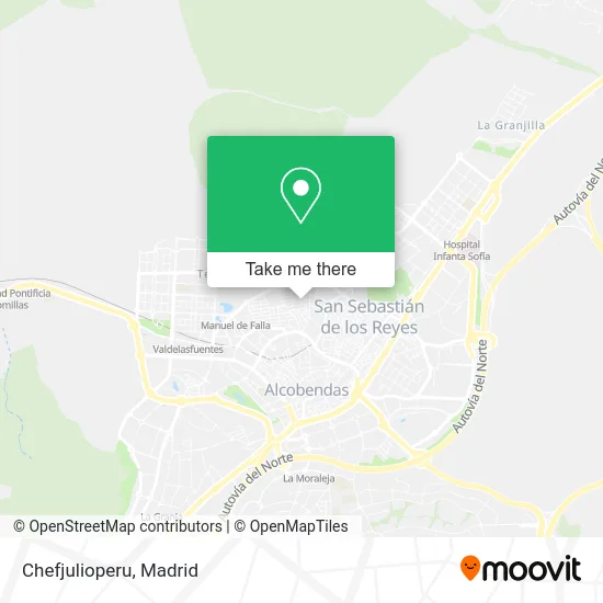
See Chefjulioperu, San Sebastián De Los Reyes, on the map
Public Transit to Chefjulioperu in San Sebastián De Los Reyes
Wondering how to get to Chefjulioperu in San Sebastián De Los Reyes? Moovit helps you find the best way to get to Chefjulioperu with step-by-step directions from the nearest public transit station.
Moovit provides free maps and live directions to help you navigate through your city. View schedules, routes, timetables, and find out how long does it take to get to Chefjulioperu in real time.
Looking for the nearest stop or station to Chefjulioperu? Check out this list of stops closest to your destination: Av. Independencia - Oviedo; Av. Valdelasfuentes - Av. Independencia; Av. Madrid - Valencia; Manuel De Falla - Instituto; Av. Sierra - Cervantes; Av. Sierra - Navas De Tolosa; Manuel De Falla; Alcobendas - San Sebastián De Los Reyes.
Bus: 153, 154, 154C, 5, 7, N101, 827A.Train: C4A.Metro: M-10.
Want to see if there’s another route that gets you there at an earlier time? Moovit helps you find alternative routes or times. Get directions from and directions to Chefjulioperu easily from the Moovit App or Website.
We make riding to Chefjulioperu easy, which is why over 1.7 million users, including users in San Sebastián De Los Reyes, trust Moovit as the best app for public transit. You don’t need to download an individual bus app or train app, Moovit is your all-in-one transit app that helps you find the best bus time or train time available.
For information on prices of bus, metro, train and light rail, costs and ride fares to Chefjulioperu, please check the Moovit app.
Use the app to navigate to popular places including to the airport, hospital, stadium, grocery store, mall, coffee shop, school, college, and university.
Chefjulioperu Address: Calle Oviedo, 28701 San Sebastián de los Reyes street in San Sebastián De Los Reyes
- Bodega Tomás,
- Peluqueria José Maria,
- Calle María Auxiliadora / Calle Gerona,
- Ferrero Fernández Santiago,
- Forum Spanish,
- Infinityglass,
- Jesús Martin Abad,
- Agrosol,
- Essex Textil,
- La Churrería,
- Calle Oviedo 2,
- Parroquia Nuestra Señora De La Vid,
- London Kebab,
- Gissela Elizabeth Basa,
- Bar Maika,
- Pescadería Ricardo,
- Sermotec Calefaccin,
- Avenida de Maximiliano Puerro del Tell,
- de la Serna Sanchez Jorge,
- Montespan Horno de Pan
Places Near Chefjulioperu (San Sebastián De Los Reyes)
- Plenilunio, Área Metropolitana De Madrid Y Corredor Del Henares,
- Mercadillo de Majadahonda, Majadahonda,
- Sala La Riviera, Madrid,
- Estadio Wanda Metropolitano, Área Metropolitana De Madrid Y Corredor Del Henares,
- Hospital Clínico Universitario San Carlos, Madrid,
- Centro Comercial La Gavia, Área Metropolitana De Madrid Y Corredor Del Henares,
- Wizink Center, Madrid,
- Tres Aguas, Alcorcón,
- Centro Comercial Oasiz Madrid, Área Metropolitana De Madrid Y Corredor Del Henares,
- Nassica, Área Metropolitana De Madrid Y Corredor Del Henares,
- Rastro De Madrid, Área Metropolitana De Madrid Y Corredor Del Henares,
- Centro Comercial Islazul, Área Metropolitana De Madrid Y Corredor Del Henares,
- Mendez Alvaro, Madrid,
- Palacio De Vistalegre, Área Metropolitana De Madrid Y Corredor Del Henares,
- Calle de López de Hoyos 169, Madrid,
- Estacion de Chamartin, Madrid,
- Plaza Mayor, Madrid,
- Hospital Universitario La Paz, Madrid,
- Centro Comercial La Vaguada, Área Metropolitana De Madrid Y Corredor Del Henares,
- Hospital Universitario Ramón y Cajal, Madrid
How to get to popular places in Madrid with public transit
Get around San Sebastián De Los Reyes by public transit!
Traveling around San Sebastián De Los Reyes has never been so easy. See step by step directions as you travel to any attraction, street or major public transit station. View bus and train schedules, arrival times, service alerts and detailed routes on a map, so you know exactly how to get to anywhere in San Sebastián De Los Reyes.
When traveling to any destination around San Sebastián De Los Reyes use Moovit's Live Directions with Get Off Notifications to know exactly where and how far to walk, how long to wait for your line, and how many stops are left. Moovit will alert you when it's time to get off — no need to constantly re-check whether yours is the next stop.
Wondering how to use public transit in San Sebastián De Los Reyes or how to pay for public transit in San Sebastián De Los Reyes? Moovit public transit app can help you navigate your way with public transit easily, and at minimum cost. It includes public transit fees, ticket prices, and costs. Looking for a map of San Sebastián De Los Reyes public transit lines? Moovit public transit app shows all public transit maps in San Sebastián De Los Reyes with all Bus, Train, Metro and Light Rail routes and stops on an interactive map.
Madrid has 4 transit type(s), including: Bus, Train, Metro and Light Rail, operated by several transit agencies, including Metro de Madrid, Metro Ligero, Tranvía de Parla, Renfe Cercanías - Servicios de Autobús especiales, Renfe Cercanias, Renfe Cercanías, EMT, Interurbanos, Urbanos de Alcalá de Henares, Urbanos de Alcobendas, Urbanos de Alcorcón, Urbanos de Algete, Urbanos de Aranjuez, Urbanos de Arganda del Rey and Urbanos de Arroyomolinos