Directions to Cherry Tree Hill (Saint Andrew) with public transportation
The following transit lines have routes that pass near Cherry Tree Hill
 Bus: 1A, 1E, 4, SE 1.
How to get to Cherry Tree Hill by bus?
Click on the bus route to see step by step directions with maps, line arrival times and updated time schedules.
Bus stop near Cherry Tree Hill in Saint Andrew
- Mount, Boscobelle, 5 min walk,
Bus lines to Cherry Tree Hill in Saint Andrew
- 1A, Princess Alice Terminal To Boscobelle,
- SE 1, Weymouth To Boscobelle/Pie Corner/Indian Ground,
What are the closest stations to Cherry Tree Hill?
The closest stations to Cherry Tree Hill are:
- Mount, Boscobelle stop is 364 meters away, 5 min walk.
Which bus lines stop near Cherry Tree Hill?
These bus lines stop near Cherry Tree Hill: 1A, 1E, 4.
What’s the nearest bus station to Cherry Tree Hill in Saint Andrew?
The nearest bus station to Cherry Tree Hill in Saint Andrew is Mount, Boscobelle. It’s a 5 min walk away.
What time is the first bus to Cherry Tree Hill in Saint Andrew?
The 1A is the first bus that goes to Cherry Tree Hill in Saint Andrew. It stops nearby at 5:05 AM.
What time is the last bus to Cherry Tree Hill in Saint Andrew?
The 1A is the last bus that goes to Cherry Tree Hill in Saint Andrew. It stops nearby at 10:49 PM.
See Cherry Tree Hill, Saint Andrew, on the map
Public Transit to Cherry Tree Hill in Saint Andrew
Wondering how to get to Cherry Tree Hill in Saint Andrew? Moovit helps you find the best way to get to Cherry Tree Hill with step-by-step directions from the nearest public transit station.
Moovit provides free maps and live directions to help you navigate through your city. View schedules, routes, timetables, and find out how long does it take to get to Cherry Tree Hill in real time.
Looking for the nearest stop or station to Cherry Tree Hill? Check out this list of stops closest to your destination: Mount.
Bus: 1A, 1E, 4, SE 1.
Want to see if there’s another route that gets you there at an earlier time? Moovit helps you find alternative routes or times. Get directions from and directions to Cherry Tree Hill easily from the Moovit App or Website.
We make riding to Cherry Tree Hill easy, which is why over 1.7 billion users, including users in Saint Andrew, trust Moovit as the best app for public transit. You don’t need to download an individual bus app or train app, Moovit is your all-in-one transit app that helps you find the best bus time or train time available.
For information on prices of bus, costs and ride fares to Cherry Tree Hill, please check the Moovit app.
Use the app to navigate to popular places including to the airport, hospital, stadium, grocery store, mall, coffee shop, school, college, and university.
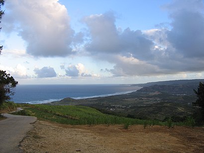
Cherry Tree Hill Address: B street in Saint Andrew
- Cherry Tree Hill,
- St. Nicholas Abbey,
- St. Philip-the-Less Anglican Church,
- Nicholas Abbey,
- Morgan Lewis Windmill,
- Wildlife Reserve,
- Barbados Wildlife Reserve,
- Grenade Hall Forest and Signal Station,
- Farley Hill National Park,
- Farley Hill Park,
- Date Tree Hill,
- Conrad Hunte Cricket Ground,
- Greenland,
- Farley Hill,
- Castle Plantation,
- Green Pond,
- pleasant hall,
- Boscobelle,
- Cove Bay,
- The French Village Pentecostal House Of Prayer
Places Near Cherry Tree Hill (Saint Andrew)
- UWI Cave Hill, Saint Michael,
- Animal Flower Cave, Bridgetown,
- American Embassy, Bridgetown,
- Barbados Association of Medical Practitioners, Bridgetown,
- Harrison's Cave, Saint Thomas,
- Nature Care Barbados, Christ Church,
- Savvy on the Bay, Bridgetown,
- Sheraton Mall, Christ Church,
- Sandy Hill St. philip, Saint Philip,
- Kelsi LTD, Saint Michael,
- Sky Mall, Bridgetown,
- Welches Plaza, Bridgetown,
- Haymans Factory, Saint Peter,
- The Crane Resort, Saint Philip,
- Bridgetown, Barbados, Bridgetown,
- Sky Mall Barbados, Saint Michael,
- Coral Ridge Memorial Gardens, Bridgetown,
- Helipad Car Park, Bridgetown,
- Brownes Beach, Bridgetown,
- Pebbles Beach, Bridgetown
How to get to popular places in Barbados with public transit
Get around Saint Andrew by public transit!
Traveling around Saint Andrew has never been so easy. See step by step directions as you travel to any attraction, street or major public transit station. View bus and train schedules, arrival times, service alerts and detailed routes on a map, so you know exactly how to get to anywhere in Saint Andrew.
When traveling to any destination around Saint Andrew use Moovit's Live Directions with Get Off Notifications to know exactly where and how far to walk, how long to wait for your line, and how many stops are left. Moovit will alert you when it's time to get off — no need to constantly re-check whether yours is the next stop.
Wondering how to use public transit in Saint Andrew or how to pay for public transit in Saint Andrew? Moovit public transit app can help you navigate your way with public transit easily, and at minimum cost. It includes public transit fees, ticket prices, and costs. Looking for a map of Saint Andrew public transit lines? Moovit public transit app shows all public transit maps in Saint Andrew with all bus routes and stops on an interactive map.
Barbados has 1 transit type(s), including: bus, operated by several transit agencies, including Transport Board