Directions to Chesa (Baltimore) with public transportation
The following transit lines have routes that pass near Chesa
 Bus: 21, 94.
- Train: NORTHEAST REGIONAL.
- Metro: METRO.
How to get to Chesa by bus?
Click on the bus route to see step by step directions with maps, line arrival times and updated time schedules.
From University Of Maryland Baltimore (Umbc), Baltimore County
80 minFrom Johns Hopkins Medicine at Green Spring Station, Baltimore County
36 minFrom Maryland, Baltimore
49 minFrom Eastern Ave (eastern avenue and dundalk av), Baltimore
55 minFrom Baltimore Greyhound Station, Baltimore
50 minFrom I-695 @ Exit 17 (Security Blvd/MD 122), Baltimore County
75 minFrom I-695 @ Exit 18 (Liberty Rd/MD 26), Baltimore County
60 minFrom Walmart, Baltimore County
72 minFrom Federal Hill, Baltimore
29 minFrom Patterson Park, Baltimore
40 min
How to get to Chesa by train?
Click on the train route to see step by step directions with maps, line arrival times and updated time schedules.
How to get to Chesa by metro?
Click on the metro route to see step by step directions with maps, line arrival times and updated time schedules.
Bus stop near Chesa in Baltimore
- 36th St & Roland Ave Wb, 2 min walk,VIEW
Light Rail stations near Chesa in Baltimore
- North Avenue, 20 min walk,VIEW
Metro station near Chesa in Baltimore
- Penn North Metro, 30 min walk,VIEW
What are the closest stations to Chesa?
The closest stations to Chesa are:
- 36th St & Roland Ave Wb is 107 yards away, 2 min walk.
- North Avenue is 1651 yards away, 20 min walk.
- Penn North Metro is 2491 yards away, 30 min walk.
Which bus lines stop near Chesa?
These bus lines stop near Chesa: 21, 94.
Which train line stops near Chesa?
NORTHEAST REGIONAL (Springfield)
Which metro line stops near Chesa?
METRO (Towards Owing Mills)
What’s the nearest light rail station to Chesa in Baltimore?
The nearest light rail station to Chesa in Baltimore is North Avenue. It’s a 20 min walk away.
What’s the nearest metro station to Chesa in Baltimore?
The nearest metro station to Chesa in Baltimore is Penn North Metro. It’s a 30 min walk away.
What’s the nearest bus station to Chesa in Baltimore?
The nearest bus station to Chesa in Baltimore is 36th St & Roland Ave Wb. It’s a 2 min walk away.
What time is the first light rail to Chesa in Baltimore?
The LIGHT RAILLINK is the first light rail that goes to Chesa in Baltimore. It stops nearby at 3:42 AM.
What time is the last light rail to Chesa in Baltimore?
The LIGHT RAILLINK is the last light rail that goes to Chesa in Baltimore. It stops nearby at 1:30 AM.
What time is the first metro to Chesa in Baltimore?
The METRO is the first metro that goes to Chesa in Baltimore. It stops nearby at 5:01 AM.
What time is the last metro to Chesa in Baltimore?
The METRO is the last metro that goes to Chesa in Baltimore. It stops nearby at 12:18 AM.
What time is the first bus to Chesa in Baltimore?
The 94 is the first bus that goes to Chesa in Baltimore. It stops nearby at 3:59 AM.
What time is the last bus to Chesa in Baltimore?
The 94 is the last bus that goes to Chesa in Baltimore. It stops nearby at 2:46 AM.
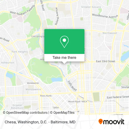
See Chesa, Baltimore, on the map
Public Transit to Chesa in Baltimore
Wondering how to get to Chesa in Baltimore? Moovit helps you find the best way to get to Chesa with step-by-step directions from the nearest public transit station.
Moovit provides free maps and live directions to help you navigate through your city. View schedules, routes, timetables, and find out how long does it take to get to Chesa in real time.
Looking for the nearest stop or station to Chesa? Check out this list of stops closest to your destination: 36th St & Roland Ave Wb; North Avenue; Penn North Metro.
Bus: 21, 94.Train: NORTHEAST REGIONAL.Metro: METRO.
Want to see if there’s another route that gets you there at an earlier time? Moovit helps you find alternative routes or times. Get directions from and directions to Chesa easily from the Moovit App or Website.
We make riding to Chesa easy, which is why over 1.7 million users, including users in Baltimore, trust Moovit as the best app for public transit. You don’t need to download an individual bus app or train app, Moovit is your all-in-one transit app that helps you find the best bus time or train time available.
For information on prices of bus, light rail, train and metro, costs and ride fares to Chesa, please check the Moovit app.
Use the app to navigate to popular places including to the airport, hospital, stadium, grocery store, mall, coffee shop, school, college, and university.
Chesa Address: 801 W 33rd St street in Baltimore
- Janeric Arts,
- Miracle on 34th Street,
- Clipper Mill Rd MD-25,
- Ekiben,
- Johns Hopkins University Homewood Campus Olin Hall,
- Hampden,
- Taylor'd,
- Elision Solutions,
- Greenhouse,
- Johns Hopkins University Glass Pavilion,
- Hampden,
- Pava Marie Lapere Center for Entrepreneurship,
- Johns Hopkins University Bloomberg Center for Physics & Astronomy,
- R. House Parking,
- Remington Ave and 29th St,
- Johns Hopkins University,
- Rotunda Splash Pad,
- Baltimore Museum Of Art,
- I-83 Exit 7 (28th St / Druid Park Lake Dr),
- Icon At The Rotunda
Places Near Chesa (Baltimore)
- Camden Yards, Baltimore,
- Westfield Montgomery Mall, Montgomery County,
- The Anthem, Washington,
- Sibley Memorial Hospital, Washington,
- Capital One Arena, Washington,
- National Theatre, Washington,
- Pennsylvania Ave NW (3rd st and pennsylvania), Washington,
- Basilica of the National Shrine, Washington,
- PG Mall, Prince George's County,
- Museum Of The Bible, Washington,
- Rock Creek Tennis Center, Washington,
- Warner Theatre, Washington,
- National Zoo, Washington,
- Washington DC VA Medical Center, Washington,
- Georgetown, Washington,
- Washington National Cathedral, Washington,
- Marriott Marquis Washington, DC, Washington,
- Amazon Hq2, Arlington County,
- National Museum of African American History and Culture, Washington,
- M&T Bank Stadium, Baltimore
How to get to popular places in Washington, D.C. - Baltimore, MD with public transit
Get around Baltimore by public transit!
Traveling around Baltimore has never been so easy. See step by step directions as you travel to any attraction, street or major public transit station. View bus and train schedules, arrival times, service alerts and detailed routes on a map, so you know exactly how to get to anywhere in Baltimore.
When traveling to any destination around Baltimore use Moovit's Live Directions with Get Off Notifications to know exactly where and how far to walk, how long to wait for your line, and how many stops are left. Moovit will alert you when it's time to get off — no need to constantly re-check whether yours is the next stop.
Wondering how to use public transit in Baltimore or how to pay for public transit in Baltimore? Moovit public transit app can help you navigate your way with public transit easily, and at minimum cost. It includes public transit fees, ticket prices, and costs. Looking for a map of Baltimore public transit lines? Moovit public transit app shows all public transit maps in Baltimore with all Bus, Train, Metro, Light Rail and Ferry routes and stops on an interactive map.
Washington, D.C. - Baltimore, MD has 5 transit type(s), including: Bus, Train, Metro, Light Rail and Ferry, operated by several transit agencies, including WMATA, Montgomery County Ride On, Fairfax Connector, TheBus, PRTC, DASH - Alexandria, Arlington Transit (ART), RTA of Central Maryland, MDOT MTA, MDOT MTA Light RailLink, MDOT MTA Commuter Bus, MDOT MTA Local Bus, FXBGO!, Virginia Railway Express (VRE) and MARC