Directions to Chester Building (Baltimore County) with public transportation
The following transit lines have routes that pass near Chester Building
 Bus: 36, 53, CITYLINK GREEN, TOWSON ORANGE, GOUCHER - LOCH RAVEN.
How to get to Chester Building by bus?
Click on the bus route to see step by step directions with maps, line arrival times and updated time schedules.
From Medstar Franklin Square Medical Center, Baltimore County
46 minFrom White Marsh Mall, Baltimore County
72 minFrom Megabus Stop - White Marsh Park & Ride, Baltimore County
65 minFrom Baltimore Polytechnic Institute, Baltimore
60 minFrom Druid Hill Park, Baltimore
93 minFrom Walters Art Museum, Baltimore
47 minFrom Franklin Square Dr (franklin hospital), Baltimore County
49 minFrom I-83 Exit 5 (Maryland Ave/Charles St), Baltimore
48 minFrom Western High School, Baltimore
62 minFrom The Maryland Zoo In Baltimore, Baltimore
63 min
Bus stops near Chester Building in Baltimore County
Bus lines to Chester Building in Baltimore County
What are the closest stations to Chester Building?
The closest stations to Chester Building are:
- 8601 Lasalle Rd Eb is 264 yards away, 4 min walk.
- Lasalle Road at Secu Eb 0026 (North) is 291 yards away, 4 min walk.
- #31 Putty Hill Ave at Towson Marketplace *** is 1297 yards away, 16 min walk.
- Goucher Blvd & Prince Rd FS Nb is 1357 yards away, 16 min walk.
Which bus lines stop near Chester Building?
These bus lines stop near Chester Building: 36, 53, CITYLINK GREEN, TOWSON ORANGE.
What’s the nearest bus station to Chester Building in Baltimore County?
The nearest bus stations to Chester Building in Baltimore County are 8601 Lasalle Rd Eb and Lasalle Road at Secu Eb 0026 (North). The closest one is a 4 min walk away.
What time is the first bus to Chester Building in Baltimore County?
The 53 is the first bus that goes to Chester Building in Baltimore County. It stops nearby at 3:51 AM.
What time is the last bus to Chester Building in Baltimore County?
The CITYLINK GREEN is the last bus that goes to Chester Building in Baltimore County. It stops nearby at 3:14 AM.
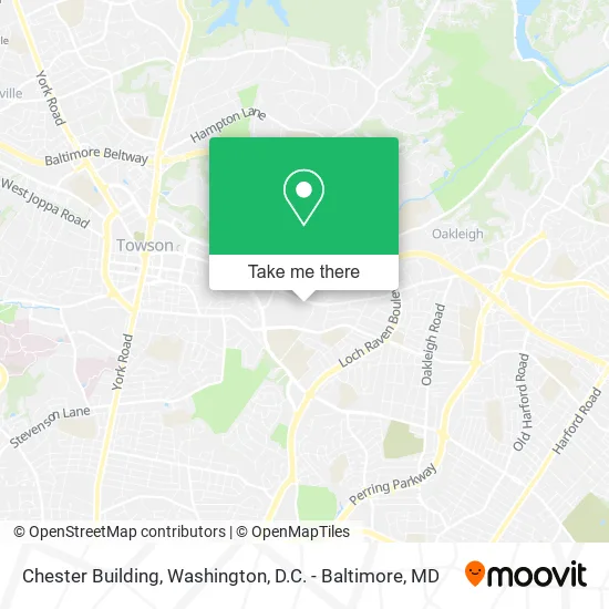
See Chester Building, Baltimore County, on the map
Public Transit to Chester Building in Baltimore County
Wondering how to get to Chester Building in Baltimore County? Moovit helps you find the best way to get to Chester Building with step-by-step directions from the nearest public transit station.
Moovit provides free maps and live directions to help you navigate through your city. View schedules, routes, timetables, and find out how long does it take to get to Chester Building in real time.
Looking for the nearest stop or station to Chester Building? Check out this list of stops closest to your destination: 8601 Lasalle Rd Eb; Lasalle Road at Secu Eb 0026 (North); #31 Putty Hill Ave at Towson Marketplace ***; Goucher Blvd & Prince Rd FS Nb.
Bus: 36, 53, CITYLINK GREEN, TOWSON ORANGE, GOUCHER - LOCH RAVEN.
Want to see if there’s another route that gets you there at an earlier time? Moovit helps you find alternative routes or times. Get directions from and directions to Chester Building easily from the Moovit App or Website.
We make riding to Chester Building easy, which is why over 1.5 million users, including users in Baltimore County, trust Moovit as the best app for public transit. You don’t need to download an individual bus app or train app, Moovit is your all-in-one transit app that helps you find the best bus time or train time available.
For information on prices of bus, costs and ride fares to Chester Building, please check the Moovit app.
Use the app to navigate to popular places including to the airport, hospital, stadium, grocery store, mall, coffee shop, school, college, and university.
Chester Building Address: 8600 La Salle Rd Towson, MD 21286 street in Baltimore County
- Gifts,
- Dr Robert Ray,
- Asi,
- Loughlin Management Group,
- Zimmerman, Rebecca L,
- Oficina de Espiritualidad Ignaciana,
- Marama,
- Lombard Securities,
- Simply Breathe Massage,
- C Opara Clay Pa,
- 1220 E Joppa Rd ,
- Rodgers Forge Apartments in Towson MD,
- 1274 at Towson,
- East Joppa Road & Lasalle Road,
- MRS. Bethany Young, LCSW-C,
- 8600 La Salle Rd,
- Chick-fil-A,
- Spector Chiropractic,
- Ste 5,
- Prometric Testing Center Towson
Places Near Chester Building (Baltimore County)
- Rock Creek Tennis Center, Washington,
- Marriott Marquis Washington, DC, Washington,
- National Museum of African American History and Culture, Washington,
- Amazon Hq2, Arlington County,
- Basilica of the National Shrine, Washington,
- Washington DC VA Medical Center, Washington,
- Georgetown, Washington,
- National Mall, Washington,
- Museum Of The Bible, Washington,
- Westfield Montgomery Mall, Montgomery County,
- Washington National Cathedral, Washington,
- Sibley Memorial Hospital, Washington,
- National Zoo, Washington,
- Pennsylvania Ave NW (3rd st and pennsylvania), Washington,
- M&T Bank Stadium, Baltimore,
- Camden Yards, Baltimore,
- Capital One Arena, Washington,
- PG Mall, Prince George's County,
- Warner Theatre, Washington,
- The Anthem, Washington
How to get to popular places in Washington, D.C. - Baltimore, MD with public transit
Get around Baltimore County by public transit!
Traveling around Baltimore County has never been so easy. See step by step directions as you travel to any attraction, street or major public transit station. View bus and train schedules, arrival times, service alerts and detailed routes on a map, so you know exactly how to get to anywhere in Baltimore County.
When traveling to any destination around Baltimore County use Moovit's Live Directions with Get Off Notifications to know exactly where and how far to walk, how long to wait for your line, and how many stops are left. Moovit will alert you when it's time to get off — no need to constantly re-check whether yours is the next stop.
Wondering how to use public transit in Baltimore County or how to pay for public transit in Baltimore County? Moovit public transit app can help you navigate your way with public transit easily, and at minimum cost. It includes public transit fees, ticket prices, and costs. Looking for a map of Baltimore County public transit lines? Moovit public transit app shows all public transit maps in Baltimore County with all Bus, Train, Metro, Light Rail and Ferry routes and stops on an interactive map.
Washington, D.C. - Baltimore, MD has 5 transit type(s), including: Bus, Train, Metro, Light Rail and Ferry, operated by several transit agencies, including WMATA, Montgomery County Ride On, Fairfax Connector, TheBus, PRTC, DASH - Alexandria, Arlington Transit (ART), RTA of Central Maryland, MDOT MTA, MDOT MTA Light RailLink, MDOT MTA Commuter Bus, MDOT MTA Local Bus, FXBGO!, Virginia Railway Express (VRE) and MARC