Directions to Chester St & Chase St (Baltimore) with public transportation
The following transit lines have routes that pass near Chester St & Chase St
 Bus: 21, 56, CITYLINK BROWN, CITYLINK GOLD, CITYLINK PINK.
- Train: MARC, ACELA, CARDINAL, CAROLINIAN, CRESCENT.
- Metro: METRO.
How to get to Chester St & Chase St by bus?
Click on the bus route to see step by step directions with maps, line arrival times and updated time schedules.
From Nick's Fish House, Baltimore
44 minFrom I-70 at Security Blvd Baltimore City Lot Park & Ride, Baltimore
60 minFrom Towson Town Center, Baltimore County
53 minFrom I-695 Exit 29 (Loch Raven Blvd (MD 542)/Cromwell Bridge Rd), Baltimore County
70 minFrom Saint Agnes Hospital, Baltimore
52 minFrom Walmart Supercenter, Baltimore County
59 minFrom Medstar Franklin Square Medical Center, Baltimore County
35 minFrom Pimlico Race Course, Baltimore
74 minFrom Baltimore Poly Tech High School, Baltimore
46 minFrom Franklin Square Dr (franklin hospital), Baltimore County
37 min
Bus stops near Chester St & Chase St in Baltimore
Metro station near Chester St & Chase St in Baltimore
- Shot Tower Metro, 4 min walk,VIEW
Train stations near Chester St & Chase St in Baltimore
Bus lines to Chester St & Chase St in Baltimore
What are the closest stations to Chester St & Chase St?
The closest stations to Chester St & Chase St are:
- Washington St & Chase St Nb is 176 yards away, 3 min walk.
- Patterson Park & Chase Sb is 259 yards away, 4 min walk.
- Shot Tower Metro is 319 yards away, 4 min walk.
- Madison St & Chester St Wb is 471 yards away, 6 min walk.
- Gay St & N Wolfe St is 644 yards away, 8 min walk.
- Penn Station Marc Sb is 3082 yards away, 37 min walk.
- Baltimore Penn Station is 4896 yards away, 58 min walk.
Which bus lines stop near Chester St & Chase St?
These bus lines stop near Chester St & Chase St: 21, 56, CITYLINK BROWN, CITYLINK GOLD, CITYLINK PINK.
What’s the nearest metro station to Chester St & Chase St in Baltimore?
The nearest metro station to Chester St & Chase St in Baltimore is Shot Tower Metro. It’s a 4 min walk away.
What’s the nearest bus station to Chester St & Chase St in Baltimore?
The nearest bus station to Chester St & Chase St in Baltimore is Washington St & Chase St Nb. It’s a 3 min walk away.
What time is the first metro to Chester St & Chase St in Baltimore?
The METRO is the first metro that goes to Chester St & Chase St in Baltimore. It stops nearby at 4:21 AM.
What time is the last metro to Chester St & Chase St in Baltimore?
The METRO is the last metro that goes to Chester St & Chase St in Baltimore. It stops nearby at 12:29 AM.
What time is the first train to Chester St & Chase St in Baltimore?
The MARC is the first train that goes to Chester St & Chase St in Baltimore. It stops nearby at 4:30 AM.
What time is the last train to Chester St & Chase St in Baltimore?
The SILVER METEOR is the last train that goes to Chester St & Chase St in Baltimore. It stops nearby at 7:57 AM.
What time is the first bus to Chester St & Chase St in Baltimore?
The CITYLINK PINK is the first bus that goes to Chester St & Chase St in Baltimore. It stops nearby at 3:00 AM.
What time is the last bus to Chester St & Chase St in Baltimore?
The CITYLINK PINK is the last bus that goes to Chester St & Chase St in Baltimore. It stops nearby at 3:07 AM.
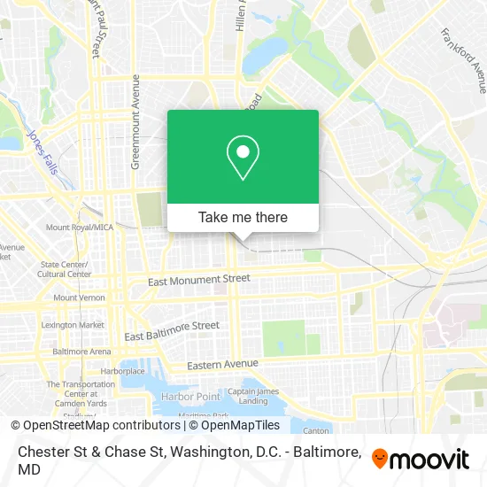
See Chester St & Chase St, Baltimore, on the map
Public Transit to Chester St & Chase St in Baltimore
Wondering how to get to Chester St & Chase St in Baltimore? Moovit helps you find the best way to get to Chester St & Chase St with step-by-step directions from the nearest public transit station.
Moovit provides free maps and live directions to help you navigate through your city. View schedules, routes, timetables, and find out how long does it take to get to Chester St & Chase St in real time.
Looking for the nearest stop or station to Chester St & Chase St? Check out this list of stops closest to your destination: Washington St & Chase St Nb; Patterson Park & Chase Sb; Shot Tower Metro; Madison St & Chester St Wb; Gay St & N Wolfe St; Penn Station Marc Sb; Baltimore Penn Station.
Bus: 21, 56, CITYLINK BROWN, CITYLINK GOLD, CITYLINK PINK.Train: MARC, ACELA, CARDINAL, CAROLINIAN, CRESCENT, NORTHEAST REGIONAL.Metro: METRO.
Want to see if there’s another route that gets you there at an earlier time? Moovit helps you find alternative routes or times. Get directions from and directions to Chester St & Chase St easily from the Moovit App or Website.
We make riding to Chester St & Chase St easy, which is why over 1.5 million users, including users in Baltimore, trust Moovit as the best app for public transit. You don’t need to download an individual bus app or train app, Moovit is your all-in-one transit app that helps you find the best bus time or train time available.
For information on prices of bus and light rail, costs and ride fares to Chester St & Chase St, please check the Moovit app.
Use the app to navigate to popular places including to the airport, hospital, stadium, grocery store, mall, coffee shop, school, college, and university.
Chester St & Chase St Address: Baltimore (CLIFTON EAST END), MD 21213 street in Baltimore
- N Chester E Chase St,
- Caroline Center Upholstery,
- Eager Park Playground,
- E & T Carwash,
- E Preston St (patterson park ave & preston),
- Yo Baltimore,
- Saint Wenceslaus Roman Catholic Church,
- E Hoffman St Building 2100,
- Dee's Place NA Meetings,
- Mi Casa Carry Out & Grocery,
- Montford E Preston St,
- Baltimore City Public School,
- Rangos Building,
- Lieber Institute for Brain Development,
- Residence Inn by Marriott Baltimore at The Johns Hopkins Medical Campus,
- Madison St and Wolfe St,
- Boss Boyz Towing,
- Montford Mini Market,
- Friendly Tobacco Grocery,
- Khadija
Places Near Chester St & Chase St (Baltimore)
- Washington National Cathedral, Washington,
- Capital One Arena, Washington,
- Marriott Marquis Washington, DC, Washington,
- Camden Yards, Baltimore,
- Amazon Hq2, Arlington County,
- National Museum of African American History and Culture, Washington,
- Rock Creek Tennis Center, Washington,
- National Mall, Washington,
- Pennsylvania Ave NW (3rd st and pennsylvania), Washington,
- Sibley Memorial Hospital, Washington,
- Georgetown, Washington,
- M&T Bank Stadium, Baltimore,
- The Anthem, Washington,
- Basilica of the National Shrine, Washington,
- Westfield Montgomery Mall, Montgomery County,
- Warner Theatre, Washington,
- PG Mall, Prince George's County,
- National Zoo, Washington,
- Washington DC VA Medical Center, Washington,
- Museum Of The Bible, Washington
How to get to popular places in Washington, D.C. - Baltimore, MD with public transit
Get around Baltimore by public transit!
Traveling around Baltimore has never been so easy. See step by step directions as you travel to any attraction, street or major public transit station. View bus and train schedules, arrival times, service alerts and detailed routes on a map, so you know exactly how to get to anywhere in Baltimore.
When traveling to any destination around Baltimore use Moovit's Live Directions with Get Off Notifications to know exactly where and how far to walk, how long to wait for your line, and how many stops are left. Moovit will alert you when it's time to get off — no need to constantly re-check whether yours is the next stop.
Wondering how to use public transit in Baltimore or how to pay for public transit in Baltimore? Moovit public transit app can help you navigate your way with public transit easily, and at minimum cost. It includes public transit fees, ticket prices, and costs. Looking for a map of Baltimore public transit lines? Moovit public transit app shows all public transit maps in Baltimore with all Bus, Train, Metro, Light Rail and Ferry routes and stops on an interactive map.
Washington, D.C. - Baltimore, MD has 5 transit type(s), including: Bus, Train, Metro, Light Rail and Ferry, operated by several transit agencies, including WMATA, Montgomery County Ride On, Fairfax Connector, TheBus, PRTC, DASH - Alexandria, Arlington Transit (ART), RTA of Central Maryland, MDOT MTA, MDOT MTA Light RailLink, MDOT MTA Commuter Bus, MDOT MTA Local Bus, FXBGO!, Virginia Railway Express (VRE) and MARC