How to get to Chethas Creation by bus?
Click on the bus route to see step by step directions with maps, line arrival times and updated time schedules.
From Sunpharma, Goregaon
34 minFrom PVR Cinemas, Andheri East
53 minFrom Hotel Tunga International, Andheri East
54 minFrom Tunga International, Andheri East
54 minFrom LOTUS Corporate Park, Goregaon
36 minFrom Radisson, Andheri East
53 minFrom Chintamani Plaza, Andheri East
44 minFrom Kashimira, Mira Bhayandar
50 minFrom Carter Road, Borivali East
38 min
How to get to Chethas Creation by train?
Click on the train route to see step by step directions with maps, line arrival times and updated time schedules.
How to get to Chethas Creation by metro?
Click on the metro route to see step by step directions with maps, line arrival times and updated time schedules.
From Sunpharma, Goregaon
76 minFrom PVR Cinemas, Andheri East
57 minFrom Hotel Tunga International, Andheri East
70 minFrom Tunga International, Andheri East
70 minFrom LOTUS Corporate Park, Goregaon
83 minFrom Radisson, Andheri East
70 minFrom Chintamani Plaza, Andheri East
62 minFrom Kashimira, Mira Bhayandar
54 minFrom Carter Road, Borivali East
67 min
Bus stops near Chethas Creation in Charkop
Metro station near Chethas Creation in Charkop
- Dahanukarwadi, 21 min walk,VIEW
Ferry station near Chethas Creation in Charkop
- Marve, 41 min walk,VIEW
Bus lines to Chethas Creation in Charkop
- A-243, Malad Station (W),VIEW
- A-622, Jankalyan Nagar Police Station,VIEW
- A-269, Borivali Station (W) - Madh Jetty,VIEW
- A-269, Gorai Depot - Madh Jetty,VIEW
- 271, Malad Station (W) - Madh Jetty,VIEW
- 272, Malad Station (W) - Marve Beach (Essel World),VIEW
- A-180, Malvani Depot (Gaikwad Nagar) - Chhatrapati Shivaji Maharaj International Airport (Sahar),VIEW
- A-180, Malvani Depot (Gaikwad Nagar) - Andheri Station (W),VIEW
- A-207, Malvani Depot (Gaikwad Nagar) - Dahisar Bus Station,VIEW
- A-241, Malvani Depot (Gaikwad Nagar) - Santacruz Depot,VIEW
- A-256, Malvani Depot (Gaikwad Nagar) - Juhu Bus Station,VIEW
- A-273, Malvani Depot (Gaikwad Nagar) - Malad Station (W),VIEW
- A-273, Malad Station (W) - Mhada Colony Malvani,VIEW
- A-359, Mhada Colony Malvani - Hiranandani Powai Bus Station,VIEW
- A-359, Malvani Depot (Gaikwad Nagar) - Hiranandani Powai Bus Station,VIEW
- A-456, Malvani Depot (Gaikwad Nagar) - Shivshahi Prakalp (Mantri Park),VIEW
- A-459, Mulund Station (W) - Malvani Depot (Gaikwad Nagar),VIEW
- A-278, Marina Enclave Complex (Malad),VIEW
What are the closest stations to Chethas Creation?
The closest stations to Chethas Creation are:
- Bafira Nagar is 25 meters away, 1 min walk.
- Jankalyan Nagar Police Station is 149 meters away, 3 min walk.
- Fire Brigade Center / Kharodi Colony is 272 meters away, 4 min walk.
- Fire Brigade / Kharodi Colony is 388 meters away, 5 min walk.
- Bhoomi Park Play Ground is 685 meters away, 9 min walk.
- Dahanukarwadi is 1608 meters away, 21 min walk.
- Marve is 3150 meters away, 41 min walk.
Which bus lines stop near Chethas Creation?
These bus lines stop near Chethas Creation: A-180, A-207, A-241, A-243, A-256, A-459.
Which train line stops near Chethas Creation?
WR (Borivali (S))
Which metro line stops near Chethas Creation?
LINE 2A (Andheri (West))
What’s the nearest metro station to Chethas Creation in Charkop?
The nearest metro station to Chethas Creation in Charkop is Dahanukarwadi. It’s a 21 min walk away.
What’s the nearest bus station to Chethas Creation in Charkop?
The nearest bus station to Chethas Creation in Charkop is Bafira Nagar. It’s a 1 min walk away.
What time is the first metro to Chethas Creation in Charkop?
The LINE 2A is the first metro that goes to Chethas Creation in Charkop. It stops nearby at 6:09 AM.
What time is the last metro to Chethas Creation in Charkop?
The LINE 2A is the last metro that goes to Chethas Creation in Charkop. It stops nearby at 11:21 PM.
What time is the first bus to Chethas Creation in Charkop?
The A-273 is the first bus that goes to Chethas Creation in Charkop. It stops nearby at 4:10 AM.
What time is the last bus to Chethas Creation in Charkop?
The A-273 is the last bus that goes to Chethas Creation in Charkop. It stops nearby at 2:15 AM.
What time is the first ferry to Chethas Creation in Charkop?
The ⛴ is the first ferry that goes to Chethas Creation in Charkop. It stops nearby at 5:20 AM.
What time is the last ferry to Chethas Creation in Charkop?
The ⛴ is the last ferry that goes to Chethas Creation in Charkop. It stops nearby at 8:00 PM.
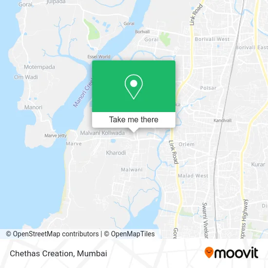
See Chethas Creation, Charkop, on the map
Public Transit to Chethas Creation in Charkop
Wondering how to get to Chethas Creation in Charkop? Moovit helps you find the best way to get to Chethas Creation with step-by-step directions from the nearest public transit station.
Moovit provides free maps and live directions to help you navigate through your city. View schedules, routes, timetables, and find out how long does it take to get to Chethas Creation in real time.
Looking for the nearest stop or station to Chethas Creation? Check out this list of stops closest to your destination: Bafira Nagar; Jankalyan Nagar Police Station; Fire Brigade Center / Kharodi Colony; Fire Brigade / Kharodi Colony; Bhoomi Park Play Ground; Dahanukarwadi; Marve.
Bus: A-180, A-207, A-241, A-243, A-256, A-459, A-622, A-269, A-269, 271, 272.Train: WR.Metro: LINE 2A.Ferry: ⛴, ⛴.
Want to see if there’s another route that gets you there at an earlier time? Moovit helps you find alternative routes or times. Get directions from and directions to Chethas Creation easily from the Moovit App or Website.
We make riding to Chethas Creation easy, which is why over 1.5 million users, including users in Charkop, trust Moovit as the best app for public transit. You don’t need to download an individual bus app or train app, Moovit is your all-in-one transit app that helps you find the best bus time or train time available.
For information on prices of bus, metro and train, costs and ride fares to Chethas Creation, please check the Moovit app.
Use the app to navigate to popular places including to the airport, hospital, stadium, grocery store, mall, coffee shop, school, college, and university.
Chethas Creation Address: Jankalyan Nagar Road Mumbai 400095 MH street in Charkop
- Hair Spa Beauty Studio,
- Callista Salon Ladies Only,
- Jhanvi Apt,
- Ajays Franky,
- Raj Computers Academy in Malad West,
- Shri Ram General and Provision Sto,
- Apsara Furnishing and Mattresses,
- Raj Computers Academy,
- Thomson Plumbing & Electricals,
- Salina Clothing Center,
- Chillista Salon,
- Royalist Services Private LDT,
- Sapna Beauty Salon,
- Mayfair Jhanvi,
- Shri Keshariyaji Pol Paper,
- Eye Zone Optics,
- St. Judes High School,
- Capricon Apartment,
- Roop Nath Dairy in Jankalyan Nagar-Malad West,
- Capricorn
Places Near Chethas Creation (Charkop)
- Dome @ Nsci - Svp Stadium Mumbai, Worli,
- Hinduja Hospital, Mahim,
- J. J. Hospital, Byculla,
- Malabar Hill, Malabar Hill,
- Govardhan Ecovillage, Palghar (St),
- TCS Olympus, Thane,
- Gateway Of India,
- Oberoi Sky City, Borivali East,
- Inorbit Mall, Malad West,
- INFINITI Mall (Infinity Mall, andheri), Versova,
- Bombay Exhibition Center, Goregaon,
- NESCO, Goregaon,
- Rani Baug, Byculla,
- R CITY MALL, Ghatkopar East,
- Mumbai University, Kalina,
- Juhu Beach,
- Oberoi Mall, Dindoshi,
- Ikea, Worli,
- Bhaucha Dhakka,
- Worli Sea Face
How to get to popular places in Mumbai with public transit
Get around Charkop by public transit!
Traveling around Charkop has never been so easy. See step by step directions as you travel to any attraction, street or major public transit station. View bus and train schedules, arrival times, service alerts and detailed routes on a map, so you know exactly how to get to anywhere in Charkop.
When traveling to any destination around Charkop use Moovit's Live Directions with Get Off Notifications to know exactly where and how far to walk, how long to wait for your line, and how many stops are left. Moovit will alert you when it's time to get off — no need to constantly re-check whether yours is the next stop.
Wondering how to use public transit in Charkop or how to pay for public transit in Charkop? Moovit public transit app can help you navigate your way with public transit easily, and at minimum cost. It includes public transit fees, ticket prices, and costs. Looking for a map of Charkop public transit lines? Moovit public transit app shows all public transit maps in Charkop with all Bus, Train, Metro and Ferry routes and stops on an interactive map.
Mumbai has 4 transit type(s), including: Bus, Train, Metro and Ferry, operated by several transit agencies, including MMMOCL (Maha Mumbai Metro Operation Corporation Ltd.), NMM CIDCO (Navi Mumbai Metro Maha Metro), Reliance Mumbai Metro, MMRCL (Mumbai Metro Rail Corporation Ltd), BEST (Brihanmumbai Electricity Supply & Transport), BEST AC Services, A.C.Trains (Air-Conditioning Trains), W.R. (Western Railways), C.R. (Central Railways), C.R.MEMU (Central Railways Shuttle MEMU Trains), H.R. (Harbour Railways), T.R.(Trans Harbour Railways), U.R.(Uran-Ulwe Railways), I.R.(Indian Railways) and TMT (Thane Municipal Transport)
Public transit lines with stations closest to Chethas Creation in Charkop
Metro lines with stations closest to Chethas Creation in Charkop
Bus lines with stations closest to Chethas Creation in Charkop
Fire Brigade / Kharodi Colony
 A-180Malvani Depot (Gaikwad Nagar) - Chhatrapati Shivaji Maharaj International Airport (Sahar)
- A-180Malvani Depot (Gaikwad Nagar) - Andheri Station (W)
- A-207Malvani Depot (Gaikwad Nagar) - Dahisar Bus Station
- A-241Malvani Depot (Gaikwad Nagar) - Santacruz Depot
- A-256Malvani Depot (Gaikwad Nagar) - Juhu Bus Station