Directions to Chevron (Roanoke) with public transportation
The following transit lines have routes that pass near Chevron
 Bus: 61, GREYHOUND US0600, 55, 56, 62.
- Train: NORTHEAST REGIONAL.
How to get to Chevron by bus?
Click on the bus route to see step by step directions with maps, line arrival times and updated time schedules.
How to get to Chevron by train?
Click on the train route to see step by step directions with maps, line arrival times and updated time schedules.
Bus stops near Chevron in Roanoke
Train station near Chevron in Roanoke
- Roanoke, 47 min walk,VIEW
Bus lines to Chevron in Roanoke
What are the closest stations to Chevron?
The closest stations to Chevron are:
- Colonial Sb at Towers Shopping Center is 141 yards away, 2 min walk.
- Colonial Nb at Brandon is 190 yards away, 3 min walk.
- Towers Mall at Dunkin Donuts is 408 yards away, 5 min walk.
- Main Nb at Windsor is 740 yards away, 9 min walk.
- Roanoke is 3913 yards away, 47 min walk.
Which bus lines stop near Chevron?
These bus lines stop near Chevron: 61, GREYHOUND US0600.
Which train line stops near Chevron?
NORTHEAST REGIONAL (Roanoke)
What’s the nearest bus station to Chevron in Roanoke?
The nearest bus station to Chevron in Roanoke is Colonial Sb at Towers Shopping Center. It’s a 2 min walk away.
What time is the first train to Chevron in Roanoke?
The NORTHEAST REGIONAL is the first train that goes to Chevron in Roanoke. It stops nearby at 9:35 AM.
What time is the last train to Chevron in Roanoke?
The NORTHEAST REGIONAL is the last train that goes to Chevron in Roanoke. It stops nearby at 10:13 PM.
What time is the first bus to Chevron in Roanoke?
The 56 is the first bus that goes to Chevron in Roanoke. It stops nearby at 5:54 AM.
What time is the last bus to Chevron in Roanoke?
The 61 is the last bus that goes to Chevron in Roanoke. It stops nearby at 8:29 PM.
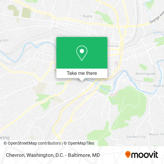
See Chevron, Roanoke, on the map
Public Transit to Chevron in Roanoke
Wondering how to get to Chevron in Roanoke? Moovit helps you find the best way to get to Chevron with step-by-step directions from the nearest public transit station.
Moovit provides free maps and live directions to help you navigate through your city. View schedules, routes, timetables, and find out how long does it take to get to Chevron in real time.
Looking for the nearest stop or station to Chevron? Check out this list of stops closest to your destination: Colonial Sb at Towers Shopping Center; Colonial Nb at Brandon; Towers Mall at Dunkin Donuts; Main Nb at Windsor; Roanoke.
Bus: 61, GREYHOUND US0600, 55, 56, 62.Train: NORTHEAST REGIONAL.
Want to see if there’s another route that gets you there at an earlier time? Moovit helps you find alternative routes or times. Get directions from and directions to Chevron easily from the Moovit App or Website.
We make riding to Chevron easy, which is why over 1.5 million users, including users in Roanoke, trust Moovit as the best app for public transit. You don’t need to download an individual bus app or train app, Moovit is your all-in-one transit app that helps you find the best bus time or train time available.
For information on prices of bus and train, costs and ride fares to Chevron, please check the Moovit app.
Use the app to navigate to popular places including to the airport, hospital, stadium, grocery store, mall, coffee shop, school, college, and university.
Chevron Address: 703 Brandon Ave SW Roanoke, VA 24015 street in Roanoke
- Brandon WB at Windsor (Little Ceasar's),
- Tropical Smoothie Cafe,
- Tech Squared,
- Re/Max,
- Geraty, Holub & MacQueen,
- Kroger Fuel Center,
- EcoATM,
- Wheelers Fast Service Laundry & Cleaning,
- Arby's,
- Monkey's Tree Service LLC,
- Bella Events,
- El Cielito Lindo,
- Dunkin',
- 23rd at Hill Before Towers Shopping Center,
- Superior Media Marketing,
- Red Wing Shoes,
- USPS Collection Box - Blue Box,
- A Cleaner World,
- Planet Fitness,
- Cost Cutters
Places Near Chevron (Roanoke)
- Warner Theatre, Washington,
- M&T Bank Stadium, Baltimore,
- Museum Of The Bible, Washington,
- National Museum of African American History and Culture, Washington,
- Rock Creek Tennis Center, Washington,
- PG Mall, Prince George's County,
- National Mall, Washington,
- The Anthem, Washington,
- Amazon Hq2, Arlington County,
- Washington National Cathedral, Washington,
- Washington DC VA Medical Center, Washington,
- Georgetown, Washington,
- Camden Yards, Baltimore,
- Marriott Marquis Washington, DC, Washington,
- National Zoo, Washington,
- Pennsylvania Ave NW (3rd st and pennsylvania), Washington,
- Sibley Memorial Hospital, Washington,
- Basilica of the National Shrine, Washington,
- Westfield Montgomery Mall, Montgomery County,
- Capital One Arena, Washington
How to get to popular places in Washington, D.C. - Baltimore, MD with public transit
Get around Roanoke by public transit!
Traveling around Roanoke has never been so easy. See step by step directions as you travel to any attraction, street or major public transit station. View bus and train schedules, arrival times, service alerts and detailed routes on a map, so you know exactly how to get to anywhere in Roanoke.
When traveling to any destination around Roanoke use Moovit's Live Directions with Get Off Notifications to know exactly where and how far to walk, how long to wait for your line, and how many stops are left. Moovit will alert you when it's time to get off — no need to constantly re-check whether yours is the next stop.
Wondering how to use public transit in Roanoke or how to pay for public transit in Roanoke? Moovit public transit app can help you navigate your way with public transit easily, and at minimum cost. It includes public transit fees, ticket prices, and costs. Looking for a map of Roanoke public transit lines? Moovit public transit app shows all public transit maps in Roanoke with all Bus, Train, Metro, Light Rail and Ferry routes and stops on an interactive map.
Washington, D.C. - Baltimore, MD has 5 transit type(s), including: Bus, Train, Metro, Light Rail and Ferry, operated by several transit agencies, including WMATA, Montgomery County Ride On, Fairfax Connector, TheBus, PRTC, DASH - Alexandria, Arlington Transit (ART), RTA of Central Maryland, MDOT MTA, MDOT MTA Light RailLink, MDOT MTA Commuter Bus, MDOT MTA Local Bus, FXBGO!, Virginia Railway Express (VRE) and MARC