How to get to Chevy Chase Ballroom by bus?
Click on the bus route to see step by step directions with maps, line arrival times and updated time schedules.
From Northwestern High School, Prince George's County
102 minFrom Hyatt Place-Arlington Courthouse Plaza (Hyatt Place Arlington/Courthouse Plaza), Arlington County
63 minFrom Smithsonian National Museum of Natural History (National Museum of Natural History), Washington
50 minFrom J. Edgar Hoover Building, Washington
44 minFrom Embassy Of Canada, Washington
45 minFrom Costco, Washington
81 minFrom Festival Grounds at RFK Campus, Washington
76 minFrom Hyattsville, MD, Prince George's County
88 minFrom U.S. Department of Justice (DOJ), Washington
50 min
How to get to Chevy Chase Ballroom by metro?
Click on the metro route to see step by step directions with maps, line arrival times and updated time schedules.
From Northwestern High School, Prince George's County
57 minFrom Hyatt Place-Arlington Courthouse Plaza (Hyatt Place Arlington/Courthouse Plaza), Arlington County
36 minFrom Smithsonian National Museum of Natural History (National Museum of Natural History), Washington
29 minFrom J. Edgar Hoover Building, Washington
21 minFrom Embassy Of Canada, Washington
24 minFrom Festival Grounds at RFK Campus, Washington
44 minFrom Hyattsville, MD, Prince George's County
60 minFrom U.S. Department of Justice (DOJ), Washington
21 min
Bus stops near Chevy Chase Ballroom in Washington
Metro stations near Chevy Chase Ballroom in Washington
Bus lines to Chevy Chase Ballroom in Washington
What are the closest stations to Chevy Chase Ballroom?
The closest stations to Chevy Chase Ballroom are:
- Connecticut Av Nw+Veazey Ter NW is 86 yards away, 2 min walk.
- Van Ness+Bay A is 142 yards away, 2 min walk.
- Connecticut Av Nw+Van Ness St NW is 167 yards away, 3 min walk.
- Woodley Park-Zoo/Adams Morgan is 1393 yards away, 17 min walk.
- Columbia Heights is 3760 yards away, 45 min walk.
Which bus lines stop near Chevy Chase Ballroom?
These bus lines stop near Chevy Chase Ballroom: C61, D70.
Which metro line stops near Chevy Chase Ballroom?
RED (Shady Grove)
What’s the nearest metro station to Chevy Chase Ballroom in Washington?
The nearest metro station to Chevy Chase Ballroom in Washington is Woodley Park-Zoo/Adams Morgan. It’s a 17 min walk away.
What’s the nearest bus station to Chevy Chase Ballroom in Washington?
The nearest bus stations to Chevy Chase Ballroom in Washington are Connecticut Av Nw+Veazey Ter NW and Van Ness+Bay A. The closest one is a 2 min walk away.
What time is the first metro to Chevy Chase Ballroom in Washington?
The GREEN is the first metro that goes to Chevy Chase Ballroom in Washington. It stops nearby at 5:16 AM.
What time is the last metro to Chevy Chase Ballroom in Washington?
The GREEN is the last metro that goes to Chevy Chase Ballroom in Washington. It stops nearby at 12:25 AM.
What time is the first bus to Chevy Chase Ballroom in Washington?
The D72 is the first bus that goes to Chevy Chase Ballroom in Washington. It stops nearby at 4:00 AM.
What time is the last bus to Chevy Chase Ballroom in Washington?
The D70 is the last bus that goes to Chevy Chase Ballroom in Washington. It stops nearby at 2:20 AM.
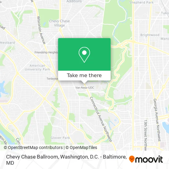
See Chevy Chase Ballroom, Washington, on the map
Public Transit to Chevy Chase Ballroom in Washington
Wondering how to get to Chevy Chase Ballroom in Washington? Moovit helps you find the best way to get to Chevy Chase Ballroom with step-by-step directions from the nearest public transit station.
Moovit provides free maps and live directions to help you navigate through your city. View schedules, routes, timetables, and find out how long does it take to get to Chevy Chase Ballroom in real time.
Looking for the nearest stop or station to Chevy Chase Ballroom? Check out this list of stops closest to your destination: Connecticut Av Nw+Veazey Ter NW; Van Ness+Bay A; Connecticut Av Nw+Van Ness St NW; Woodley Park-Zoo/Adams Morgan; Columbia Heights.
Bus: C61, D70, D72, C87.Metro: RED, GREEN, YELLOW.
Want to see if there’s another route that gets you there at an earlier time? Moovit helps you find alternative routes or times. Get directions from and directions to Chevy Chase Ballroom easily from the Moovit App or Website.
We make riding to Chevy Chase Ballroom easy, which is why over 1.5 million users, including users in Washington, trust Moovit as the best app for public transit. You don’t need to download an individual bus app or train app, Moovit is your all-in-one transit app that helps you find the best bus time or train time available.
For information on prices of metro and bus, costs and ride fares to Chevy Chase Ballroom, please check the Moovit app.
Use the app to navigate to popular places including to the airport, hospital, stadium, grocery store, mall, coffee shop, school, college, and university.
Chevy Chase Ballroom Address: 4200 Connecticut Ave NW Washington, DC 20008 street in Washington
- Van Ness,
- University Of District Of Columbia,
- Van Ness Center,
- UDC Student Center,
- Van Ness Metro / Udc,
- Sofa Stain Removal,
- Libertyx Bitcoin ATM,
- Flash,
- Indian Ocean,
- Baron Wines USA LLC,
- Budget,
- Concentric Educational Solutions,
- Kuwait Health Office Dr ,
- GSCNC,
- Girl Scout Council of the Nations Capital,
- Van Ness Travel,
- Carpet Cleaning DC,
- Park America,
- Loctw,
- Select Physical Therapy
Places Near Chevy Chase Ballroom (Washington)
- Pennsylvania Ave NW (3rd st and pennsylvania), Washington,
- National Zoo, Washington,
- Westfield Montgomery Mall, Montgomery County,
- Marriott Marquis Washington, DC, Washington,
- Sibley Memorial Hospital, Washington,
- National Mall, Washington,
- Georgetown, Washington,
- The Anthem, Washington,
- Washington National Cathedral, Washington,
- PG Mall, Prince George's County,
- Amazon Hq2, Arlington County,
- Rock Creek Tennis Center, Washington,
- Washington DC VA Medical Center, Washington,
- Museum Of The Bible, Washington,
- Basilica of the National Shrine, Washington,
- Warner Theatre, Washington,
- National Museum of African American History and Culture, Washington,
- Capital One Arena, Washington,
- Camden Yards, Baltimore,
- M&T Bank Stadium, Baltimore
How to get to popular places in Washington, D.C. - Baltimore, MD with public transit
Get around Washington by public transit!
Traveling around Washington has never been so easy. See step by step directions as you travel to any attraction, street or major public transit station. View bus and train schedules, arrival times, service alerts and detailed routes on a map, so you know exactly how to get to anywhere in Washington.
When traveling to any destination around Washington use Moovit's Live Directions with Get Off Notifications to know exactly where and how far to walk, how long to wait for your line, and how many stops are left. Moovit will alert you when it's time to get off — no need to constantly re-check whether yours is the next stop.
Wondering how to use public transit in Washington or how to pay for public transit in Washington? Moovit public transit app can help you navigate your way with public transit easily, and at minimum cost. It includes public transit fees, ticket prices, and costs. Looking for a map of Washington public transit lines? Moovit public transit app shows all public transit maps in Washington with all Bus, Train, Metro, Light Rail and Ferry routes and stops on an interactive map.
Washington, D.C. - Baltimore, MD has 5 transit type(s), including: Bus, Train, Metro, Light Rail and Ferry, operated by several transit agencies, including WMATA, Montgomery County Ride On, Fairfax Connector, TheBus, PRTC, DASH - Alexandria, Arlington Transit (ART), RTA of Central Maryland, MDOT MTA, MDOT MTA Light RailLink, MDOT MTA Commuter Bus, MDOT MTA Local Bus, FXBGO!, Virginia Railway Express (VRE) and MARC