How to get to Chi Dogs by bus?
Click on the bus route to see step by step directions with maps, line arrival times and updated time schedules.
From Tri-Rail-Deerfield Beach Station, Deerfield Beach
78 minFrom Intersection : N Andrews Ave & Sample Rd., Pompano Beach
88 minFrom Ollie's Bargain Outlet, Boynton Beach-Delray Beach
62 minFrom Pretty in Palm Beach, Boynton Beach-Delray Beach
84 minFrom Amazon Fulfillment Center-DMF3, Pompano Beach
103 minFrom Tri-Rail-Pompano Beach Station, Pompano Beach
87 minFrom Brazzers, Boca Raton
36 minFrom Sample Rd, Deerfield Beach
92 min
How to get to Chi Dogs by train?
Click on the train route to see step by step directions with maps, line arrival times and updated time schedules.
Bus stops near Chi Dogs in Boca Raton
Train stations near Chi Dogs in Boca Raton
Bus lines to Chi Dogs in Boca Raton
What are the closest stations to Chi Dogs?
The closest stations to Chi Dogs are:
- NW 20TH ST at NW 1ST CT is 614 yards away, 8 min walk.
- FEDERAL HWY at GLADES RD is 1166 yards away, 14 min walk.
- UNIVERSITY DR at GLADES RD is 1516 yards away, 18 min walk.
- Boca Raton Station is 4167 yards away, 49 min walk.
- Boca Raton is 4930 yards away, 58 min walk.
Which bus lines stop near Chi Dogs?
These bus lines stop near Chi Dogs: 1, 91, 94.
Which train line stops near Chi Dogs?
TRIRAIL (Northbound To Mangonia Park)
What’s the nearest bus station to Chi Dogs in Boca Raton?
The nearest bus station to Chi Dogs in Boca Raton is NW 20TH ST at NW 1ST CT. It’s a 8 min walk away.
What time is the first train to Chi Dogs in Boca Raton?
The TRIRAIL is the first train that goes to Chi Dogs in Boca Raton. It stops nearby at 4:28 AM.
What time is the last train to Chi Dogs in Boca Raton?
The BLFM is the last train that goes to Chi Dogs in Boca Raton. It stops nearby at 11:53 PM.
What time is the first bus to Chi Dogs in Boca Raton?
The 1 is the first bus that goes to Chi Dogs in Boca Raton. It stops nearby at 6:10 AM.
What time is the last bus to Chi Dogs in Boca Raton?
The 1 is the last bus that goes to Chi Dogs in Boca Raton. It stops nearby at 9:46 PM.
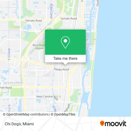
See Chi Dogs, Boca Raton, on the map
Public Transit to Chi Dogs in Boca Raton
Wondering how to get to Chi Dogs in Boca Raton? Moovit helps you find the best way to get to Chi Dogs with step-by-step directions from the nearest public transit station.
Moovit provides free maps and live directions to help you navigate through your city. View schedules, routes, timetables, and find out how long does it take to get to Chi Dogs in real time.
Looking for the nearest stop or station to Chi Dogs? Check out this list of stops closest to your destination: NW 20TH ST at NW 1ST CT; FEDERAL HWY at GLADES RD; UNIVERSITY DR at GLADES RD; Boca Raton Station; Boca Raton.
Bus: 1, 91, 94.Train: TRIRAIL, BLFM.
Want to see if there’s another route that gets you there at an earlier time? Moovit helps you find alternative routes or times. Get directions from and directions to Chi Dogs easily from the Moovit App or Website.
We make riding to Chi Dogs easy, which is why over 1.5 million users, including users in Boca Raton, trust Moovit as the best app for public transit. You don’t need to download an individual bus app or train app, Moovit is your all-in-one transit app that helps you find the best bus time or train time available.
For information on prices of bus and train, costs and ride fares to Chi Dogs, please check the Moovit app.
Use the app to navigate to popular places including to the airport, hospital, stadium, grocery store, mall, coffee shop, school, college, and university.
Chi Dogs Address: 150 NW 16th St Boca Raton, FL 33432 street in Boca Raton
- Merged Flavors,
- The Kebab Stop,
- Zhixiang Asian Cuisine,
- Ilza's Hotdogs,
- Bouji Meals N Hookah,
- Calavera Coffee,
- Tasty Tricycle,
- Zenzero Pizza,
- Exclusive Eatz,
- Kelly's Cooking,
- Mr B's,
- Christa Krzeminski,
- Sea Glam Caribbean Taste,
- Fresh Feed,
- Queen P Smoothies,
- Morocco's Taco's,
- Billys Curbside Grill,
- The Succulent,
- Healthy Food Factory Commissary Kitchen,
- Flex Bites
Places Near Chi Dogs (Boca Raton)
- Port of Miami Cruise Terminal, Miami,
- Sawgrass Mall, Miami,
- Marlins Park, Miami,
- Miami Design District, Miami,
- Miami Freedom Park, Miami,
- Keiser University Flagship Campus, West Palm Beach,
- Zoo Miami, Miami,
- Dolphin Mall Bus, Miami,
- Wynwood, Miami,
- Dolphin Mall, Miami,
- Sawgrass mall ( FL ), Miami Beach,
- Brickell City Centre, Miami,
- Bayside Marketplace, Miami,
- Miami VA Hospital, Miami,
- Aventura Mall, Miami,
- Richard E. Gerstein Justice Building, Miami,
- Miami-Dade County Courthouse, Miami,
- Hard Rock Stadium, Miami Gardens,
- Little Havana, Miami,
- Aventura Mall, Miami Beach
How to get to popular places in Miami with public transit
Get around Boca Raton by public transit!
Traveling around Boca Raton has never been so easy. See step by step directions as you travel to any attraction, street or major public transit station. View bus and train schedules, arrival times, service alerts and detailed routes on a map, so you know exactly how to get to anywhere in Boca Raton.
When traveling to any destination around Boca Raton use Moovit's Live Directions with Get Off Notifications to know exactly where and how far to walk, how long to wait for your line, and how many stops are left. Moovit will alert you when it's time to get off — no need to constantly re-check whether yours is the next stop.
Wondering how to use public transit in Boca Raton or how to pay for public transit in Boca Raton? Moovit public transit app can help you navigate your way with public transit easily, and at minimum cost. It includes public transit fees, ticket prices, and costs. Looking for a map of Boca Raton public transit lines? Moovit public transit app shows all public transit maps in Boca Raton with all Bus, Train, Light Rail and Ferry routes and stops on an interactive map.
Miami has 4 transit type(s), including: Bus, Train, Light Rail and Ferry, operated by several transit agencies, including Broward County Transit, Miami-Dade Transit, Metrorail, Palm Tran, Tri-Rail, Brightline, MARTY, City of Homestead Trolley, Key West Transit, Treasure Coast Connector, GoLine IRT, Amtrak, Greyhound-us, FlixBus-us and Aventura Express Shuttle Bus