How to get to Chi Dogs by bus?
Click on the bus route to see step by step directions with maps, line arrival times and updated time schedules.
From Ollie's Bargain Outlet, Boynton Beach-Delray Beach
54 minFrom Greenacres, FL, Lake Worth
71 minFrom John I. Leonard High School, Lake Worth
67 minFrom Brazzers, Boca Raton
52 minFrom 1661B South Congress Avenue, Lake Worth
52 minFrom W Woolbright Rd / Jog Rd, Boynton Beach-Delray Beach
53 minFrom Lake Worth, FL, Lake Worth
37 minFrom JFK Medical Center, Lake Worth
37 minFrom DXN Florida, Boynton Beach-Delray Beach
44 min
Bus stops near Chi Dogs in Boynton Beach-Delray Beach
Bus lines to Chi Dogs in Boynton Beach-Delray Beach
What are the closest stations to Chi Dogs?
The closest stations to Chi Dogs are:
- BOYNTON BCH BLVD at BLD1413 is 94 yards away, 2 min walk.
- CONGRESS AVE at W BOYNTON BCH BLVD is 323 yards away, 4 min walk.
Which bus lines stop near Chi Dogs?
These bus lines stop near Chi Dogs: 2, 73.
What’s the nearest bus station to Chi Dogs in Boynton Beach-Delray Beach?
The nearest bus station to Chi Dogs in Boynton Beach-Delray Beach is BOYNTON BCH BLVD at BLD1413. It’s a 2 min walk away.
What time is the first bus to Chi Dogs in Boynton Beach-Delray Beach?
The 73 is the first bus that goes to Chi Dogs in Boynton Beach-Delray Beach. It stops nearby at 5:31 AM.
What time is the last bus to Chi Dogs in Boynton Beach-Delray Beach?
The 2 is the last bus that goes to Chi Dogs in Boynton Beach-Delray Beach. It stops nearby at 10:42 PM.
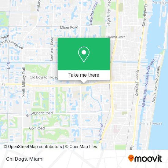
See Chi Dogs, Boynton Beach-Delray Beach, on the map
Public Transit to Chi Dogs in Boynton Beach-Delray Beach
Wondering how to get to Chi Dogs in Boynton Beach-Delray Beach? Moovit helps you find the best way to get to Chi Dogs with step-by-step directions from the nearest public transit station.
Moovit provides free maps and live directions to help you navigate through your city. View schedules, routes, timetables, and find out how long does it take to get to Chi Dogs in real time.
Looking for the nearest stop or station to Chi Dogs? Check out this list of stops closest to your destination: BOYNTON BCH BLVD at BLD1413; CONGRESS AVE at W BOYNTON BCH BLVD.
Bus: 2, 73.
Want to see if there’s another route that gets you there at an earlier time? Moovit helps you find alternative routes or times. Get directions from and directions to Chi Dogs easily from the Moovit App or Website.
We make riding to Chi Dogs easy, which is why over 1.5 million users, including users in Boynton Beach-Delray Beach, trust Moovit as the best app for public transit. You don’t need to download an individual bus app or train app, Moovit is your all-in-one transit app that helps you find the best bus time or train time available.
For information on prices of bus, costs and ride fares to Chi Dogs, please check the Moovit app.
Use the app to navigate to popular places including to the airport, hospital, stadium, grocery store, mall, coffee shop, school, college, and university.
Chi Dogs Address: 1403 W Boynton Beach Blvd Boynton Beach, FL 33426 street in Boynton Beach-Delray Beach
- A D T,
- Boynton Medical Center,
- Academy of Awards,
- Advanced Dental Care,
- Cricket,
- DUNKIN',
- New Alliance Haitian Church of Boynton,
- Praise & Deliverance Church of God by Faith,
- Boynton Brick Pavers,
- Winn-Dixie,
- Congress Ave Locksmith Company,
- STARBUCKS,
- Byrd's Hot Chicken,
- Xfinity Store by Comcast,
- Rumble Boxing,
- Ibmsecu 280 Boynton Beach Boulevard,
- Stanton Optical,
- Livevibrant Wellness & Aesthetics,
- My Clinical Solution,
- Venwa Bodyworks
Places Near Chi Dogs (Boynton Beach-Delray Beach)
- Little Havana, Miami,
- Keiser University Flagship Campus, West Palm Beach,
- Hard Rock Stadium, Miami Gardens,
- Dolphin Mall Bus, Miami,
- Miami VA Hospital, Miami,
- Brickell City Centre, Miami,
- Miami Design District, Miami,
- Sawgrass Mall, Miami,
- Miami-Dade County Courthouse, Miami,
- Dolphin Mall, Miami,
- Miami Freedom Park, Miami,
- Richard E. Gerstein Justice Building, Miami,
- Sawgrass mall ( FL ), Miami Beach,
- Wynwood, Miami,
- Zoo Miami, Miami,
- Marlins Park, Miami,
- Bayside Marketplace, Miami,
- Port of Miami Cruise Terminal, Miami,
- Aventura Mall, Miami,
- Aventura Mall, Miami Beach
How to get to popular places in Miami with public transit
Get around Boynton Beach-Delray Beach by public transit!
Traveling around Boynton Beach-Delray Beach has never been so easy. See step by step directions as you travel to any attraction, street or major public transit station. View bus and train schedules, arrival times, service alerts and detailed routes on a map, so you know exactly how to get to anywhere in Boynton Beach-Delray Beach.
When traveling to any destination around Boynton Beach-Delray Beach use Moovit's Live Directions with Get Off Notifications to know exactly where and how far to walk, how long to wait for your line, and how many stops are left. Moovit will alert you when it's time to get off — no need to constantly re-check whether yours is the next stop.
Wondering how to use public transit in Boynton Beach-Delray Beach or how to pay for public transit in Boynton Beach-Delray Beach? Moovit public transit app can help you navigate your way with public transit easily, and at minimum cost. It includes public transit fees, ticket prices, and costs. Looking for a map of Boynton Beach-Delray Beach public transit lines? Moovit public transit app shows all public transit maps in Boynton Beach-Delray Beach with all Bus, Train, Light Rail and Ferry routes and stops on an interactive map.
Miami has 4 transit type(s), including: Bus, Train, Light Rail and Ferry, operated by several transit agencies, including Broward County Transit, Miami-Dade Transit, Metrorail, Palm Tran, Tri-Rail, Brightline, MARTY, City of Homestead Trolley, Key West Transit, Treasure Coast Connector, GoLine IRT, Amtrak, Greyhound-us, FlixBus-us and Aventura Express Shuttle Bus