How to get to Chick Fil A by bus?
Click on the bus route to see step by step directions with maps, line arrival times and updated time schedules.
Bus stops near Chick Fil A in West Hartford
Bus lines to Chick Fil A in West Hartford
- 901, 901 - Avon-Canton Express,VIEW
- 926, 926 - Avon-Canton-Winsted Express,VIEW
- 927, 927 - Hartford Express,VIEW
- 926/927, 926/927 - Hartford Express,VIEW
- 72, 72a - Asylum Av-Bishops Corner-Cigna-Metlife,VIEW
- 153, 153 - Elmwood Stn Via West Hartford Ctr,VIEW
- 62, 62 - Farmington Av-North Main St-Bishops Corner,VIEW
- 58, 58 - Albany Av-Bishops Corner,VIEW
What are the closest stations to Chick Fil A?
The closest stations to Chick Fil A are:
- Albany Ave @ Mattress Firm is 80 yards away, 2 min walk.
- N Main St @ Albany Ave is 211 yards away, 3 min walk.
- Albany Ave @ Starbucks is 297 yards away, 4 min walk.
- N Main St @ Whole Foods Supermaket is 349 yards away, 5 min walk.
- Albany Ave @ Pet Supplies Store is 382 yards away, 5 min walk.
Which bus lines stop near Chick Fil A?
These bus lines stop near Chick Fil A: 58, 62.
What’s the nearest bus station to Chick Fil A in West Hartford?
The nearest bus station to Chick Fil A in West Hartford is Albany Ave @ Mattress Firm. It’s a 2 min walk away.
What time is the first bus to Chick Fil A in West Hartford?
The 153 is the first bus that goes to Chick Fil A in West Hartford. It stops nearby at 5:16 AM.
What time is the last bus to Chick Fil A in West Hartford?
The 153 is the last bus that goes to Chick Fil A in West Hartford. It stops nearby at 12:11 AM.
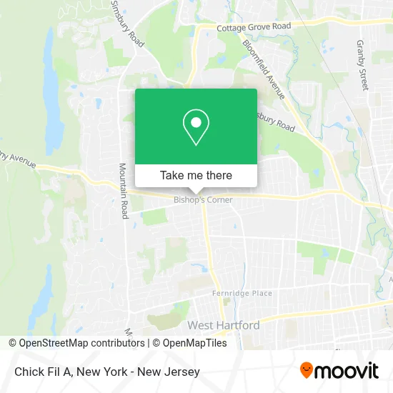
See Chick Fil A, West Hartford, on the map
Public Transit to Chick Fil A in West Hartford
Wondering how to get to Chick Fil A in West Hartford? Moovit helps you find the best way to get to Chick Fil A with step-by-step directions from the nearest public transit station.
Moovit provides free maps and live directions to help you navigate through your city. View schedules, routes, timetables, and find out how long does it take to get to Chick Fil A in real time.
Looking for the nearest stop or station to Chick Fil A? Check out this list of stops closest to your destination: Albany Ave @ Mattress Firm; N Main St @ Albany Ave; Albany Ave @ Starbucks; N Main St @ Whole Foods Supermaket; Albany Ave @ Pet Supplies Store.
Bus: 58, 62, 901, 926, 927, 926/927, 72, 153.
Want to see if there’s another route that gets you there at an earlier time? Moovit helps you find alternative routes or times. Get directions from and directions to Chick Fil A easily from the Moovit App or Website.
We make riding to Chick Fil A easy, which is why over 1.5 million users, including users in West Hartford, trust Moovit as the best app for public transit. You don’t need to download an individual bus app or train app, Moovit is your all-in-one transit app that helps you find the best bus time or train time available.
For information on prices of bus and train, costs and ride fares to Chick Fil A, please check the Moovit app.
Use the app to navigate to popular places including to the airport, hospital, stadium, grocery store, mall, coffee shop, school, college, and university.
Chick Fil A Address: 2534 Albany Ave street in West Hartford
- Chase,
- West Hartford Lock and Key,
- Usa Reading Clinic Llc,
- Harvey's Wine & Spirit Shoppe,
- Chick-Fil-A,
- Ziprent,
- Healthlink,
- Party City,
- Neuskale Title Services,
- Alex Breanne Corporation,
- A&M Renovations Llc,
- Customz by Trinity,
- IVX Health Infusion Center,
- Sunvivo,
- Verizon Wireless,
- Ups Access Point Location,
- West Hartford 66,
- Just Salad,
- Subway,
- Nautical Bowls
Places Near Chick Fil A (West Hartford)
- Times Square, Manhattan,
- Mountainside Hospital, Glen Ridge,
- Hudson Yards, Manhattan,
- Queens Center Mall, Queens,
- 376 Hudson Street, Manhattan,
- Pier 83, Manhattan,
- 1 Police Plaza, Manhattan,
- Rockefeller Center, Manhattan,
- qqqq, Manhattan,
- 26 Federal Plaza, Manhattan,
- 3 Stone St, Manhattan,
- Bellevue Hospital, Manhattan,
- Chinatown, Manhattan,
- Wall Street, Manhattan,
- SoHo, Manhattan,
- 66 John Street, Manhattan,
- 911 Memorial, Manhattan,
- Katz's Deli, Manhattan,
- San Gennaro Feast, Manhattan,
- 111 Centre New York City Supreme Court, Manhattan
How to get to popular places in New York - New Jersey with public transit
Get around West Hartford by public transit!
Traveling around West Hartford has never been so easy. See step by step directions as you travel to any attraction, street or major public transit station. View bus and train schedules, arrival times, service alerts and detailed routes on a map, so you know exactly how to get to anywhere in West Hartford.
When traveling to any destination around West Hartford use Moovit's Live Directions with Get Off Notifications to know exactly where and how far to walk, how long to wait for your line, and how many stops are left. Moovit will alert you when it's time to get off — no need to constantly re-check whether yours is the next stop.
Wondering how to use public transit in West Hartford or how to pay for public transit in West Hartford? Moovit public transit app can help you navigate your way with public transit easily, and at minimum cost. It includes public transit fees, ticket prices, and costs. Looking for a map of West Hartford public transit lines? Moovit public transit app shows all public transit maps in West Hartford with all Bus, Train, Subway, Light Rail, Ferry and Cable Car routes and stops on an interactive map.
New York - New Jersey has 6 transit type(s), including: Bus, Train, Subway, Light Rail, Ferry and Cable Car, operated by several transit agencies, including MTA Subway, Metro-North Railroad, LIRR, PATH, MTA New York City Transit - Express routes, MTA Bus, NJ Transit, NYC Ferry, NICE bus, Bee-Line Bus, NJ Transit Rail, Norwalk Transit District, Hartford Line, River Valley Transit and HART