How to get to Chick-Fil-A by bus?
Click on the bus route to see step by step directions with maps, line arrival times and updated time schedules.
From Cross County Shopping Center, Yonkers
23 minFrom Van Cortlandt Park, Bronx
59 minFrom New York State DMV, Yonkers
45 minFrom Mamaroneck NY, Mamaroneck
79 minFrom White Plains, NY, White Plains
42 minFrom Montefiore Medical Center, Bronx
37 minFrom Montefiore Hospital, Bronx
38 minFrom New Rochelle, NY, New Rochelle
55 minFrom Co-op City, Bronx
81 minFrom Co-Op City, Bronx
90 min
How to get to Chick-Fil-A by train?
Click on the train route to see step by step directions with maps, line arrival times and updated time schedules.
Bus stop near Chick-Fil-A in Yonkers
- Central Park Ave @ Roxbury Dr, 3 min walk,VIEW
Train station near Chick-Fil-A in Yonkers
- Scarsdale, 28 min walk,VIEW
Bus lines to Chick-Fil-A in Yonkers
What are the closest stations to Chick-Fil-A?
The closest stations to Chick-Fil-A are:
- Central Park Ave @ Roxbury Dr is 224 yards away, 3 min walk.
- Scarsdale is 2394 yards away, 28 min walk.
Which bus lines stop near Chick-Fil-A?
These bus lines stop near Chick-Fil-A: 20, 21.
Which train line stops near Chick-Fil-A?
2 (511#| North White Plains)
What’s the nearest train station to Chick-Fil-A in Yonkers?
The nearest train station to Chick-Fil-A in Yonkers is Scarsdale. It’s a 28 min walk away.
What’s the nearest bus station to Chick-Fil-A in Yonkers?
The nearest bus station to Chick-Fil-A in Yonkers is Central Park Ave @ Roxbury Dr. It’s a 3 min walk away.
What time is the first train to Chick-Fil-A in Yonkers?
The 2 is the first train that goes to Chick-Fil-A in Yonkers. It stops nearby at 4:54 AM.
What time is the last train to Chick-Fil-A in Yonkers?
The 2 is the last train that goes to Chick-Fil-A in Yonkers. It stops nearby at 2:40 AM.
What time is the first bus to Chick-Fil-A in Yonkers?
The 20 is the first bus that goes to Chick-Fil-A in Yonkers. It stops nearby at 5:15 AM.
What time is the last bus to Chick-Fil-A in Yonkers?
The 20 is the last bus that goes to Chick-Fil-A in Yonkers. It stops nearby at 1:33 AM.
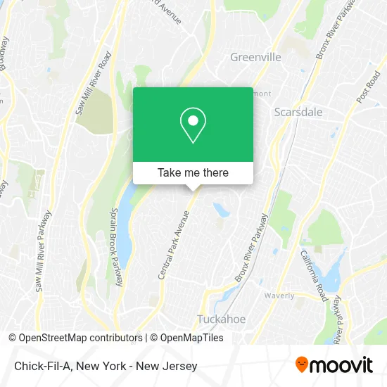
See Chick-Fil-A, Yonkers, on the map
Public Transit to Chick-Fil-A in Yonkers
Wondering how to get to Chick-Fil-A in Yonkers? Moovit helps you find the best way to get to Chick-Fil-A with step-by-step directions from the nearest public transit station.
Moovit provides free maps and live directions to help you navigate through your city. View schedules, routes, timetables, and find out how long does it take to get to Chick-Fil-A in real time.
Looking for the nearest stop or station to Chick-Fil-A? Check out this list of stops closest to your destination: Central Park Ave @ Roxbury Dr; Scarsdale.
Bus: 20, 21, 28.Train: 2.
Want to see if there’s another route that gets you there at an earlier time? Moovit helps you find alternative routes or times. Get directions from and directions to Chick-Fil-A easily from the Moovit App or Website.
We make riding to Chick-Fil-A easy, which is why over 1.5 million users, including users in Yonkers, trust Moovit as the best app for public transit. You don’t need to download an individual bus app or train app, Moovit is your all-in-one transit app that helps you find the best bus time or train time available.
For information on prices of bus and train, costs and ride fares to Chick-Fil-A, please check the Moovit app.
Use the app to navigate to popular places including to the airport, hospital, stadium, grocery store, mall, coffee shop, school, college, and university.
Chick-Fil-A Address: 2205 Central Park Ave street in Yonkers
- Hsbc Bank,
- La Sensacion Bar & Lounge,
- Lidia's Hair Salon,
- Geico Insurance Agent,
- Sulu Aura Skin Studio,
- Adobo Mexican Grill,
- Cell Phone Repair,
- Jean Tickell - Yonkers Real Estate,
- Skn Spa Yonkers,
- Adobo Mexican Grill,
- Keyme Locksmiths,
- Salma Amo - Real Estate,
- Yonkers Real Estate and Community Information,
- The Stretch Yoga,
- Weezie Mullaly,
- Weezie Mullaly - Geico Insurance Agent,
- Cpr Cell Phone Repair Yonkers, NY,
- Total by Verizon,
- Citizens,
- Brian E Schaaf
Places Near Chick-Fil-A (Yonkers)
- 3 Stone St, Manhattan,
- SoHo, Manhattan,
- 376 Hudson Street, Manhattan,
- Mountainside Hospital, Glen Ridge,
- Queens Center Mall, Queens,
- Chinatown, Manhattan,
- 911 Memorial, Manhattan,
- 66 John Street, Manhattan,
- San Gennaro Feast, Manhattan,
- Bellevue Hospital, Manhattan,
- qqqq, Manhattan,
- Pier 83, Manhattan,
- Wall Street, Manhattan,
- 111 Centre New York City Supreme Court, Manhattan,
- 26 Federal Plaza, Manhattan,
- 1 Police Plaza, Manhattan,
- Times Square, Manhattan,
- Katz's Deli, Manhattan,
- Rockefeller Center, Manhattan,
- Hudson Yards, Manhattan
How to get to popular places in New York - New Jersey with public transit
Get around Yonkers by public transit!
Traveling around Yonkers has never been so easy. See step by step directions as you travel to any attraction, street or major public transit station. View bus and train schedules, arrival times, service alerts and detailed routes on a map, so you know exactly how to get to anywhere in Yonkers.
When traveling to any destination around Yonkers use Moovit's Live Directions with Get Off Notifications to know exactly where and how far to walk, how long to wait for your line, and how many stops are left. Moovit will alert you when it's time to get off — no need to constantly re-check whether yours is the next stop.
Wondering how to use public transit in Yonkers or how to pay for public transit in Yonkers? Moovit public transit app can help you navigate your way with public transit easily, and at minimum cost. It includes public transit fees, ticket prices, and costs. Looking for a map of Yonkers public transit lines? Moovit public transit app shows all public transit maps in Yonkers with all Bus, Train, Subway, Light Rail, Ferry and Cable Car routes and stops on an interactive map.
New York - New Jersey has 6 transit type(s), including: Bus, Train, Subway, Light Rail, Ferry and Cable Car, operated by several transit agencies, including MTA Subway, Metro-North Railroad, LIRR, PATH, MTA New York City Transit - Express routes, MTA Bus, NJ Transit, NYC Ferry, NICE bus, Bee-Line Bus, NJ Transit Rail, Norwalk Transit District, Hartford Line, River Valley Transit and HART