How to get to Chicken Kitchen by bus?
Click on the bus route to see step by step directions with maps, line arrival times and updated time schedules.
From Century Medical Center, Miami
48 minFrom Interstate 95 & FL Turnpike/US 441/Palmetto Expy/FL 826, Miami
78 minFrom Walmart North Miami Beach (Walmart Garden Center), Miami
54 minFrom Haulover Nude Beach, Miami Beach
56 minFrom Beach Outlet, Miami Beach
57 minFrom General Consulate Trinidad and Tobago, Miami
40 minFrom Haulover Nude Beach, Miami, Miami Beach
56 minFrom Haulover Beach, Miami Beach
59 minFrom Consulado General Del Ecuador en Miami, Miami
48 minFrom Haulover Park (Haulover Beach), Miami Beach
56 min
Bus stops near Chicken Kitchen in Miami
Bus lines to Chicken Kitchen in Miami
What are the closest stations to Chicken Kitchen?
The closest stations to Chicken Kitchen are:
- Biscayne Bd & Ne 71 St is 100 yards away, 2 min walk.
- Ne 62 St & Biscayne Blvd is 759 yards away, 10 min walk.
- Ne 61 St & Biscayne Blvd is 829 yards away, 11 min walk.
Which bus lines stop near Chicken Kitchen?
These bus lines stop near Chicken Kitchen: 203, 3, 9.
What’s the nearest bus station to Chicken Kitchen in Miami?
The nearest bus station to Chicken Kitchen in Miami is Biscayne Bd & Ne 71 St. It’s a 2 min walk away.
What time is the first bus to Chicken Kitchen in Miami?
The 3 is the first bus that goes to Chicken Kitchen in Miami. It stops nearby at 3:29 AM.
What time is the last bus to Chicken Kitchen in Miami?
The 3 is the last bus that goes to Chicken Kitchen in Miami. It stops nearby at 2:34 AM.
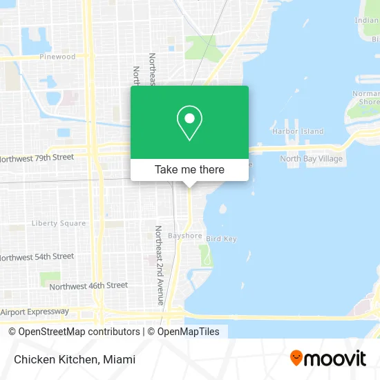
See Chicken Kitchen, Miami, on the map
Public Transit to Chicken Kitchen in Miami
Wondering how to get to Chicken Kitchen in Miami? Moovit helps you find the best way to get to Chicken Kitchen with step-by-step directions from the nearest public transit station.
Moovit provides free maps and live directions to help you navigate through your city. View schedules, routes, timetables, and find out how long does it take to get to Chicken Kitchen in real time.
Looking for the nearest stop or station to Chicken Kitchen? Check out this list of stops closest to your destination: Biscayne Bd & Ne 71 St; Ne 62 St & Biscayne Blvd; Ne 61 St & Biscayne Blvd.
Bus: 203, 3, 9, 62, MIAHAIT, 54.
Want to see if there’s another route that gets you there at an earlier time? Moovit helps you find alternative routes or times. Get directions from and directions to Chicken Kitchen easily from the Moovit App or Website.
We make riding to Chicken Kitchen easy, which is why over 1.5 million users, including users in Miami, trust Moovit as the best app for public transit. You don’t need to download an individual bus app or train app, Moovit is your all-in-one transit app that helps you find the best bus time or train time available.
For information on prices of bus, costs and ride fares to Chicken Kitchen, please check the Moovit app.
Use the app to navigate to popular places including to the airport, hospital, stadium, grocery store, mall, coffee shop, school, college, and university.
Chicken Kitchen Address: 6907 Biscayne Blvd Miami, FL 33138 street in Miami
- Kava Kavern,
- FedEx Office,
- Wood Mobile Locksmith,
- Oakberry Acai,
- Sub Zero Nitrogen Ice Cream,
- Lucky Vape & Smoke,
- Peel,
- DOT Black Agency,
- Shred Nations,
- Beauty Specialists,
- Nannybag Luggage Storage,
- Biscayne Boulevard & Northeast 71st Street,
- Commercial ATM System,
- Salim Lyazidi Photography,
- Aria on the Bay,
- Brookins Kenneth W Brookins Law Firm,
- Manta Security Recruiters,
- Vegan Vibess,
- A Family,
- Sera Sera Experiences
Places Near Chicken Kitchen (Miami)
- Little Havana, Miami,
- Sawgrass Mall, Miami,
- Port of Miami Cruise Terminal, Miami,
- Brickell City Centre, Miami,
- Miami VA Hospital, Miami,
- Aventura Mall, Miami,
- Dolphin Mall Bus, Miami,
- Miami-Dade County Courthouse, Miami,
- Miami Design District, Miami,
- Marlins Park, Miami,
- Wynwood, Miami,
- Richard E. Gerstein Justice Building, Miami,
- Zoo Miami, Miami,
- Sawgrass mall ( FL ), Miami Beach,
- Aventura Mall, Miami Beach,
- Dolphin Mall, Miami,
- Bayside Marketplace, Miami,
- Hard Rock Stadium, Miami Gardens,
- Miami Freedom Park, Miami,
- Keiser University Flagship Campus, West Palm Beach
How to get to popular places in Miami with public transit
Get around Miami by public transit!
Traveling around Miami has never been so easy. See step by step directions as you travel to any attraction, street or major public transit station. View bus and train schedules, arrival times, service alerts and detailed routes on a map, so you know exactly how to get to anywhere in Miami.
When traveling to any destination around Miami use Moovit's Live Directions with Get Off Notifications to know exactly where and how far to walk, how long to wait for your line, and how many stops are left. Moovit will alert you when it's time to get off — no need to constantly re-check whether yours is the next stop.
Wondering how to use public transit in Miami or how to pay for public transit in Miami? Moovit public transit app can help you navigate your way with public transit easily, and at minimum cost. It includes public transit fees, ticket prices, and costs. Looking for a map of Miami public transit lines? Moovit public transit app shows all public transit maps in Miami with all Bus, Train, Light Rail and Ferry routes and stops on an interactive map.
Miami has 4 transit type(s), including: Bus, Train, Light Rail and Ferry, operated by several transit agencies, including Broward County Transit, Miami-Dade Transit, Metrorail, Palm Tran, Tri-Rail, Brightline, MARTY, City of Homestead Trolley, Key West Transit, Treasure Coast Connector, GoLine IRT, Amtrak, Greyhound-us, FlixBus-us and Aventura Express Shuttle Bus