Directions to Chicken Salad Chick (Indianapolis City (Balance)) with public transportation
The following transit lines have routes that pass near Chicken Salad Chick
 Bus: 16.
How to get to Chicken Salad Chick by bus?
Click on the bus route to see step by step directions with maps, line arrival times and updated time schedules.
From Wethington Law Office, Beech Grove
24 minFrom AMC Theatres-Indianapolis 17 (AMC Showplace 17 IMAX), Indianapolis City (Balance)
70 minFrom JBN Family Applian, Indianapolis City (Balance)
38 minFrom FedEx, Indianapolis City (Balance)
40 minFrom Emma Donnan Middle School, Indianapolis City (Balance)
38 minFrom National Pony of the Americas Club, Beech Grove
58 minFrom WING STOP, Indianapolis City (Balance)
72 minFrom Northern Tool Equipment, Indianapolis City (Balance)
33 minFrom Uab Recycling LLC, Indianapolis City (Balance)
40 min
Bus stop near Chicken Salad Chick in Indianapolis City (Balance)
- Emerson Ave & Ehler Dr, 6 min walk,VIEW
Bus lines to Chicken Salad Chick in Indianapolis City (Balance)
- 16, County Line Rd,VIEW
What are the closest stations to Chicken Salad Chick?
The closest stations to Chicken Salad Chick are:
- Emerson Ave & Ehler Dr is 506 yards away, 6 min walk.
Which bus line stops near Chicken Salad Chick?
16 (County Line Rd)
What’s the nearest bus station to Chicken Salad Chick in Indianapolis City (Balance)?
The nearest bus station to Chicken Salad Chick in Indianapolis City (Balance) is Emerson Ave & Ehler Dr. It’s a 6 min walk away.
What time is the first bus to Chicken Salad Chick in Indianapolis City (Balance)?
The 16 is the first bus that goes to Chicken Salad Chick in Indianapolis City (Balance). It stops nearby at 4:47 AM.
What time is the last bus to Chicken Salad Chick in Indianapolis City (Balance)?
The 16 is the last bus that goes to Chicken Salad Chick in Indianapolis City (Balance). It stops nearby at 10:18 PM.
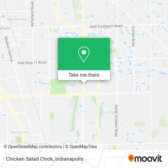
See Chicken Salad Chick, Indianapolis City (Balance), on the map
Public Transit to Chicken Salad Chick in Indianapolis City (Balance)
Wondering how to get to Chicken Salad Chick in Indianapolis City (Balance)? Moovit helps you find the best way to get to Chicken Salad Chick with step-by-step directions from the nearest public transit station.
Moovit provides free maps and live directions to help you navigate through your city. View schedules, routes, timetables, and find out how long does it take to get to Chicken Salad Chick in real time.
Looking for the nearest stop or station to Chicken Salad Chick? Check out this list of stops closest to your destination: Emerson Ave & Ehler Dr.
Bus: 16.
Want to see if there’s another route that gets you there at an earlier time? Moovit helps you find alternative routes or times. Get directions from and directions to Chicken Salad Chick easily from the Moovit App or Website.
We make riding to Chicken Salad Chick easy, which is why over 1.5 million users, including users in Indianapolis City (Balance), trust Moovit as the best app for public transit. You don’t need to download an individual bus app or train app, Moovit is your all-in-one transit app that helps you find the best bus time or train time available.
For information on prices of bus, costs and ride fares to Chicken Salad Chick, please check the Moovit app.
Use the app to navigate to popular places including to the airport, hospital, stadium, grocery store, mall, coffee shop, school, college, and university.
Chicken Salad Chick Address: 8635 S Emerson Ave street in Indianapolis City (Balance)
- LENS CRAFTERS,
- Bibibop Asian Grill,
- Cousins,
- Mochinut Greenwood,
- Sleep Center at Furniture Fair,
- Cellular Connection,
- Mattress Pack,
- Owlslee CBD - Greenwood,
- Communicare,
- Cousins,
- Freddy's Frozen Custard & Steakburger,
- Matthew M Davis DDS,
- Popeyes LOUISIANA KITCHEN,
- TACO BELL,
- Woods Jas E Pastor,
- Tracy Whitaker - Old National Bank,
- Marla Steigerwald - Old National Bank,
- S Emerson Ave / E County Line Rd,
- Beech Grove ob/Gyn,
- 5255 Noggle Way
Places Near Chicken Salad Chick (Indianapolis City (Balance))
- Methodist Hospital of Indianapolis, Indianapolis City (Balance),
- Castleton Square Mall, Indianapolis,
- Indiana Convention Center, Indianapolis City (Balance),
- THE BALT, Indianapolis City (Balance),
- Jersey Barn, Indianapolis City (Balance),
- St. Vincent entrance #1, Indianapolis City (Balance),
- Gainbridge Fieldhouse, Indianapolis City (Balance),
- Indiana, Indianapolis City (Balance),
- Eskenazi Hospital, Indianapolis City (Balance),
- Train Ride At Castleton Mall, Indianapolis City (Balance),
- Indianapolis Motor Speedway, Speedway,
- Lucas Oil Stadium, Indianapolis City (Balance),
- St. Vincent Hospital - Indianapolis, Indianapolis City (Balance),
- Cotter's Massage Parlor With Happy Endings, Indianapolis City (Balance),
- I-465 / I-65 Interchange, Indianapolis City (Balance),
- Plainfield, IN, Plainfield,
- 119 W 19th St Parking, Indianapolis City (Balance),
- I U Health Methodist Hospital, Indianapolis City (Balance),
- Indianapolis Airport Zone 2, Indianapolis City (Balance),
- Lilly Corporate Center (Eli Lilly & Co), Indianapolis City (Balance)
How to get to popular places in Indianapolis with public transit
Get around Indianapolis City (Balance) by public transit!
Traveling around Indianapolis City (Balance) has never been so easy. See step by step directions as you travel to any attraction, street or major public transit station. View bus and train schedules, arrival times, service alerts and detailed routes on a map, so you know exactly how to get to anywhere in Indianapolis City (Balance).
When traveling to any destination around Indianapolis City (Balance) use Moovit's Live Directions with Get Off Notifications to know exactly where and how far to walk, how long to wait for your line, and how many stops are left. Moovit will alert you when it's time to get off — no need to constantly re-check whether yours is the next stop.
Wondering how to use public transit in Indianapolis City (Balance) or how to pay for public transit in Indianapolis City (Balance)? Moovit public transit app can help you navigate your way with public transit easily, and at minimum cost. It includes public transit fees, ticket prices, and costs. Looking for a map of Indianapolis City (Balance) public transit lines? Moovit public transit app shows all public transit maps in Indianapolis City (Balance) with all bus routes and stops on an interactive map.
Indianapolis has 1 transit type(s), including: bus, operated by several transit agencies, including IndyGo, FlixBus-us and Greyhound-us