How to get to Children's Nook - Gamdevi by bus?
Click on the bus route to see step by step directions with maps, line arrival times and updated time schedules.
How to get to Children's Nook - Gamdevi by train?
Click on the train route to see step by step directions with maps, line arrival times and updated time schedules.
How to get to Children's Nook - Gamdevi by metro?
Click on the metro route to see step by step directions with maps, line arrival times and updated time schedules.
Bus stops near Children's Nook - Gamdevi in Malabar Hill
Train station near Children's Nook - Gamdevi in Malabar Hill
- Mumbai Central, 21 min walk,VIEW
Metro station near Children's Nook - Gamdevi in Malabar Hill
- Jagannath Shankar Sheth Metro, 25 min walk,VIEW
Bus lines to Children's Nook - Gamdevi in Malabar Hill
- 28, JVPD Bus Station - Chhatrapati Shivaji Maharaj Terminus,VIEW
- 57, Prabodhankar Thackeray Udyan Bus Station (Sewree) - Walkeshwar,VIEW
- A-62, Vidyavihar Bus Station - Pandit Paluskar Chowk (Opera House),VIEW
- 83, Santacruz Depot - Pandit Paluskar Chowk (Opera House),VIEW
- 83, Santacruz Depot - Colaba Bus Station,VIEW
- C-86, Backbay Depot - Bandra (W) Bus Station,VIEW
- 88, Pratiksha Nagar Depot - Mantralaya,VIEW
- A-89, Worli Depot - Mantralaya,VIEW
- C-305, Backbay Depot - Dharavi Depot,VIEW
- A-104, J.Mehta Marg (Napean Sea Road) - Grant Road Station (W),VIEW
- A-104, J.Mehta Marg (Napean Sea Road) - Vijay Vallabh Chowk (Pydhonie),VIEW
- A-121, Backbay Depot - J.Mehta Marg (Napean Sea Road),VIEW
- A-122, Ballard Pier - J.Mehta Marg (Napean Sea Road),VIEW
- A-132, Mumbai Central Depot - Colaba Bus Station,VIEW
- A-135, J.Mehta Marg (Napean Sea Road) - Ferry Wharf,VIEW
- A-42, Kamala Nehru Park (Malabar Hill) - Ferry Wharf,VIEW
- A-42, Kamala Nehru Park (Malabar Hill) - Noorbaug,VIEW
- A-42, Kamala Nehru Park (Malabar Hill) - Maharana Pratap Chowk (Mazgaon),VIEW
- 67, Antop Hill - Walkeshwar,VIEW
- A-105, Kamala Nehru Park (Malabar Hill) - Tardeo Bus Station (Rushi Mehta Chowk),VIEW
What are the closest stations to Children's Nook - Gamdevi?
The closest stations to Children's Nook - Gamdevi are:
- Babulnath Junction is 88 meters away, 2 min walk.
- August Kranti Maidan is 242 meters away, 4 min walk.
- Gaondevi Police Station is 289 meters away, 4 min walk.
- Nana Chowk is 466 meters away, 7 min walk.
- Mumbai Central is 1577 meters away, 21 min walk.
- Jagannath Shankar Sheth Metro is 1935 meters away, 25 min walk.
Which bus lines stop near Children's Nook - Gamdevi?
These bus lines stop near Children's Nook - Gamdevi: 83, 88, A-104, A-123, A-89, C-305, C-86.
Which train line stops near Children's Nook - Gamdevi?
WR (Churchgate (F))
Which metro line stops near Children's Nook - Gamdevi?
LINE 3 (Aarey JVLR)
What’s the nearest metro station to Children's Nook - Gamdevi in Malabar Hill?
The nearest metro station to Children's Nook - Gamdevi in Malabar Hill is Jagannath Shankar Sheth Metro. It’s a 25 min walk away.
What’s the nearest train station to Children's Nook - Gamdevi in Malabar Hill?
The nearest train station to Children's Nook - Gamdevi in Malabar Hill is Mumbai Central. It’s a 21 min walk away.
What’s the nearest bus station to Children's Nook - Gamdevi in Malabar Hill?
The nearest bus station to Children's Nook - Gamdevi in Malabar Hill is Babulnath Junction. It’s a 2 min walk away.
What time is the first metro to Children's Nook - Gamdevi in Malabar Hill?
The LINE 3 is the first metro that goes to Children's Nook - Gamdevi in Malabar Hill. It stops nearby at 6:07 AM.
What time is the last metro to Children's Nook - Gamdevi in Malabar Hill?
The LINE 3 is the last metro that goes to Children's Nook - Gamdevi in Malabar Hill. It stops nearby at 11:10 PM.
What time is the first train to Children's Nook - Gamdevi in Malabar Hill?
The WR is the first train that goes to Children's Nook - Gamdevi in Malabar Hill. It stops nearby at 4:20 AM.
What time is the last train to Children's Nook - Gamdevi in Malabar Hill?
The WR is the last train that goes to Children's Nook - Gamdevi in Malabar Hill. It stops nearby at 1:44 AM.
What time is the first bus to Children's Nook - Gamdevi in Malabar Hill?
The 67 is the first bus that goes to Children's Nook - Gamdevi in Malabar Hill. It stops nearby at 5:56 AM.
What time is the last bus to Children's Nook - Gamdevi in Malabar Hill?
The C-86 is the last bus that goes to Children's Nook - Gamdevi in Malabar Hill. It stops nearby at 1:26 AM.
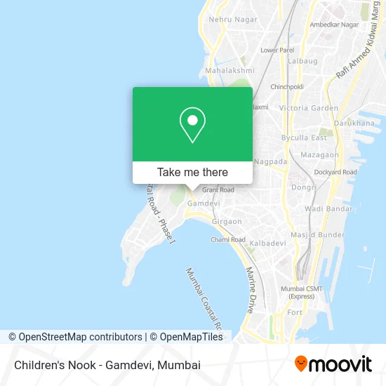
See Children's Nook - Gamdevi, Malabar Hill, on the map
Public Transit to Children's Nook - Gamdevi in Malabar Hill
Wondering how to get to Children's Nook - Gamdevi in Malabar Hill? Moovit helps you find the best way to get to Children's Nook - Gamdevi with step-by-step directions from the nearest public transit station.
Moovit provides free maps and live directions to help you navigate through your city. View schedules, routes, timetables, and find out how long does it take to get to Children's Nook - Gamdevi in real time.
Looking for the nearest stop or station to Children's Nook - Gamdevi? Check out this list of stops closest to your destination: Babulnath Junction; August Kranti Maidan; Gaondevi Police Station; Nana Chowk; Mumbai Central; Jagannath Shankar Sheth Metro.
Bus: 83, 88, A-104, A-123, A-89, C-305, C-86, 28, 57, A-62, A-121, A-122, A-132, A-42, A-42, A-42, 67, A-105, A-155.Train: WR, CGDR, WR-AC, WR-AC, WR-AC.Metro: LINE 3.
Want to see if there’s another route that gets you there at an earlier time? Moovit helps you find alternative routes or times. Get directions from and directions to Children's Nook - Gamdevi easily from the Moovit App or Website.
We make riding to Children's Nook - Gamdevi easy, which is why over 1.5 million users, including users in Malabar Hill, trust Moovit as the best app for public transit. You don’t need to download an individual bus app or train app, Moovit is your all-in-one transit app that helps you find the best bus time or train time available.
For information on prices of bus, train and metro, costs and ride fares to Children's Nook - Gamdevi, please check the Moovit app.
Use the app to navigate to popular places including to the airport, hospital, stadium, grocery store, mall, coffee shop, school, college, and university.
Children's Nook - Gamdevi Address: Tejpal Road Mumbai 400007 MH street in Malabar Hill
- B. P. Gora Gandhi Chowk,
- Samrat Restaurant,
- Mahatma Gandhi Museum,
- TDS Corp,
- Eie India,
- Hinex Chemimicals,
- Sanskruti,
- Skylon Coatings,
- Paintkart Shop,
- Santitias,
- Shahi Hair & Beauty Studio,
- Dr Usha Krishna,
- Ajit Villa,
- Zoeb Dohadwala,
- Juice,
- Bombay Durga Bari Samiti,
- Kotak Kunj,
- Dr Sanjay Burudes,
- Kohinoor,
- Surprise Home Linen
Places Near Children's Nook - Gamdevi (Malabar Hill)
- Shanmukhananda Hall, Sion , Mumbai, Sion Koliwada,
- INFINITI Mall (Infinity Mall, andheri), Versova,
- Malabar Hill, Malabar Hill,
- Ikea, Worli,
- Oberoi Mall, Dindoshi,
- R CITY MALL, Ghatkopar East,
- Hinduja Hospital, Mahim,
- Oberoi Sky City, Borivali East,
- Worli Sea Face,
- Govardhan Ecovillage, Palghar (St),
- Mumbai University, Kalina,
- Rani Baug, Byculla,
- TCS Olympus, Thane,
- J. J. Hospital, Byculla,
- Bombay Exhibition Center, Goregaon,
- Gateway Of India,
- Dome @ Nsci - Svp Stadium Mumbai, Worli,
- NESCO, Goregaon,
- Inorbit Mall, Malad West,
- Bhaucha Dhakka
How to get to popular places in Mumbai with public transit
Get around Malabar Hill by public transit!
Traveling around Malabar Hill has never been so easy. See step by step directions as you travel to any attraction, street or major public transit station. View bus and train schedules, arrival times, service alerts and detailed routes on a map, so you know exactly how to get to anywhere in Malabar Hill.
When traveling to any destination around Malabar Hill use Moovit's Live Directions with Get Off Notifications to know exactly where and how far to walk, how long to wait for your line, and how many stops are left. Moovit will alert you when it's time to get off — no need to constantly re-check whether yours is the next stop.
Wondering how to use public transit in Malabar Hill or how to pay for public transit in Malabar Hill? Moovit public transit app can help you navigate your way with public transit easily, and at minimum cost. It includes public transit fees, ticket prices, and costs. Looking for a map of Malabar Hill public transit lines? Moovit public transit app shows all public transit maps in Malabar Hill with all Bus, Train, Metro and Ferry routes and stops on an interactive map.
Mumbai has 4 transit type(s), including: Bus, Train, Metro and Ferry, operated by several transit agencies, including MMMOCL (Maha Mumbai Metro Operation Corporation Ltd.), NMM CIDCO (Navi Mumbai Metro Maha Metro), Reliance Mumbai Metro, MMRCL (Mumbai Metro Rail Corporation Ltd), BEST (Brihanmumbai Electricity Supply & Transport), BEST AC Services, A.C.Trains (Air-Conditioning Trains), W.R. (Western Railways), C.R. (Central Railways), C.R.MEMU (Central Railways Shuttle MEMU Trains), H.R. (Harbour Railways), T.R.(Trans Harbour Railways), U.R.(Uran-Ulwe Railways), I.R.(Indian Railways) and TMT (Thane Municipal Transport)