How to get to Chipotle by bus?
Click on the bus route to see step by step directions with maps, line arrival times and updated time schedules.
From Arundel Mills, Anne Arundel County
92 minFrom Walmart, Baltimore County
84 minFrom Elkridge, MD, Howard County
85 minFrom I-95 Exit 33 - Laurel/Burtonsville (Sandy Spring Rd/MD 198), Prince George's County
74 minFrom Maryland Live! Casino, Anne Arundel County
94 minFrom MD Live Casino Arundel Mills, Anne Arundel County
90 minFrom Laurel, Maryland, Prince George's County
73 minFrom Guinness Open Gate Brewery & Barrel House, Baltimore County
148 minFrom NSA Friendship Annex (FANX), Anne Arundel County
133 min
Bus stops near Chipotle in Howard County
Bus lines to Chipotle in Howard County
What are the closest stations to Chipotle?
The closest stations to Chipotle are:
- Broken Land & Cradlerock S Sb is 395 yards away, 5 min walk.
- Broken Land Pkwy / Cradlerock Way South (Southbound) is 423 yards away, 6 min walk.
- Owen Brown Village Center is 2221 yards away, 26 min walk.
Which bus line stops near Chipotle?
503 (Towne Centre Laurel)
What’s the nearest bus station to Chipotle in Howard County?
The nearest bus station to Chipotle in Howard County is Broken Land & Cradlerock S Sb. It’s a 5 min walk away.
What time is the first bus to Chipotle in Howard County?
The 305 is the first bus that goes to Chipotle in Howard County. It stops nearby at 4:45 AM.
What time is the last bus to Chipotle in Howard County?
The 407 is the last bus that goes to Chipotle in Howard County. It stops nearby at 11:20 PM.
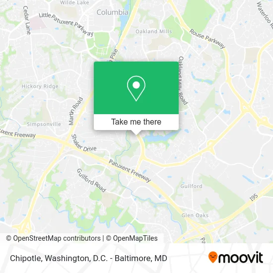
See Chipotle, Howard County, on the map
Public Transit to Chipotle in Howard County
Wondering how to get to Chipotle in Howard County? Moovit helps you find the best way to get to Chipotle with step-by-step directions from the nearest public transit station.
Moovit provides free maps and live directions to help you navigate through your city. View schedules, routes, timetables, and find out how long does it take to get to Chipotle in real time.
Looking for the nearest stop or station to Chipotle? Check out this list of stops closest to your destination: Broken Land & Cradlerock S Sb; Broken Land Pkwy / Cradlerock Way South (Southbound); Owen Brown Village Center.
Bus: 503, 305, 315, 407.
Want to see if there’s another route that gets you there at an earlier time? Moovit helps you find alternative routes or times. Get directions from and directions to Chipotle easily from the Moovit App or Website.
We make riding to Chipotle easy, which is why over 1.5 million users, including users in Howard County, trust Moovit as the best app for public transit. You don’t need to download an individual bus app or train app, Moovit is your all-in-one transit app that helps you find the best bus time or train time available.
For information on prices of bus, costs and ride fares to Chipotle, please check the Moovit app.
Get to Chipotle with public transit and pay for the ride in the Moovit app. In addition to all info you may need for your trip to Chipotle, including live directions, real-time arrivals and fare prices, you can also buy public transit passes for your rides. No need for cash or paper tickets to get to Chipotle - everything you need is accessible in the app with a click of the button.
Use the app to navigate to popular places including to the airport, hospital, stadium, grocery store, mall, coffee shop, school, college, and university.
Chipotle Address: 9851 Broken Land Pkwy Columbia, MD 21046 street in Howard County
- Mahana Fresh,
- Tree Trimming Service,
- Weichert Realtors McKenna & Vane,
- Markzedgie Tree Trimming,
- Harbor Financial Group,
- Healthstream,
- Lingual Information System Technologies,
- Arcadis US,
- Fitzgerald Financial Group,
- Sajjad Electrical Store,
- Scottrade,
- Govt High School Paharpur,
- Patuxent Crossing Business Center,
- Valerie Campbell, Pa-C,
- Mercy Personal Physicians at Columbia,
- COLA,
- Dodek & Dodek,
- Joshua Rosenthal MD,
- LJT & Associates,
- Bodywise Physical Therapy and Acupuncture
Places Near Chipotle (Howard County)
- Rock Creek Tennis Center, Washington,
- Museum Of The Bible, Washington,
- National Museum of African American History and Culture, Washington,
- Georgetown, Washington,
- Warner Theatre, Washington,
- National Zoo, Washington,
- Camden Yards, Baltimore,
- Basilica of the National Shrine, Washington,
- The Anthem, Washington,
- Pennsylvania Ave NW (3rd st and pennsylvania), Washington,
- PG Mall, Prince George's County,
- National Mall, Washington,
- Westfield Montgomery Mall, Montgomery County,
- Sibley Memorial Hospital, Washington,
- Capital One Arena, Washington,
- M&T Bank Stadium, Baltimore,
- Washington National Cathedral, Washington,
- Amazon Hq2, Arlington County,
- Marriott Marquis Washington, DC, Washington,
- Washington DC VA Medical Center, Washington
How to get to popular places in Washington, D.C. - Baltimore, MD with public transit
Get around Howard County by public transit!
Traveling around Howard County has never been so easy. See step by step directions as you travel to any attraction, street or major public transit station. View bus and train schedules, arrival times, service alerts and detailed routes on a map, so you know exactly how to get to anywhere in Howard County.
When traveling to any destination around Howard County use Moovit's Live Directions with Get Off Notifications to know exactly where and how far to walk, how long to wait for your line, and how many stops are left. Moovit will alert you when it's time to get off — no need to constantly re-check whether yours is the next stop.
Wondering how to use public transit in Howard County or how to pay for public transit in Howard County? Moovit public transit app can help you navigate your way with public transit easily, and at minimum cost. It includes public transit fees, ticket prices, and costs. Looking for a map of Howard County public transit lines? Moovit public transit app shows all public transit maps in Howard County with all Bus, Train, Metro, Light Rail and Ferry routes and stops on an interactive map.
Washington, D.C. - Baltimore, MD has 5 transit type(s), including: Bus, Train, Metro, Light Rail and Ferry, operated by several transit agencies, including WMATA, Montgomery County Ride On, Fairfax Connector, TheBus, PRTC, DASH - Alexandria, Arlington Transit (ART), RTA of Central Maryland, MDOT MTA, MDOT MTA Light RailLink, MDOT MTA Commuter Bus, MDOT MTA Local Bus, FXBGO!, Virginia Railway Express (VRE) and MARC