How to get to Chispas Discotheque by bus?
Click on the bus route to see step by step directions with maps, line arrival times and updated time schedules.
From 1629 Roosevelt Ave Parking, Indianapolis City (Balance)
46 minFrom St Vincent Hospital Gift Shop, Indianapolis City (Balance)
60 minFrom Sheraton Indianapolis City Centre Hotel, Indianapolis City (Balance)
35 minFrom St. Vincent Outpatient Lab, Indianapolis City (Balance)
56 minFrom Wheeler Mission, Indianapolis City (Balance)
43 minFrom MERRELL, Indianapolis City (Balance)
39 minFrom Lockfield Commons, Indianapolis City (Balance)
32 minFrom Market Square Arena, Indianapolis City (Balance)
38 minFrom Jimenez MR.Discount, Indianapolis City (Balance)
43 minFrom bp, Indianapolis City (Balance)
32 min
Bus stops near Chispas Discotheque in Indianapolis
What are the closest stations to Chispas Discotheque?
The closest stations to Chispas Discotheque are:
- Georgetown Rd & 38th St is 189 yards away, 3 min walk.
- Lafayette Rd - 3900 N is 221 yards away, 3 min walk.
Which bus lines stop near Chispas Discotheque?
These bus lines stop near Chispas Discotheque: 37, 38.
What’s the nearest bus station to Chispas Discotheque in Indianapolis?
The nearest bus stations to Chispas Discotheque in Indianapolis are Georgetown Rd & 38th St and Lafayette Rd - 3900 N. The closest one is a 3 min walk away.
What time is the first bus to Chispas Discotheque in Indianapolis?
The 37 is the first bus that goes to Chispas Discotheque in Indianapolis. It stops nearby at 5:07 AM.
What time is the last bus to Chispas Discotheque in Indianapolis?
The 37 is the last bus that goes to Chispas Discotheque in Indianapolis. It stops nearby at 11:15 PM.
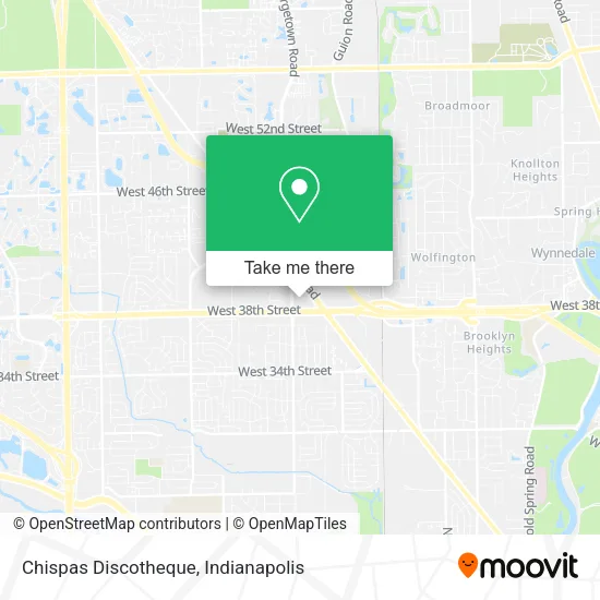
See Chispas Discotheque, Indianapolis, on the map
Public Transit to Chispas Discotheque in Indianapolis
Wondering how to get to Chispas Discotheque in Indianapolis? Moovit helps you find the best way to get to Chispas Discotheque with step-by-step directions from the nearest public transit station.
Moovit provides free maps and live directions to help you navigate through your city. View schedules, routes, timetables, and find out how long does it take to get to Chispas Discotheque in real time.
Looking for the nearest stop or station to Chispas Discotheque? Check out this list of stops closest to your destination: Georgetown Rd & 38th St; Lafayette Rd - 3900 N.
Bus: 37, 38.
Want to see if there’s another route that gets you there at an earlier time? Moovit helps you find alternative routes or times. Get directions from and directions to Chispas Discotheque easily from the Moovit App or Website.
We make riding to Chispas Discotheque easy, which is why over 1.5 million users, including users in Indianapolis, trust Moovit as the best app for public transit. You don’t need to download an individual bus app or train app, Moovit is your all-in-one transit app that helps you find the best bus time or train time available.
For information on prices of bus, costs and ride fares to Chispas Discotheque, please check the Moovit app.
Use the app to navigate to popular places including to the airport, hospital, stadium, grocery store, mall, coffee shop, school, college, and university.
Chispas Discotheque Address: 3890 Lafayette Rd Indianapolis, IN 46254 street in Indianapolis
- Chispas Discoteque (El Chispas 2),
- Ingrid Beauty Salón,
- Delicias Jalisco (Delicious Jalisco),
- About Face Beauty Boutique,
- R & A Fashions,
- Cohen Garage Door Security,
- Style N Dial,
- 38th Buffet,
- Bestaff,
- Money Saver Grocery,
- Church's Texas Chicken,
- Alamo Drafthouse Cinema Indianapolis,
- Winners Chapel International,
- Glamour Boutique & Spa,
- MS 15 Boutique,
- 247 Garage Door,
- National Bank,
- Vision Care Holdings,
- Eyeworks,
- 38th st and georgetown rd
Places Near Chispas Discotheque (Indianapolis)
- Lucas Oil Stadium, Indianapolis City (Balance),
- THE BALT, Indianapolis City (Balance),
- Cotter's Massage Parlor With Happy Endings, Indianapolis City (Balance),
- Train Ride At Castleton Mall, Indianapolis City (Balance),
- St. Vincent Hospital - Indianapolis, Indianapolis City (Balance),
- Eskenazi Hospital, Indianapolis City (Balance),
- St. Vincent entrance #1, Indianapolis City (Balance),
- I U Health Methodist Hospital, Indianapolis City (Balance),
- I-465 / I-65 Interchange, Indianapolis City (Balance),
- 119 W 19th St Parking, Indianapolis City (Balance),
- Indianapolis Airport Zone 2, Indianapolis City (Balance),
- Indiana Convention Center, Indianapolis City (Balance),
- Lilly Corporate Center (Eli Lilly & Co), Indianapolis City (Balance),
- Plainfield, IN, Plainfield,
- Jersey Barn, Indianapolis City (Balance),
- Castleton Square Mall, Indianapolis,
- Gainbridge Fieldhouse, Indianapolis City (Balance),
- Methodist Hospital of Indianapolis, Indianapolis City (Balance),
- Indiana, Indianapolis City (Balance),
- Indianapolis Motor Speedway, Speedway
How to get to popular places in Indianapolis with public transit
Get around Indianapolis by public transit!
Traveling around Indianapolis has never been so easy. See step by step directions as you travel to any attraction, street or major public transit station. View bus and train schedules, arrival times, service alerts and detailed routes on a map, so you know exactly how to get to anywhere in Indianapolis.
When traveling to any destination around Indianapolis use Moovit's Live Directions with Get Off Notifications to know exactly where and how far to walk, how long to wait for your line, and how many stops are left. Moovit will alert you when it's time to get off — no need to constantly re-check whether yours is the next stop.
Wondering how to use public transit in Indianapolis or how to pay for public transit in Indianapolis? Moovit public transit app can help you navigate your way with public transit easily, and at minimum cost. It includes public transit fees, ticket prices, and costs. Looking for a map of Indianapolis public transit lines? Moovit public transit app shows all public transit maps in Indianapolis with all bus routes and stops on an interactive map.
Indianapolis has 1 transit type(s), including: bus, operated by several transit agencies, including IndyGo, FlixBus-us and Greyhound-us