How to get to Cho Re Hospital by bus?
Click on the bus route to see step by step directions with maps, line arrival times and updated time schedules.
Bus stop near Cho Re Hospital in Shirur
- Mangalmurti Nagar Shirur Road, 2 min walk,VIEW
Bus lines to Cho Re Hospital in Shirur
What are the closest stations to Cho Re Hospital?
The closest stations to Cho Re Hospital are:
- Mangalmurti Nagar Shirur Road is 113 meters away, 2 min walk.
Which bus lines stop near Cho Re Hospital?
These bus lines stop near Cho Re Hospital: 161B, 161D.
What’s the nearest bus station to Cho Re Hospital in Shirur?
The nearest bus station to Cho Re Hospital in Shirur is Mangalmurti Nagar Shirur Road. It’s a 2 min walk away.
What time is the first bus to Cho Re Hospital in Shirur?
The 161D is the first bus that goes to Cho Re Hospital in Shirur. It stops nearby at 7:24 AM.
What time is the last bus to Cho Re Hospital in Shirur?
The 161D is the last bus that goes to Cho Re Hospital in Shirur. It stops nearby at 8:06 PM.
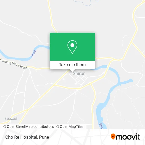
See Cho Re Hospital, Shirur, on the map
Public Transit to Cho Re Hospital in Shirur
Wondering how to get to Cho Re Hospital in Shirur? Moovit helps you find the best way to get to Cho Re Hospital with step-by-step directions from the nearest public transit station.
Moovit provides free maps and live directions to help you navigate through your city. View schedules, routes, timetables, and find out how long does it take to get to Cho Re Hospital in real time.
Looking for the nearest stop or station to Cho Re Hospital? Check out this list of stops closest to your destination: Mangalmurti Nagar Shirur Road.
Bus: 161B, 161D.
Want to see if there’s another route that gets you there at an earlier time? Moovit helps you find alternative routes or times. Get directions from and directions to Cho Re Hospital easily from the Moovit App or Website.
We make riding to Cho Re Hospital easy, which is why over 1.5 million users, including users in Shirur, trust Moovit as the best app for public transit. You don’t need to download an individual bus app or train app, Moovit is your all-in-one transit app that helps you find the best bus time or train time available.
For information on prices of bus, costs and ride fares to Cho Re Hospital, please check the Moovit app.
Use the app to navigate to popular places including to the airport, hospital, stadium, grocery store, mall, coffee shop, school, college, and university.
Cho Re Hospital Address: SH-54 शिरूर 412210 MH street in Shirur
- Sai Shrdha Garage,
- Shraddha Enterprises,
- Mahaganapati Electricals & Enterprises,
- Shri Sadguru Auto,
- Ramdev Plywood and Hardware,
- Jaymalhar Pan Centre,
- Sai Tyre Works,
- National Welding Works,
- Samarth Gadi Bhandar,
- Dev Kirana,
- Hotel Shri Swami Samarth,
- Gahinath Supplayers,
- Vishav Enterprises,
- Chavan Spray Painting,
- Shri Dutt Tractor Garage,
- Star Battery,
- Yash Mobile,
- Kamdhenu Tmt Steel,
- Sambahji Kirana,
- Rajuri Steel
Places Near Cho Re Hospital (Shirur)
- Symbiosis Lavale Bus Stop, Pune & Velhe,
- Senapati Bapat Road, Pune & Velhe,
- Dagadusheth Halwai Ganapati Temple, Pune & Velhe,
- Chaturshringi Temple, Pune & Velhe,
- ISKCON Pune, Pune & Velhe,
- Laxmi Road, Pune & Velhe,
- Vishwakarma Institute Of Technology (Vit), Pune & Velhe,
- Swaminarayan Mandir, Pune & Velhe,
- ISKCON Nvcc Temple, Pune & Velhe,
- Pune Okayama Friendship Garden, Pune & Velhe,
- Ion Digital Zone, Pune & Velhe,
- Pvr Icon - Pavilion Mall, Pune & Velhe,
- Dagdusheth Halwai Ganpati Mandir, Pune & Velhe,
- Sarasbaug, Pune & Velhe,
- M G Road, Pune & Velhe,
- Cognizant Deccan Campus (CDC), Paud,
- BAPS Shri Swaminarayan Mandir, Pune & Velhe,
- Westend Mall, Pune & Velhe,
- Tulshibaug, Pune & Velhe,
- Fc Road, Pune & Velhe
How to get to popular places in Pune with public transit
Get around Shirur by public transit!
Traveling around Shirur has never been so easy. See step by step directions as you travel to any attraction, street or major public transit station. View bus and train schedules, arrival times, service alerts and detailed routes on a map, so you know exactly how to get to anywhere in Shirur.
When traveling to any destination around Shirur use Moovit's Live Directions with Get Off Notifications to know exactly where and how far to walk, how long to wait for your line, and how many stops are left. Moovit will alert you when it's time to get off — no need to constantly re-check whether yours is the next stop.
Wondering how to use public transit in Shirur or how to pay for public transit in Shirur? Moovit public transit app can help you navigate your way with public transit easily, and at minimum cost. It includes public transit fees, ticket prices, and costs. Looking for a map of Shirur public transit lines? Moovit public transit app shows all public transit maps in Shirur with all Bus, Train and Metro routes and stops on an interactive map.
Pune has 3 transit type(s), including: Bus, Train and Metro, operated by several transit agencies, including Pune Metro (Maha Metro), PMPML, PMPML Night Bus Service (Ratrani) and Central Railways (Indian Railways)