Directions to Chopt (Greenwich) with public transportation
The following transit lines have routes that pass near Chopt
 Bus: 311, 312, 324.
- Train: 3, ACELA, COMMUTER RAIL, NORTHEAST REGIONAL, VERMONTER.
How to get to Chopt by bus?
Click on the bus route to see step by step directions with maps, line arrival times and updated time schedules.
From White Plains, NY, White Plains
51 minFrom GFFF, Stamford
40 minFrom Elmsford, NY, Elmsford
99 minFrom Westchester Mall, White Plains
52 minFrom NBC Sports Shuttle, Stamford
59 minFrom The Sono Collection, Norwalk
74 minFrom Port Chester, NY, Port Chester
42 minFrom Rye Playland, Rye
69 minFrom Mamaroneck NY, Mamaroneck
81 minFrom New Rochelle, NY, New Rochelle
102 min
How to get to Chopt by train?
Click on the train route to see step by step directions with maps, line arrival times and updated time schedules.
Bus stops near Chopt in Greenwich
Train station near Chopt in Greenwich
- Stamford, 46 min walk,VIEW
Bus lines to Chopt in Greenwich
What are the closest stations to Chopt?
The closest stations to Chopt are:
- E Putnam Ave @ Neil Ln 1 is 226 yards away, 3 min walk.
- E Putnam Ave @ Sound Beach Ave is 410 yards away, 6 min walk.
- E Putnam Ave @ Sound Beach Ave Ext is 428 yards away, 6 min walk.
- Stamford is 3870 yards away, 46 min walk.
Which bus line stops near Chopt?
311 (311b - Stamford Via Hamilton Ave)
Which train line stops near Chopt?
3 (1316#| Stamford)
What’s the nearest bus station to Chopt in Greenwich?
The nearest bus station to Chopt in Greenwich is E Putnam Ave @ Neil Ln 1. It’s a 3 min walk away.
What time is the first train to Chopt in Greenwich?
The 3 is the first train that goes to Chopt in Greenwich. It stops nearby at 3:02 AM.
What time is the last train to Chopt in Greenwich?
The 3 is the last train that goes to Chopt in Greenwich. It stops nearby at 3:02 AM.
What time is the first bus to Chopt in Greenwich?
The 312 is the first bus that goes to Chopt in Greenwich. It stops nearby at 5:08 AM.
What time is the last bus to Chopt in Greenwich?
The 311 is the last bus that goes to Chopt in Greenwich. It stops nearby at 12:23 AM.
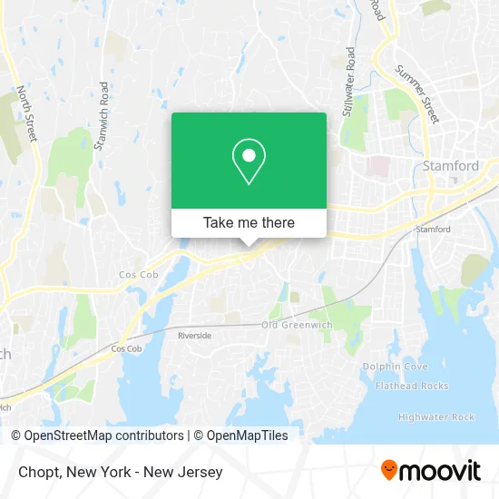
See Chopt, Greenwich, on the map
Public Transit to Chopt in Greenwich
Wondering how to get to Chopt in Greenwich? Moovit helps you find the best way to get to Chopt with step-by-step directions from the nearest public transit station.
Moovit provides free maps and live directions to help you navigate through your city. View schedules, routes, timetables, and find out how long does it take to get to Chopt in real time.
Looking for the nearest stop or station to Chopt? Check out this list of stops closest to your destination: E Putnam Ave @ Neil Ln 1; E Putnam Ave @ Sound Beach Ave; E Putnam Ave @ Sound Beach Ave Ext; Stamford.
Bus: 311, 312, 324.Train: 3, ACELA, COMMUTER RAIL, NORTHEAST REGIONAL, VERMONTER.
Want to see if there’s another route that gets you there at an earlier time? Moovit helps you find alternative routes or times. Get directions from and directions to Chopt easily from the Moovit App or Website.
We make riding to Chopt easy, which is why over 1.5 million users, including users in Greenwich, trust Moovit as the best app for public transit. You don’t need to download an individual bus app or train app, Moovit is your all-in-one transit app that helps you find the best bus time or train time available.
For information on prices of bus and train, costs and ride fares to Chopt, please check the Moovit app.
Use the app to navigate to popular places including to the airport, hospital, stadium, grocery store, mall, coffee shop, school, college, and university.
Chopt Address: 1271 E Putnam Ave street in Greenwich
- Greenwich Top Salon,
- Outreach To Pets In Need,
- Coinstar - Bitcoin ATM,
- Coinme,
- Riverside Commons,
- Acme,
- The Acne Clinic,
- Cvs Pharmacy,
- STARBUCKS,
- Jiffy Cleaners,
- Riverside, CT,
- Ups Access Point Location,
- Jersey Mike's,
- Suburbs 101,
- Royal Limousines NYC,
- USPS Collection Box - Blue Box,
- Post Office,
- Verizon,
- Party City,
- Amazon Locker-Finnja
Places Near Chopt (Greenwich)
- Bellevue Hospital, Manhattan,
- 376 Hudson Street, Manhattan,
- Wall Street, Manhattan,
- Times Square, Manhattan,
- 1 Police Plaza, Manhattan,
- qqqq, Manhattan,
- Chinatown, Manhattan,
- Katz's Deli, Manhattan,
- Queens Center Mall, Queens,
- 911 Memorial, Manhattan,
- San Gennaro Feast, Manhattan,
- Mountainside Hospital, Glen Ridge,
- Rockefeller Center, Manhattan,
- Hudson Yards, Manhattan,
- 3 Stone St, Manhattan,
- 26 Federal Plaza, Manhattan,
- SoHo, Manhattan,
- 66 John Street, Manhattan,
- 111 Centre New York City Supreme Court, Manhattan,
- Pier 83, Manhattan
How to get to popular places in New York - New Jersey with public transit
Get around Greenwich by public transit!
Traveling around Greenwich has never been so easy. See step by step directions as you travel to any attraction, street or major public transit station. View bus and train schedules, arrival times, service alerts and detailed routes on a map, so you know exactly how to get to anywhere in Greenwich.
When traveling to any destination around Greenwich use Moovit's Live Directions with Get Off Notifications to know exactly where and how far to walk, how long to wait for your line, and how many stops are left. Moovit will alert you when it's time to get off — no need to constantly re-check whether yours is the next stop.
Wondering how to use public transit in Greenwich or how to pay for public transit in Greenwich? Moovit public transit app can help you navigate your way with public transit easily, and at minimum cost. It includes public transit fees, ticket prices, and costs. Looking for a map of Greenwich public transit lines? Moovit public transit app shows all public transit maps in Greenwich with all Bus, Train, Subway, Light Rail, Ferry and Cable Car routes and stops on an interactive map.
New York - New Jersey has 6 transit type(s), including: Bus, Train, Subway, Light Rail, Ferry and Cable Car, operated by several transit agencies, including MTA Subway, Metro-North Railroad, LIRR, PATH, MTA New York City Transit - Express routes, MTA Bus, NJ Transit, NYC Ferry, NICE bus, Bee-Line Bus, NJ Transit Rail, Norwalk Transit District, Hartford Line, River Valley Transit and HART