Directions to Chopt Creative Salad (Richmond) with public transportation
The following transit lines have routes that pass near Chopt Creative Salad
 Bus: 14, 5, FLIXBUS N2471, FLIXBUS N2601, GREYHOUND US0670.
- Train: NORTHEAST REGIONAL.
How to get to Chopt Creative Salad by bus?
Click on the bus route to see step by step directions with maps, line arrival times and updated time schedules.
From Potomac Mills Mall, Prince William County
195 minFrom Busch Gardens Williamsburg (Employee Parking Lot), James City County
136 minFrom Rose Gaming Resort, Prince William County
220 minFrom Hampton University, Hampton
290 minFrom Lorton, VA - Amtrak Auto Train Station (LOR), Fairfax County
210 minFrom Lorton, VA, Fairfax County
204 minFrom UVA Hospital Medical Center, Charlottesville
302 minFrom Amazon Fulfillment Center-Ric3, Richmond
60 minFrom Woodbridge, VA, Prince William County
139 min
How to get to Chopt Creative Salad by train?
Click on the train route to see step by step directions with maps, line arrival times and updated time schedules.
Bus stops near Chopt Creative Salad in Richmond
Train station near Chopt Creative Salad in Richmond
- Pathrichmond Main Street Amtrak Station, 28 min walk,VIEW
Bus lines to Chopt Creative Salad in Richmond
- 2A, Forest Hill/North Ave,VIEW
- 2B, Jahnke/Forest Hill/North Ave,VIEW
- 2C, Semmes/Midlothian/Belt Blvd,VIEW
- 5, Cary/Main/Whitcomb,VIEW
- 64, 64x Stony Point Express (Ric),VIEW
- 82, 82x Commonwealth 20 (Chf) Downtown (Chf),VIEW
- 87, Bellemeade/Hopkins/Ss Plaza,VIEW
- 14, Hermitage/Azalea,VIEW
- 29, 29x Gaskins Express(Hrc),VIEW
- 95, 95x Richmond-Petersburg Express (Pbg),VIEW
What are the closest stations to Chopt Creative Salad?
The closest stations to Chopt Creative Salad are:
- 9th + Cary is 80 yards away, 1 min walk.
- 8th + Cary is 152 yards away, 2 min walk.
- Cary + 8th is 160 yards away, 2 min walk.
- Main + 9th is 170 yards away, 3 min walk.
- Pathrichmond Main Street Amtrak Station is 2375 yards away, 28 min walk.
Which bus lines stop near Chopt Creative Salad?
These bus lines stop near Chopt Creative Salad: 14, 5, FLIXBUS N2471, FLIXBUS N2601, GREYHOUND US0670.
Which train line stops near Chopt Creative Salad?
NORTHEAST REGIONAL (Newport News)
What’s the nearest train station to Chopt Creative Salad in Richmond?
The nearest train station to Chopt Creative Salad in Richmond is Pathrichmond Main Street Amtrak Station. It’s a 28 min walk away.
What’s the nearest bus station to Chopt Creative Salad in Richmond?
The nearest bus station to Chopt Creative Salad in Richmond is 9th + Cary. It’s a 1 min walk away.
What time is the first train to Chopt Creative Salad in Richmond?
The NORTHEAST REGIONAL is the first train that goes to Chopt Creative Salad in Richmond. It stops nearby at 5:19 AM.
What time is the last train to Chopt Creative Salad in Richmond?
The NORTHEAST REGIONAL is the last train that goes to Chopt Creative Salad in Richmond. It stops nearby at 6:52 PM.
What time is the first bus to Chopt Creative Salad in Richmond?
The 14 is the first bus that goes to Chopt Creative Salad in Richmond. It stops nearby at 5:11 AM.
What time is the last bus to Chopt Creative Salad in Richmond?
The 2C is the last bus that goes to Chopt Creative Salad in Richmond. It stops nearby at 1:28 AM.
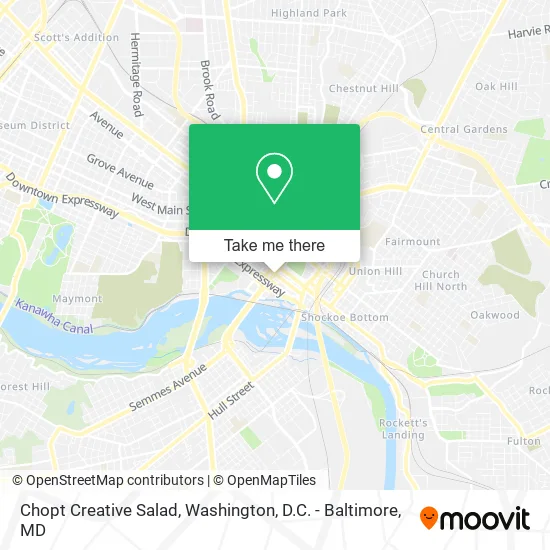
See Chopt Creative Salad, Richmond, on the map
Public Transit to Chopt Creative Salad in Richmond
Wondering how to get to Chopt Creative Salad in Richmond? Moovit helps you find the best way to get to Chopt Creative Salad with step-by-step directions from the nearest public transit station.
Moovit provides free maps and live directions to help you navigate through your city. View schedules, routes, timetables, and find out how long does it take to get to Chopt Creative Salad in real time.
Looking for the nearest stop or station to Chopt Creative Salad? Check out this list of stops closest to your destination: 9th + Cary; 8th + Cary; Cary + 8th; Main + 9th; Pathrichmond Main Street Amtrak Station.
Bus: 14, 5, FLIXBUS N2471, FLIXBUS N2601, GREYHOUND US0670, 2A, 2B, 2C, 64, 87, 29, 95.Train: NORTHEAST REGIONAL.
Want to see if there’s another route that gets you there at an earlier time? Moovit helps you find alternative routes or times. Get directions from and directions to Chopt Creative Salad easily from the Moovit App or Website.
We make riding to Chopt Creative Salad easy, which is why over 1.5 million users, including users in Richmond, trust Moovit as the best app for public transit. You don’t need to download an individual bus app or train app, Moovit is your all-in-one transit app that helps you find the best bus time or train time available.
For information on prices of bus and train, costs and ride fares to Chopt Creative Salad, please check the Moovit app.
Use the app to navigate to popular places including to the airport, hospital, stadium, grocery store, mall, coffee shop, school, college, and university.
Chopt Creative Salad Address: 901 E Cary St Richmond, VA 23219 street in Richmond
- Dabbs, David F - MC Guire Woods,
- Christian & Barton,
- The Mary Morton Parsons Foundation,
- Hca Healthcare Capital Division,
- Cigna,
- CSX,
- ATM,
- Southstate Bank,
- Chip Beveridge Southstate Mortgage,
- Piedmont Capital,
- Richmond - Deck Builders,
- Ernst & Young,
- Dana G Fitzsimons,
- Anne Marie Whittemore,
- Maddock John H III Attorney,
- The The Home Insurance of Richmond,
- John S Barr,
- J Tracy Walker IV Lawyer,
- James H Walsh,
- David F Bernhardt Attorney
Places Near Chopt Creative Salad (Richmond)
- Sibley Memorial Hospital, Washington,
- Basilica of the National Shrine, Washington,
- Washington National Cathedral, Washington,
- Camden Yards, Baltimore,
- PG Mall, Prince George's County,
- Washington DC VA Medical Center, Washington,
- National Zoo, Washington,
- Pennsylvania Ave NW (3rd st and pennsylvania), Washington,
- National Museum of African American History and Culture, Washington,
- Warner Theatre, Washington,
- Museum Of The Bible, Washington,
- Rock Creek Tennis Center, Washington,
- Marriott Marquis Washington, DC, Washington,
- Capital One Arena, Washington,
- M&T Bank Stadium, Baltimore,
- Georgetown, Washington,
- Westfield Montgomery Mall, Montgomery County,
- National Mall, Washington,
- Amazon Hq2, Arlington County,
- The Anthem, Washington
How to get to popular places in Washington, D.C. - Baltimore, MD with public transit
Get around Richmond by public transit!
Traveling around Richmond has never been so easy. See step by step directions as you travel to any attraction, street or major public transit station. View bus and train schedules, arrival times, service alerts and detailed routes on a map, so you know exactly how to get to anywhere in Richmond.
When traveling to any destination around Richmond use Moovit's Live Directions with Get Off Notifications to know exactly where and how far to walk, how long to wait for your line, and how many stops are left. Moovit will alert you when it's time to get off — no need to constantly re-check whether yours is the next stop.
Wondering how to use public transit in Richmond or how to pay for public transit in Richmond? Moovit public transit app can help you navigate your way with public transit easily, and at minimum cost. It includes public transit fees, ticket prices, and costs. Looking for a map of Richmond public transit lines? Moovit public transit app shows all public transit maps in Richmond with all Bus, Train, Metro, Light Rail and Ferry routes and stops on an interactive map.
Washington, D.C. - Baltimore, MD has 5 transit type(s), including: Bus, Train, Metro, Light Rail and Ferry, operated by several transit agencies, including WMATA, Montgomery County Ride On, Fairfax Connector, TheBus, PRTC, DASH - Alexandria, Arlington Transit (ART), RTA of Central Maryland, MDOT MTA, MDOT MTA Light RailLink, MDOT MTA Commuter Bus, MDOT MTA Local Bus, FXBGO!, Virginia Railway Express (VRE) and MARC