How to get to Christian Science by bus?
Click on the bus route to see step by step directions with maps, line arrival times and updated time schedules.
Bus stops near Christian Science in Hampton
Bus lines to Christian Science in Hampton
What are the closest stations to Christian Science?
The closest stations to Christian Science are:
- Kecoughtan & Raleigh is 77 yards away, 2 min walk.
- Shell & Raleigh is 977 yards away, 12 min walk.
Which bus line stops near Christian Science?
103 (Hampton Transit Center)
What’s the nearest bus station to Christian Science in Hampton?
The nearest bus station to Christian Science in Hampton is Kecoughtan & Raleigh. It’s a 2 min walk away.
What time is the first bus to Christian Science in Hampton?
The 103 is the first bus that goes to Christian Science in Hampton. It stops nearby at 5:27 AM.
What time is the last bus to Christian Science in Hampton?
The 101 is the last bus that goes to Christian Science in Hampton. It stops nearby at 11:59 PM.
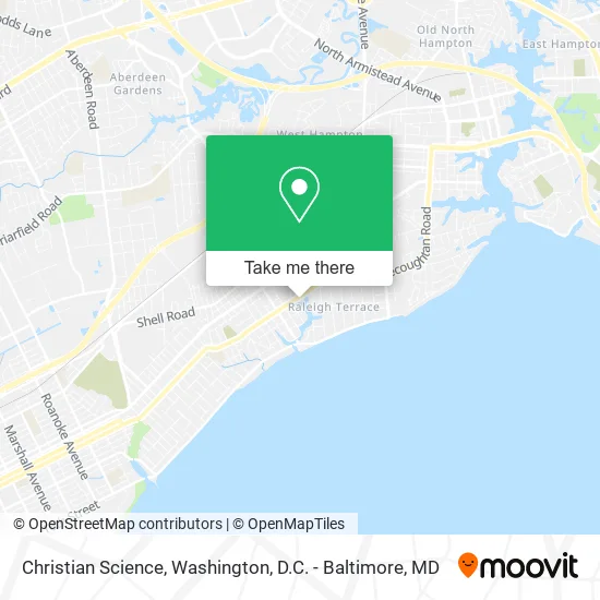
See Christian Science, Hampton, on the map
Public Transit to Christian Science in Hampton
Wondering how to get to Christian Science in Hampton? Moovit helps you find the best way to get to Christian Science with step-by-step directions from the nearest public transit station.
Moovit provides free maps and live directions to help you navigate through your city. View schedules, routes, timetables, and find out how long does it take to get to Christian Science in real time.
Looking for the nearest stop or station to Christian Science? Check out this list of stops closest to your destination: Kecoughtan & Raleigh; Shell & Raleigh.
Bus: 103, 101.
Want to see if there’s another route that gets you there at an earlier time? Moovit helps you find alternative routes or times. Get directions from and directions to Christian Science easily from the Moovit App or Website.
We make riding to Christian Science easy, which is why over 1.5 million users, including users in Hampton, trust Moovit as the best app for public transit. You don’t need to download an individual bus app or train app, Moovit is your all-in-one transit app that helps you find the best bus time or train time available.
For information on prices of bus, costs and ride fares to Christian Science, please check the Moovit app.
Use the app to navigate to popular places including to the airport, hospital, stadium, grocery store, mall, coffee shop, school, college, and university.
Christian Science Address: 2808 Kecoughtan Rd Hampton, VA 23661 street in Hampton
- First Church Of Christ Scientist,
- Kecoughtan & Little Farms,
- Kecoughtan & Ocanoe,
- M & T Market,
- Zero's Subs,
- ATM,
- Earthsown Soapery,
- Disciples of Jesus Christ,
- Hampton Apostolic Church,
- United Pentecostal Church,
- Living Waters Christian Center,
- A S Kenley Contractors,
- Black Bull Tires,
- 48v6i Locksmith,
- All Day Services,
- Just Us Detailin & Used Tires,
- Sweets Made Wright,
- Kecoughtan Laundry Cleaners,
- Statewide Alliance Termite & Moisture,
- Light Hearts - A Clown Company
Places Near Christian Science (Hampton)
- Westfield Montgomery Mall, Montgomery County,
- National Museum of African American History and Culture, Washington,
- Georgetown, Washington,
- PG Mall, Prince George's County,
- Washington DC VA Medical Center, Washington,
- Marriott Marquis Washington, DC, Washington,
- Basilica of the National Shrine, Washington,
- Sibley Memorial Hospital, Washington,
- Warner Theatre, Washington,
- National Mall, Washington,
- Camden Yards, Baltimore,
- Washington National Cathedral, Washington,
- Museum Of The Bible, Washington,
- Rock Creek Tennis Center, Washington,
- The Anthem, Washington,
- Amazon Hq2, Arlington County,
- National Zoo, Washington,
- Capital One Arena, Washington,
- Pennsylvania Ave NW (3rd st and pennsylvania), Washington,
- M&T Bank Stadium, Baltimore
How to get to popular places in Washington, D.C. - Baltimore, MD with public transit
Get around Hampton by public transit!
Traveling around Hampton has never been so easy. See step by step directions as you travel to any attraction, street or major public transit station. View bus and train schedules, arrival times, service alerts and detailed routes on a map, so you know exactly how to get to anywhere in Hampton.
When traveling to any destination around Hampton use Moovit's Live Directions with Get Off Notifications to know exactly where and how far to walk, how long to wait for your line, and how many stops are left. Moovit will alert you when it's time to get off — no need to constantly re-check whether yours is the next stop.
Wondering how to use public transit in Hampton or how to pay for public transit in Hampton? Moovit public transit app can help you navigate your way with public transit easily, and at minimum cost. It includes public transit fees, ticket prices, and costs. Looking for a map of Hampton public transit lines? Moovit public transit app shows all public transit maps in Hampton with all Bus, Train, Metro, Light Rail and Ferry routes and stops on an interactive map.
Washington, D.C. - Baltimore, MD has 5 transit type(s), including: Bus, Train, Metro, Light Rail and Ferry, operated by several transit agencies, including WMATA, Montgomery County Ride On, Fairfax Connector, TheBus, PRTC, DASH - Alexandria, Arlington Transit (ART), RTA of Central Maryland, MDOT MTA, MDOT MTA Light RailLink, MDOT MTA Commuter Bus, MDOT MTA Local Bus, FXBGO!, Virginia Railway Express (VRE) and MARC