How to get to Christianus Informatik by bus?
Click on the bus route to see step by step directions with maps, line arrival times and updated time schedules.
How to get to Christianus Informatik by train?
Click on the train route to see step by step directions with maps, line arrival times and updated time schedules.
From Arcus Klinik, Pforzheim
80 minFrom Rkh Kliniken, Verwaltungsgemeinschaft Bretten
49 minFrom Epplesee, Rheinstetten
40 minFrom Arcus Kliniken Pforzheim, Pforzheim
79 minFrom POCO Einrichtungsmärkte, Pforzheim
84 minFrom Karlsruher Straße, Pforzheim
83 minFrom Media Markt, Pforzheim
78 minFrom Kaufland Pforzheim Wilhelm-Becker-Str., Pforzheim
78 minFrom Waldbronn Eistreff, Waldbronn
73 min
Light Rail stations near Christianus Informatik in Stuttgart
- Karlsruhe Hauptfriedhof, 1 min walk,VIEW
Bus stops near Christianus Informatik in Stuttgart
Bus lines to Christianus Informatik in Stuttgart
What are the closest stations to Christianus Informatik?
The closest stations to Christianus Informatik are:
- Karlsruhe Hauptfriedhof is 15 meters away, 1 min walk.
- Karlsruhe Emil-Gött-Straße Bstg B is 741 meters away, 10 min walk.
- Karlsruhe Emil-Gött-Straße is 756 meters away, 10 min walk.
- Ka Tullastraße/Alter Schlachthof is 775 meters away, 10 min walk.
- Karlsruhe Studentenhaus Bstg B is 1100 meters away, 15 min walk.
- Karlsruhe Studentenhaus is 1100 meters away, 15 min walk.
Which train line stops near Christianus Informatik?
S2 (Hagsfeld Reitschulschlag)
Which light rail line stops near Christianus Informatik?
3 (Rintheim)
Which bus line stops near Christianus Informatik?
42 (Ka Durlacher Tor/Kit-Campus Süd)
What’s the nearest light rail station to Christianus Informatik in Stuttgart?
The nearest light rail station to Christianus Informatik in Stuttgart is Karlsruhe Hauptfriedhof. It’s a 1 min walk away.
What’s the nearest bus station to Christianus Informatik in Stuttgart?
The nearest bus station to Christianus Informatik in Stuttgart is Karlsruhe Hauptfriedhof. It’s a 2 min walk away.
What time is the first light rail to Christianus Informatik in Stuttgart?
The E is the first light rail that goes to Christianus Informatik in Stuttgart. It stops nearby at 3:53 AM.
What time is the last light rail to Christianus Informatik in Stuttgart?
The E is the last light rail that goes to Christianus Informatik in Stuttgart. It stops nearby at 2:02 AM.
What time is the first bus to Christianus Informatik in Stuttgart?
The 30 is the first bus that goes to Christianus Informatik in Stuttgart. It stops nearby at 5:23 AM.
What time is the last bus to Christianus Informatik in Stuttgart?
The 30 is the last bus that goes to Christianus Informatik in Stuttgart. It stops nearby at 12:53 AM.
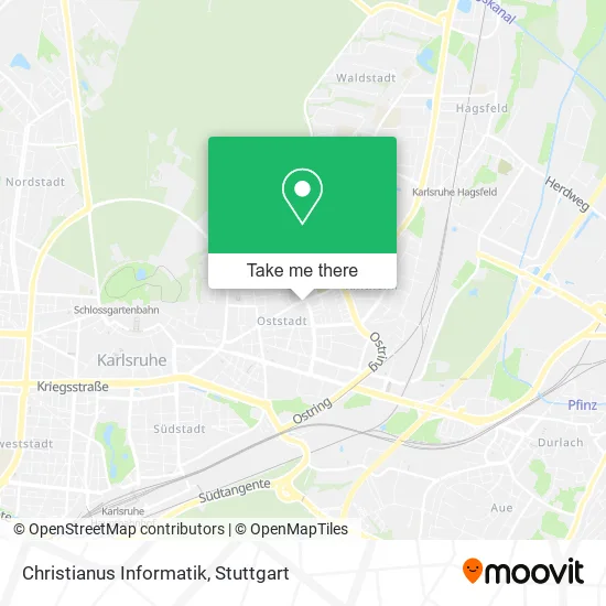
See Christianus Informatik, Stuttgart, on the map
Public Transit to Christianus Informatik in Stuttgart
Wondering how to get to Christianus Informatik in Stuttgart? Moovit helps you find the best way to get to Christianus Informatik with step-by-step directions from the nearest public transit station.
Moovit provides free maps and live directions to help you navigate through your city. View schedules, routes, timetables, and find out how long does it take to get to Christianus Informatik in real time.
Looking for the nearest stop or station to Christianus Informatik? Check out this list of stops closest to your destination: Karlsruhe Hauptfriedhof; Karlsruhe Emil-Gött-Straße Bstg B; Karlsruhe Emil-Gött-Straße; Ka Tullastraße/Alter Schlachthof; Karlsruhe Studentenhaus Bstg B; Karlsruhe Studentenhaus.
Train: S2.Light Rail: 3.Bus: 42, 125X, 30, 30, 71, 71.
Want to see if there’s another route that gets you there at an earlier time? Moovit helps you find alternative routes or times. Get directions from and directions to Christianus Informatik easily from the Moovit App or Website.
We make riding to Christianus Informatik easy, which is why over 1.5 million users, including users in Stuttgart, trust Moovit as the best app for public transit. You don’t need to download an individual bus app or train app, Moovit is your all-in-one transit app that helps you find the best bus time or train time available.
For information on prices of train, bus and light rail, costs and ride fares to Christianus Informatik, please check the Moovit app.
Use the app to navigate to popular places including to the airport, hospital, stadium, grocery store, mall, coffee shop, school, college, and university.
Christianus Informatik Address: Haid-und-Neu-Straße 36 Oststadt, 76131 Karlsruhe street in Stuttgart
- Atelier Feuerroth - 3D Architektur Visualisierung,
- Trauerhilfe Stier,
- Fluffy Fairy Games,
- Steinbach Floristik,
- Debeka Versicherungen,
- Steinbach Floristik Friedhofsgärtnerei,
- Optik Süß,
- Blumen Ball,
- Info Center am Hauptfriedhof,
- Oliver Kelm,
- Hatz,
- Rainer Betting Energieberater,
- Pflege Und Wohnen Alte Mälzerei,
- Hans Huber,
- Praxis Oststadt,
- Trompeter von Säckingen,
- Tigris Pizza & Kebaphaus,
- Berthold-Apotheke Karlsruhe,
- Spargelhof Heneka,
- Elmar Kaufmann Raumausstattung
Places Near Christianus Informatik (Stuttgart)
- Geilhaus Haus 33a, Reutlingen-Betzingen,
- Gleis 101/102 (tief), Stuttgart-Mitte,
- Hauptbahnhof Stuttgart, Stuttgart-Mitte,
- Schleyerhalle, Bad Cannstatt,
- Porsche-Arena, Bad Cannstatt,
- Mettingen Eros-Center Puff Laufhaus, Esslingen Am Neckar,
- Mercedes-Benz Museum (Mercedes Museum Stuttgart), Bad Cannstatt,
- Hanns-Martin-Schleyer-Halle, Bad Cannstatt,
- SI-Centrum, Möhringen,
- Mercedes-Benz Museum, Bad Cannstatt,
- Hanns-Martin-Schleyer-Halle (Stuttgart Hans-Martin-Schleyerhalle), Bad Cannstatt,
- Pariser Platz Stuttgart, Stuttgart-Mitte,
- FlixBus Haltestelle, Stuttgart,
- Klinikum Stuttgart - Katharinenhospital, Stuttgart-Mitte,
- Waldfriedhof, Degerloch,
- Porsche Museum, Zuffenhausen,
- Marmorsaal Im Weissenburgpark, Stuttgart-Süd,
- Wilhelma (U-Bahn Wilhelma), Bad Cannstatt,
- Gasometer Pforzheim, Pforzheim,
- Im Wizemann (Halle), Bad Cannstatt
How to get to popular places in Stuttgart with public transit
Get around Stuttgart by public transit!
Traveling around Stuttgart has never been so easy. See step by step directions as you travel to any attraction, street or major public transit station. View bus and train schedules, arrival times, service alerts and detailed routes on a map, so you know exactly how to get to anywhere in Stuttgart.
When traveling to any destination around Stuttgart use Moovit's Live Directions with Get Off Notifications to know exactly where and how far to walk, how long to wait for your line, and how many stops are left. Moovit will alert you when it's time to get off — no need to constantly re-check whether yours is the next stop.
Wondering how to use public transit in Stuttgart or how to pay for public transit in Stuttgart? Moovit public transit app can help you navigate your way with public transit easily, and at minimum cost. It includes public transit fees, ticket prices, and costs. Looking for a map of Stuttgart public transit lines? Moovit public transit app shows all public transit maps in Stuttgart with all Bus, Train, Subway, Light Rail, Ferry, S-Bahn and Funicular routes and stops on an interactive map.
Stuttgart has 7 transit type(s), including: Bus, Train, Subway, Light Rail, Ferry, S-Bahn and Funicular, operated by several transit agencies, including SSB - Stadtbahn, SSB, SSB - Seilbahn / Zacke, S-Bahn Stuttgart, Rhein-Neckar-Verkehr GmbH (rnv), Karlsruher Verkehrsverbund, DB AG, DB Regiobus BW, Arverio Baden-Württemberg GmbH, DB RegioNetz Verkehrs GmbH Westfrankenbahn, DB Regio AG Baden-Württemberg, Südwestdeutsche Verkehrs-AG, DB Regio AG Mitte Region Hessen, DB and Bodensee-Oberschwaben-Bahn