
Cicero & Lexington (Blue Line) (North) stop - Tuesday schedule
| Line | Direction | Time |
|---|---|---|
| 54 | Cicero & Pensacola Terminal (East) | 5:08 AM |
| 54 | Cicero & Pensacola Terminal (East) | 5:25 AM |
| 54 | Cicero & Pensacola Terminal (East) | 5:35 AM |
| 54 | Cicero & Pensacola Terminal (East) | 5:45 AM |
| 54 | Cicero & Pensacola Terminal (East) | 5:55 AM |
| 54 | Cicero & Pensacola Terminal (East) | 6:05 AM |
| 54 | Cicero & Pensacola Terminal (East) | 6:15 AM |
| 54 | Cicero & Pensacola Terminal (East) | 6:24 AM |
| 54 | Cicero & Pensacola Terminal (East) | 6:32 AM |
| 54 | Cicero & Pensacola Terminal (East) | 6:40 AM |
| 54 | Cicero & Pensacola Terminal (East) | 6:48 AM |
| 54 | Cicero & Pensacola Terminal (East) | 6:56 AM |
| 54 | Cicero & Pensacola Terminal (East) | 7:05 AM |
| 54 | Cicero & Pensacola Terminal (East) | 7:15 AM |
| 54 | Cicero & Pensacola Terminal (East) | 7:25 AM |
| 54 | Cicero & Pensacola Terminal (East) | 7:35 AM |
| 54 | Cicero & Pensacola Terminal (East) | 7:45 AM |
| 54 | Cicero & Pensacola Terminal (East) | 7:55 AM |
| 54 | Cicero & Pensacola Terminal (East) | 8:05 AM |
| 54 | Cicero & Pensacola Terminal (East) | 8:15 AM |
| 54 | Cicero & Pensacola Terminal (East) | 8:25 AM |
| 54 | Cicero & Pensacola Terminal (East) | 8:35 AM |
| 54 | Cicero & Pensacola Terminal (East) | 8:45 AM |
| 54 | Cicero & Pensacola Terminal (East) | 8:55 AM |
| 54 | Cicero & Pensacola Terminal (East) | 9:05 AM |
Directions to Cicero & Lexington (Blue Line) (North) stop (Chicago) with public transit
The following transit lines have routes that pass near Cicero & Lexington (Blue Line) (North)
 Bus: 54, 7, 392, 316, 305.
- Train: BNSF.
- Chicago 'L': BLUE LINE, PINK LINE, GREEN LINE.
How to get to Cicero & Lexington (Blue Line) (North) stop by public transit?
Click on the bus route to see step-by-step directions with maps, line arrival times and updated time schedules.
How to get to Cicero & Lexington (Blue Line) (North) stop by public transit?
Click on the train route to see step-by-step directions with maps, line arrival times and updated time schedules.
How to get to Cicero & Lexington (Blue Line) (North) stop by public transit?
Click on the Chicago 'L' route to see step-by-step directions with maps, line arrival times and updated time schedules.
Bus stops near Cicero & Lexington (Blue Line) (North) stop in Chicago
- Cicero/Lexington, 1 min walk,
- Cicero Ave & Lexington St, 1 min walk,
- Cicero Cta Blue Line, 1 min walk,
- Cicero & Flournoy (North), 2 min walk,
- Harrison/Cicero, 4 min walk,
Chicago 'L' stations near Cicero & Lexington (Blue Line) (North) station in Chicago
- Cicero (Blue), 15 min walk,
- Cicero (Pink), 19 min walk,
- Cicero (Green), 23 min walk,
Bus lines to Cicero & Lexington (Blue Line) (North) stop in Chicago
- 392, Ups Terminal 2,
- 316, Morton College,
- 54, Cicero & Pensacola Terminal (East),
- 305, Cicero Cta Blue Line,
- 57, Harrison & Cicero (West),
- 7, Congress Plaza & Michigan (Ne),
What are the closest stations to Cicero & Lexington (Blue Line) (North)?
The closest stations to Cicero & Lexington (Blue Line) (North) are:
- Cicero/Lexington stop is 7 yards away, 1 min walk.
- Cicero Ave & Lexington St stop is 37 yards away, 1 min walk.
- Cicero Cta Blue Line stop is 84 yards away, 1 min walk.
- Cicero & Flournoy (North) stop is 139 yards away, 2 min walk.
- Harrison/Cicero stop is 260 yards away, 4 min walk.
- Cicero (Blue) station is 1252 yards away, 15 min walk.
- Cicero (Pink) station is 1585 yards away, 19 min walk.
- Cicero (Green) station is 1931 yards away, 23 min walk.
Which bus lines stop near Cicero & Lexington (Blue Line) (North)?
These bus lines stop near Cicero & Lexington (Blue Line) (North): 54, 7.
Which train line stops near Cicero & Lexington (Blue Line) (North)?
BNSF (Aurora (West))
Which Chicago 'L' line stops near Cicero & Lexington (Blue Line) (North)?
BLUE LINE (Towards Forest Park)
What’s the nearest Chicago 'L' station to Cicero & Lexington (Blue Line) (North) in Chicago?
The nearest Chicago 'L' station to Cicero & Lexington (Blue Line) (North) in Chicago is Cicero (Blue). It’s a 15 min walk away.
What’s the nearest bus station to Cicero & Lexington (Blue Line) (North) in Chicago?
The nearest bus stations to Cicero & Lexington (Blue Line) (North) in Chicago are Cicero/Lexington, Cicero Ave & Lexington St and Cicero Cta Blue Line. The closest one is a 1 min walk away.
Cicero & Lexington (Blue Line) (North) station
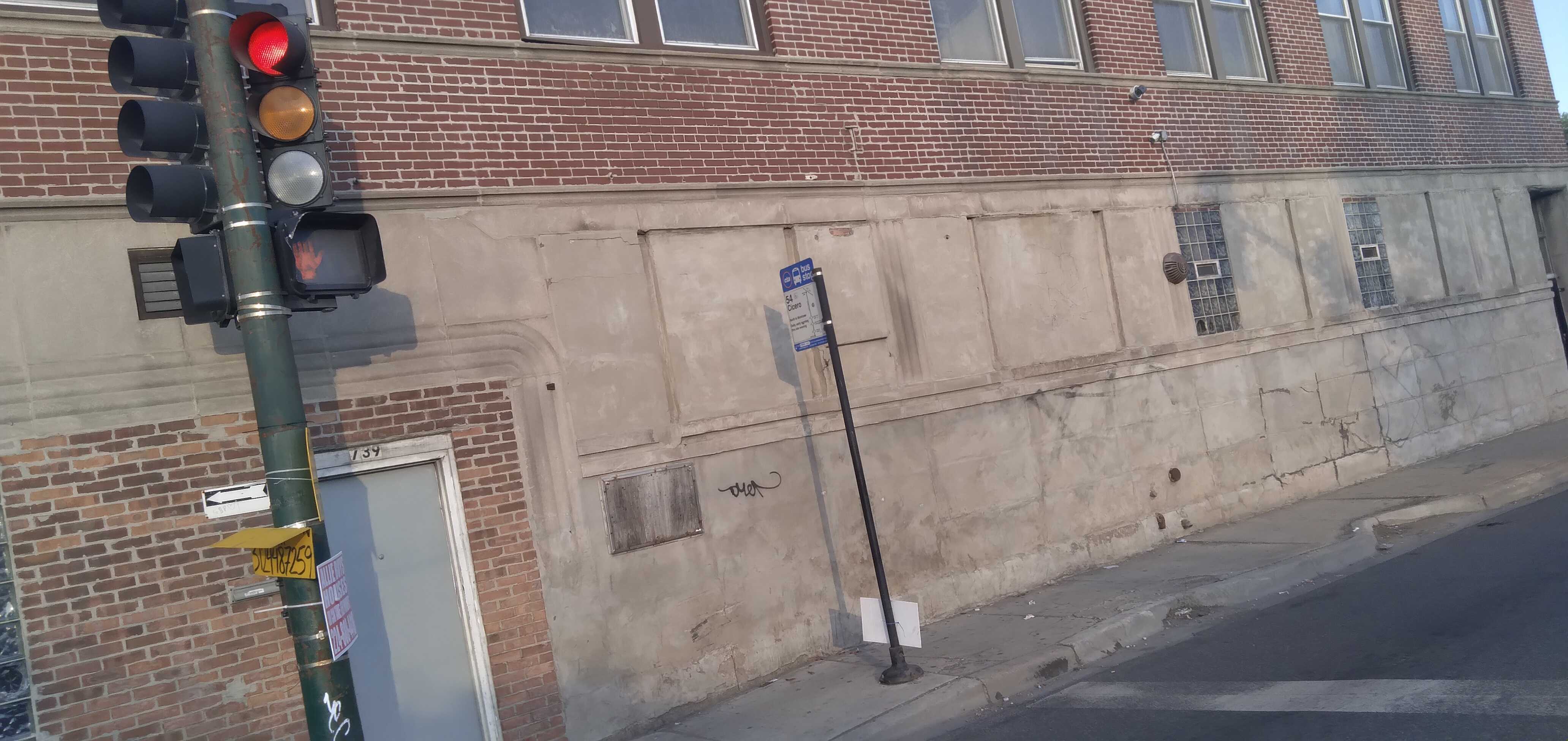 Taken by Anonymous
See Cicero & Lexington (Blue Line) (North) stop, Chicago, on the map
Public transit to Cicero & Lexington (Blue Line) (North) stop (ID: 10285) in Chicago
Looking for directions to Cicero & Lexington (Blue Line) (North) in Chicago, United States?
Download the Moovit App to find the current schedule and step-by-step directions for Chicago 'L', Bus or Train routes that pass through Cicero & Lexington (Blue Line) (North).
Looking for the stops closest to Cicero & Lexington (Blue Line) (North)? Check out this list of closest stops to your destination: Cicero/Lexington; Cicero Ave & Lexington St; Cicero Cta Blue Line; Cicero & Flournoy (North); Harrison/Cicero; Cicero (Blue); Cicero (Pink); Cicero (Green).
Bus: 54, 7, 392, 316, 305.Train: BNSF.Chicago 'L': BLUE LINE, PINK LINE, GREEN LINE.
We make riding on public transit to Cicero & Lexington (Blue Line) (North) easy, which is why over 1.7 billion users, including users in Chicago, trust Moovit as the best app for public transit.
Use the app to navigate to popular places including to the airport, hospital, stadium, grocery store, mall, coffee shop, school, college, and university.
Cicero & Lexington (Blue Line) (North) stop’s code is 10285
The first line to this stop is 54, at 5:08 AM, and the last line is 54 at 4:48 AM.
739 S Cicero Ave, West Side, Chicago, IL, USA
This stop serves CTA’s lines
- Cicero/Lexington,
- Cicero Ave & Lexington St,
- Cicero Cta Blue Line,
- Cicero & Flournoy (North),
- Harrison/Cicero
Bus stops near Cicero & Lexington (Blue Line) (North) stop
- Cicero (Blue),
- Cicero (Pink),
- Cicero (Green)
Chicago 'L' stations near Cicero & Lexington (Blue Line) (North) station
- Cermak-Mccormick Place Green Line Station (East),
- Maywood,
- 87th St & Ridgeland Ave/State Rd/Narragansett Ave,
- Illinois Route 59 & Montgomery Rd/83rd St,
- 111th Street & Indiana (East),
- 59th Street & Halsted (West),
- Racine,
- King Drive & 65th Street (South),
- Harlem Ave & Archer Ave,
- Higgins Rd & Landmeier Rd,
- Woodstock Metra Station,
- Crawford Ave & Main St,
- Illinois Route 59 & 103rd St,
- Grand Ave & Harlem Ave,
- Ashland & Wellington (North),
- Grand Ave & Harlem Ave,
- Van Buren & Halsted (West),
- Pulaski & 75th Place (South),
- Touhy Ave & Linder Ave,
- 95th St & Central Ave