Directions to Cicles Gabriel (Xaxim) with public transportation
The following transit lines have routes that pass near Cicles Gabriel
How to get to Cicles Gabriel by bus?
Click on the bus route to see step by step directions with maps, line arrival times and updated time schedules.
From Hospital XV, Alto Da Rua XV
54 minFrom Hospital Oswaldo Cruz, Alto Da Rua XV
52 minFrom Tribunal Regional Eleitoral do Paraná, Prado Velho
32 minFrom Rua Brigadeiro Franco, Centro
46 minFrom Hospital de Clínicas (HC - UFPR), Centro
53 minFrom Rua Almirante Tamandaré, Alto Da Rua XV
52 minFrom UPA 24h - Campo Comprido, Campo Comprido
67 minFrom Supercenter Angeloni Água Verde, Vila Izabel
37 minFrom UPA 24h - Unidade De Pronto Atendimento Barigui, Cic
41 minFrom Rua Comendador Macedo, Centro
47 min
Bus stops near Cicles Gabriel in Xaxim
Bus lines to Cicles Gabriel in Xaxim
- 526 ITAMARATI / VILA SÃO PEDRO, Terminal Capão Raso → Terminal Hauer,VIEW
- 506 BAIRRO NOVO, Osternack → Praça Rui Barbosa,VIEW
- 665 VILA REX, Praça Rui Barbosa → Vila Rex,VIEW
- 030 INTERBAIRROS III, Terminal Santa Cândida → Terminal Capão Raso,VIEW
- 625 GRAMADOS, Terminal Capão Raso → Terminal Sítio Cercado,VIEW
- 689 MAD. SÃO PEDRO / RIO NEGRO, Praça Rui Barbosa ↺ São Pedro / Rio Negro (Circular),VIEW
- 631 PIRATINI / BR 476, Terminal Pinheirinho ↺ Piratini (Circular),VIEW
What are the closest stations to Cicles Gabriel?
The closest stations to Cicles Gabriel are:
- R. Primeiro De Maio, 976 is 118 meters away, 2 min walk.
- Vila São Pedro is 123 meters away, 2 min walk.
- R. Primeiro De Maio, 975 is 130 meters away, 2 min walk.
- R. Barão de Santo Ângelo, 957 is 314 meters away, 5 min walk.
- R. Barão de Santo Ângelo, 1201 is 568 meters away, 8 min walk.
- R. Cid Marcondes de Albuquerque, 300 is 638 meters away, 9 min walk.
Which bus lines stop near Cicles Gabriel?
These bus lines stop near Cicles Gabriel: 506 BAIRRO NOVO, 526 ITAMARATI / VILA SÃO PEDRO, 625 GRAMADOS, 665 VILA REX.
What’s the nearest bus station to Cicles Gabriel in Xaxim?
The nearest bus stations to Cicles Gabriel in Xaxim are R. Primeiro De Maio, 976, Vila São Pedro and R. Primeiro De Maio, 975. The closest one is a 2 min walk away.
What time is the first bus to Cicles Gabriel in Xaxim?
The 689 MAD. SÃO PEDRO / RIO NEGRO is the first bus that goes to Cicles Gabriel in Xaxim. It stops nearby at 3:16 AM.
What time is the last bus to Cicles Gabriel in Xaxim?
The 689 MAD. SÃO PEDRO / RIO NEGRO is the last bus that goes to Cicles Gabriel in Xaxim. It stops nearby at 3:16 AM.
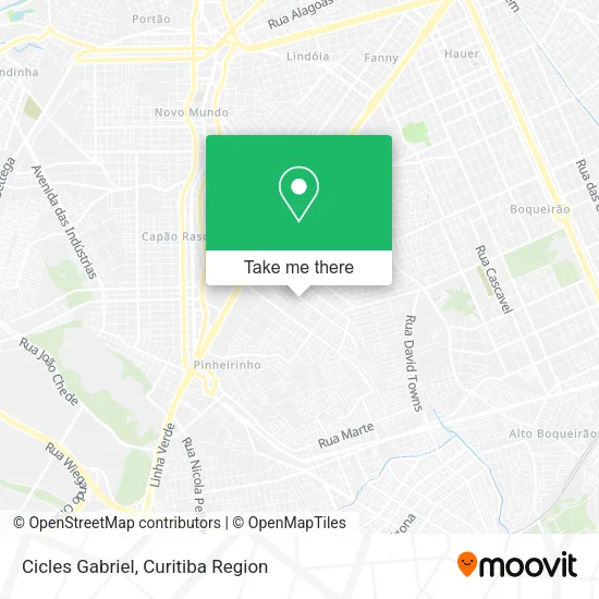
See Cicles Gabriel, Xaxim, on the map
Public Transit to Cicles Gabriel in Xaxim
Wondering how to get to Cicles Gabriel in Xaxim? Moovit helps you find the best way to get to Cicles Gabriel with step-by-step directions from the nearest public transit station.
Moovit provides free maps and live directions to help you navigate through your city. View schedules, routes, timetables, and find out how long does it take to get to Cicles Gabriel in real time.
Looking for the nearest stop or station to Cicles Gabriel? Check out this list of stops closest to your destination: R. Primeiro De Maio; Vila São Pedro; R. Primeiro De Maio; R. Barão de Santo Ângelo; R. Barão de Santo Ângelo; R. Cid Marcondes de Albuquerque.
Bus: 506 BAIRRO NOVO, 526 ITAMARATI / VILA SÃO PEDRO, 625 GRAMADOS, 665 VILA REX, 030 INTERBAIRROS III, 689 MAD. SÃO PEDRO / RIO NEGRO, 631 PIRATINI / BR 476.
Want to see if there’s another route that gets you there at an earlier time? Moovit helps you find alternative routes or times. Get directions from and directions to Cicles Gabriel easily from the Moovit App or Website.
We make riding to Cicles Gabriel easy, which is why over 1.5 million users, including users in Xaxim, trust Moovit as the best app for public transit. You don’t need to download an individual bus app or train app, Moovit is your all-in-one transit app that helps you find the best bus time or train time available.
For information on prices of bus, costs and ride fares to Cicles Gabriel, please check the Moovit app.
Use the app to navigate to popular places including to the airport, hospital, stadium, grocery store, mall, coffee shop, school, college, and university.
Cicles Gabriel Address: Rua Primeiro de Maio, 828 Xaxim Curitiba-PR 81810-000 street in Xaxim
- Lanchonete Nicacio,
- Consultório de Fisioterapia Estética,
- Tecendo Amor Atelie,
- MRCL Informatica & Lan House,
- Rua Rodolfo Amoedo 46,
- Boutique e Brecho Amor de Mae,
- Rua Primeiro de Maio,
- Clube da Bebida Distribuidora,
- Lucia Gomes,
- Rua Primeiro de Maio, 975 - Xaxim,
- Deccotech Servicos de Limpeza de Terrenos,
- Rua Carmem Miranda 302,
- Igreja Evangélica Irmãos Menonitas do Jardim Urano,
- Rua Barão de Santo Ângelo,
- Supermercado Karvat,
- Rua Carmem Miranda 36,
- Associacao Paranaense de Grupo de Capoeira Nacao,
- Rua Primeiro de Maio 608,
- Lava Car Campese,
- Cristal Desenvolvimento Educacional e Profissional
Places Near Cicles Gabriel (Xaxim)
- Hospital Da Cruz Vermelha, Batel,
- Pontifícia Universidade Católica do Paraná (PUCPR), Prado Velho,
- Hospital Nossa Senhora Das Graças, Mercês,
- Hospital do Rocio, Campo,
- Shopping Palladium, Portão,
- Park Shopping Barigüi, Mossunguê,
- Jockey Plaza Shopping Center, Tarumã,
- Shopping Estação, Rebouças,
- Hospital Madalena Sofia, Bairro Alto,
- Hospital Angelina Caron, Campina Grande Do Sul,
- Rua General Mário Tourinho, Campina Do Siqueira,
- Arena Da Baixada - Curitiba,
- Hhhhh, Fazendinha,
- Parque Barigui, Mercês,
- Rua Martim Afonso 558, Mercês,
- Hospital Universitário Evangélico de Curitiba, Bigorrilho,
- Jardim Botânico de Curitiba PR, Centro,
- Hospital Do Senhor - Madre Virgínia, São José Dos Pinhais,
- Hospital de Clínicas (HC - UFPR), Centro,
- Hospital Erasto Gaertner, Jardim Das Américas
How to get to popular places in Curitiba Region with public transit
Get around Xaxim by public transit!
Traveling around Xaxim has never been so easy. See step by step directions as you travel to any attraction, street or major public transit station. View bus and train schedules, arrival times, service alerts and detailed routes on a map, so you know exactly how to get to anywhere in Xaxim.
When traveling to any destination around Xaxim use Moovit's Live Directions with Get Off Notifications to know exactly where and how far to walk, how long to wait for your line, and how many stops are left. Moovit will alert you when it's time to get off — no need to constantly re-check whether yours is the next stop.
Wondering how to use public transit in Xaxim or how to pay for public transit in Xaxim? Moovit public transit app can help you navigate your way with public transit easily, and at minimum cost. It includes public transit fees, ticket prices, and costs. Looking for a map of Xaxim public transit lines? Moovit public transit app shows all public transit maps in Xaxim with all Bus and Cable Car routes and stops on an interactive map.
Curitiba Region has 2 transit type(s), including: Bus and Cable Car, operated by several transit agencies, including Sistema Integrado de Mobilidade (URBS), Sistema Integrado de Mobilidade (AMEP), URBS (Cartões bancários e Dinheiro), URBS (Cartões bancários / Cartão URBS), AMEP (Cartões bancários / Cartão MetroCard), AMEP (Cartões bancários / Cartão MetroCard / Dinheiro), Viação Colombo (Dinheiro), TRIAR (Cartão TRIAR / Dinheiro), Empresa Curitiba Cerro Azul (Dinheiro), Expresso Nossa Senhora da Penha (Dinheiro), Empresa Campo Alto Tijucas (Dinheiro), Auto Viação São José (Cartão VEM / Dinheiro), BRT S/A (Cartão VEM / Dinheiro), TransPiedade (Cartão Cidadão / Dinheiro) and Oceânica Sul (Cartão Transporte / Dinheiro)