How to get to Cigna by bus?
Click on the bus route to see step by step directions with maps, line arrival times and updated time schedules.
From Throw Social, Washington
61 minFrom Suburban Hospital, Montgomery County
41 minFrom New New Hampshire Ave N, Washington
51 minFrom Other Half Brewing, Washington
61 minFrom Walmart Supercenter Fort Totten - Riggs Rd NE, Washington
47 minFrom Canopy by Hilton Washington DC Embassy Row, Washington
43 minFrom Georgetown University Hospital, Washington
54 minFrom VA Medical Center, Washington
43 minFrom Homewood Suites by Hilton Washington DC, Washington
46 minFrom Lauriol Plaza, Washington
42 min
How to get to Cigna by metro?
Click on the metro route to see step by step directions with maps, line arrival times and updated time schedules.
From Suburban Hospital, Montgomery County
65 minFrom New New Hampshire Ave N, Washington
39 minFrom Walmart Supercenter Fort Totten - Riggs Rd NE, Washington
25 minFrom Canopy by Hilton Washington DC Embassy Row, Washington
37 minFrom VA Medical Center, Washington
40 minFrom Homewood Suites by Hilton Washington DC, Washington
41 minFrom Lauriol Plaza, Washington
42 min
Bus stops near Cigna in Montgomery County
Metro station near Cigna in Montgomery County
- Forest Glen, 23 min walk,VIEW
Train station near Cigna in Montgomery County
- Silver Spring Marc Wb, 51 min walk,VIEW
Bus lines to Cigna in Montgomery County
- 18, Silver Spring Via Takoma,VIEW
- 28, Vango-Free Silver Spring,VIEW
- 1, Silver Spring Via Leland,VIEW
- 4, Wheaton Via Kensington,VIEW
- 5, Silver Spring Victory F,VIEW
- 11, Silver Spring,VIEW
- M20, North To Wheaton,VIEW
- 305, 305/3 Washington Dc,VIEW
- 315, 315/1 Washington Dc,VIEW
- 325, 325/3 Washington Dc / Capitol Hill,VIEW
- 8, Wheaton,VIEW
- 21, Briggs Chaney,VIEW
- 22, Hillandale,VIEW
- M52, North To Laurel,VIEW
- M54, North To Greencastle,VIEW
What are the closest stations to Cigna?
The closest stations to Cigna are:
- Fenwick Ln & 1st Ave is 94 yards away, 2 min walk.
- Cameron St & Georgia Ave is 120 yards away, 2 min walk.
- 2nd Ave & @1400 is 201 yards away, 3 min walk.
- Georgia Av+Cameron St is 207 yards away, 3 min walk.
- Silver Spring Metro Station is 330 yards away, 5 min walk.
- Colesville Rd & Georgia Ave is 414 yards away, 6 min walk.
- Forest Glen is 1924 yards away, 23 min walk.
- Silver Spring Marc Wb is 4283 yards away, 51 min walk.
Which bus lines stop near Cigna?
These bus lines stop near Cigna: 17, 18, C87, D4X, D60, D6X, M70.
Which metro line stops near Cigna?
RED (Glenmont)
What’s the nearest metro station to Cigna in Montgomery County?
The nearest metro station to Cigna in Montgomery County is Forest Glen. It’s a 23 min walk away.
What’s the nearest bus station to Cigna in Montgomery County?
The nearest bus stations to Cigna in Montgomery County are Fenwick Ln & 1st Ave and Cameron St & Georgia Ave. The closest one is a 2 min walk away.
What time is the first metro to Cigna in Montgomery County?
The RED is the first metro that goes to Cigna in Montgomery County. It stops nearby at 5:07 AM.
What time is the last metro to Cigna in Montgomery County?
The RED is the last metro that goes to Cigna in Montgomery County. It stops nearby at 12:31 AM.
What time is the first train to Cigna in Montgomery County?
The MARC is the first train that goes to Cigna in Montgomery County. It stops nearby at 5:51 AM.
What time is the last train to Cigna in Montgomery County?
The MARC is the last train that goes to Cigna in Montgomery County. It stops nearby at 7:37 PM.
What time is the first bus to Cigna in Montgomery County?
The M20 is the first bus that goes to Cigna in Montgomery County. It stops nearby at 4:17 AM.
What time is the last bus to Cigna in Montgomery County?
The 5 is the last bus that goes to Cigna in Montgomery County. It stops nearby at 2:06 AM.
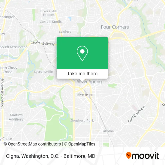
See Cigna, Montgomery County, on the map
Public Transit to Cigna in Montgomery County
Wondering how to get to Cigna in Montgomery County? Moovit helps you find the best way to get to Cigna with step-by-step directions from the nearest public transit station.
Moovit provides free maps and live directions to help you navigate through your city. View schedules, routes, timetables, and find out how long does it take to get to Cigna in real time.
Looking for the nearest stop or station to Cigna? Check out this list of stops closest to your destination: Fenwick Ln & 1st Ave; Cameron St & Georgia Ave; 2nd Ave & @1400; Georgia Av+Cameron St; Silver Spring Metro Station; Colesville Rd & Georgia Ave; Forest Glen; Silver Spring Marc Wb.
Bus: 17, 18, C87, D4X, D60, D6X, M70, 28, 1, 4, 5, 11, M20.Train: MARC.Metro: RED.
Want to see if there’s another route that gets you there at an earlier time? Moovit helps you find alternative routes or times. Get directions from and directions to Cigna easily from the Moovit App or Website.
We make riding to Cigna easy, which is why over 1.5 million users, including users in Montgomery County, trust Moovit as the best app for public transit. You don’t need to download an individual bus app or train app, Moovit is your all-in-one transit app that helps you find the best bus time or train time available.
For information on prices of bus and metro, costs and ride fares to Cigna, please check the Moovit app.
Use the app to navigate to popular places including to the airport, hospital, stadium, grocery store, mall, coffee shop, school, college, and university.
Cigna Address: 8403 Colesville Rd street in Montgomery County
- Fenwick 2nd Ave,
- Montgomery County District Court (Government Offices State District Court of Maryland),
- Sanz School,
- Minority Medical Faculty Development Program,
- Darby Integrative Counseling,
- Truist Bank,
- LabCorp,
- Allstate Insurance,
- Additional Hair Clinic,
- L Andrew Huff MD MPH,
- Cristina Cunha - Strasser,
- Believe N Bread,
- Abraza Skin Studio,
- Puroclean of Silver Spring,
- Elizabeth Perwin,
- Holloway & Norman Law Group,
- Law Office of Asher Weinberg,
- Refreshh Skin Clinic,
- Leslie F Smith,
- The Montgomery County Community Foundation
Places Near Cigna (Montgomery County)
- Camden Yards, Baltimore,
- Rock Creek Tennis Center, Washington,
- PG Mall, Prince George's County,
- Pennsylvania Ave NW (3rd st and pennsylvania), Washington,
- Marriott Marquis Washington, DC, Washington,
- Georgetown, Washington,
- National Mall, Washington,
- Basilica of the National Shrine, Washington,
- Westfield Montgomery Mall, Montgomery County,
- National Zoo, Washington,
- M&T Bank Stadium, Baltimore,
- Washington DC VA Medical Center, Washington,
- The Anthem, Washington,
- Capital One Arena, Washington,
- Warner Theatre, Washington,
- Amazon Hq2, Arlington County,
- Washington National Cathedral, Washington,
- Museum Of The Bible, Washington,
- National Museum of African American History and Culture, Washington,
- Sibley Memorial Hospital, Washington
How to get to popular places in Washington, D.C. - Baltimore, MD with public transit
Get around Montgomery County by public transit!
Traveling around Montgomery County has never been so easy. See step by step directions as you travel to any attraction, street or major public transit station. View bus and train schedules, arrival times, service alerts and detailed routes on a map, so you know exactly how to get to anywhere in Montgomery County.
When traveling to any destination around Montgomery County use Moovit's Live Directions with Get Off Notifications to know exactly where and how far to walk, how long to wait for your line, and how many stops are left. Moovit will alert you when it's time to get off — no need to constantly re-check whether yours is the next stop.
Wondering how to use public transit in Montgomery County or how to pay for public transit in Montgomery County? Moovit public transit app can help you navigate your way with public transit easily, and at minimum cost. It includes public transit fees, ticket prices, and costs. Looking for a map of Montgomery County public transit lines? Moovit public transit app shows all public transit maps in Montgomery County with all Bus, Train, Metro, Light Rail and Ferry routes and stops on an interactive map.
Washington, D.C. - Baltimore, MD has 5 transit type(s), including: Bus, Train, Metro, Light Rail and Ferry, operated by several transit agencies, including WMATA, Montgomery County Ride On, Fairfax Connector, TheBus, PRTC, DASH - Alexandria, Arlington Transit (ART), RTA of Central Maryland, MDOT MTA, MDOT MTA Light RailLink, MDOT MTA Commuter Bus, MDOT MTA Local Bus, FXBGO!, Virginia Railway Express (VRE) and MARC