Directions to Cigna HealthSpring Living Well Center (Baltimore) with public transportation
The following transit lines have routes that pass near Cigna HealthSpring Living Well Center
 Bus: 40, 80, 94, CITYLINK PURPLE, 73.
- Metro: METRO.
- Light Rail: LIGHT RAILLINK.
How to get to Cigna HealthSpring Living Well Center by bus?
Click on the bus route to see step by step directions with maps, line arrival times and updated time schedules.
From Baltimore Poly Tech High School, Baltimore
40 minFrom Walmart, Baltimore County
50 minFrom Loyola University Maryland, Baltimore
41 minFrom I-70 at Security Blvd Baltimore City Lot Park & Ride, Baltimore
37 minFrom NSA Friendship Annex (FANX), Anne Arundel County
76 minFrom Morgan State University, Baltimore
46 minFrom I-695 @ Exit 17 (Security Blvd/MD 122), Baltimore County
36 minFrom I-695 @ Exit 18 (Liberty Rd/MD 26), Baltimore County
54 minFrom Pimlico Race Course, Baltimore
68 minFrom MVA Glen Burnie, Anne Arundel County
44 min
Bus stops near Cigna HealthSpring Living Well Center in Baltimore
Metro station near Cigna HealthSpring Living Well Center in Baltimore
- Lexington Market Metro, 4 min walk,VIEW
Light Rail stations near Cigna HealthSpring Living Well Center in Baltimore
- Lexington Market, 5 min walk,VIEW
Bus lines to Cigna HealthSpring Living Well Center in Baltimore
What are the closest stations to Cigna HealthSpring Living Well Center?
The closest stations to Cigna HealthSpring Living Well Center are:
- Saratoga St & Mlk Blvd FS Wb is 65 yards away, 1 min walk.
- Greene St & Lexington St FS Sb is 177 yards away, 3 min walk.
- Saratoga St & Greene St Eb is 199 yards away, 3 min walk.
- Lexington Market Metro is 294 yards away, 4 min walk.
- Lexington Market is 367 yards away, 5 min walk.
- Mlk Blvd & Fayette St FS Wb is 389 yards away, 5 min walk.
- Fayette St & Fremont Ave is 490 yards away, 6 min walk.
Which bus lines stop near Cigna HealthSpring Living Well Center?
These bus lines stop near Cigna HealthSpring Living Well Center: 40, 80, 94, CITYLINK PURPLE.
Which light rail line stops near Cigna HealthSpring Living Well Center?
LIGHT RAILLINK (Northbound)
What’s the nearest light rail station to Cigna HealthSpring Living Well Center in Baltimore?
The nearest light rail station to Cigna HealthSpring Living Well Center in Baltimore is Lexington Market. It’s a 5 min walk away.
What’s the nearest metro station to Cigna HealthSpring Living Well Center in Baltimore?
The nearest metro station to Cigna HealthSpring Living Well Center in Baltimore is Lexington Market Metro. It’s a 4 min walk away.
What’s the nearest bus station to Cigna HealthSpring Living Well Center in Baltimore?
The nearest bus station to Cigna HealthSpring Living Well Center in Baltimore is Saratoga St & Mlk Blvd FS Wb. It’s a 1 min walk away.
What time is the first light rail to Cigna HealthSpring Living Well Center in Baltimore?
The LIGHT RAILLINK is the first light rail that goes to Cigna HealthSpring Living Well Center in Baltimore. It stops nearby at 3:53 AM.
What time is the last light rail to Cigna HealthSpring Living Well Center in Baltimore?
The LIGHT RAILLINK is the last light rail that goes to Cigna HealthSpring Living Well Center in Baltimore. It stops nearby at 1:23 AM.
What time is the first metro to Cigna HealthSpring Living Well Center in Baltimore?
The METRO is the first metro that goes to Cigna HealthSpring Living Well Center in Baltimore. It stops nearby at 5:07 AM.
What time is the last metro to Cigna HealthSpring Living Well Center in Baltimore?
The METRO is the last metro that goes to Cigna HealthSpring Living Well Center in Baltimore. It stops nearby at 12:23 AM.
What time is the first bus to Cigna HealthSpring Living Well Center in Baltimore?
The 80 is the first bus that goes to Cigna HealthSpring Living Well Center in Baltimore. It stops nearby at 3:16 AM.
What time is the last bus to Cigna HealthSpring Living Well Center in Baltimore?
The 73 is the last bus that goes to Cigna HealthSpring Living Well Center in Baltimore. It stops nearby at 3:16 AM.
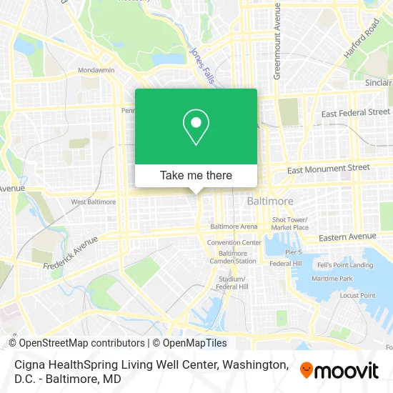
See Cigna HealthSpring Living Well Center, Baltimore, on the map
Public Transit to Cigna HealthSpring Living Well Center in Baltimore
Wondering how to get to Cigna HealthSpring Living Well Center in Baltimore? Moovit helps you find the best way to get to Cigna HealthSpring Living Well Center with step-by-step directions from the nearest public transit station.
Moovit provides free maps and live directions to help you navigate through your city. View schedules, routes, timetables, and find out how long does it take to get to Cigna HealthSpring Living Well Center in real time.
Looking for the nearest stop or station to Cigna HealthSpring Living Well Center? Check out this list of stops closest to your destination: Saratoga St & Mlk Blvd FS Wb; Greene St & Lexington St FS Sb; Saratoga St & Greene St Eb; Lexington Market Metro; Lexington Market; Mlk Blvd & Fayette St FS Wb; Fayette St & Fremont Ave.
Bus: 40, 80, 94, CITYLINK PURPLE, 73, 71, 78, CITYLINK ORANGE.Metro: METRO.Light Rail: LIGHT RAILLINK.
Want to see if there’s another route that gets you there at an earlier time? Moovit helps you find alternative routes or times. Get directions from and directions to Cigna HealthSpring Living Well Center easily from the Moovit App or Website.
We make riding to Cigna HealthSpring Living Well Center easy, which is why over 1.5 million users, including users in Baltimore, trust Moovit as the best app for public transit. You don’t need to download an individual bus app or train app, Moovit is your all-in-one transit app that helps you find the best bus time or train time available.
For information on prices of bus, light rail and metro, costs and ride fares to Cigna HealthSpring Living Well Center, please check the Moovit app.
Use the app to navigate to popular places including to the airport, hospital, stadium, grocery store, mall, coffee shop, school, college, and university.
Cigna HealthSpring Living Well Center Address: 312 Martin Luther King Jr Blvd street in Baltimore
- Mecu Credit Union,
- 720 W Saratoga St Parking,
- Social Security Administration,
- University Bookstore,
- Mother Mary Lange Catholic School,
- Vine St Building 722,
- Saratoga Building,
- Flying Heating & Cooling Repair,
- Metro West Garage,
- Arts That Heal,
- Perkins Square Gazebo,
- Medicaid Solutions of Boston,
- Rieman Block,
- Nicole J. Brandt, Pharmd,
- Student Section of the Maryland Public Health Association,
- The University of Maryland, Baltimore - Pearl Street Garage,
- W Lexington St Building 902,
- Post Office,
- University of Maryland School of Dentistry,
- Harlem Park Congregation of Jehovah's Witnesses
Places Near Cigna HealthSpring Living Well Center (Baltimore)
- Amazon Hq2, Arlington County,
- National Zoo, Washington,
- PG Mall, Prince George's County,
- National Museum of African American History and Culture, Washington,
- The Anthem, Washington,
- Camden Yards, Baltimore,
- Pennsylvania Ave NW (3rd st and pennsylvania), Washington,
- M&T Bank Stadium, Baltimore,
- Capital One Arena, Washington,
- Washington National Cathedral, Washington,
- Westfield Montgomery Mall, Montgomery County,
- Rock Creek Tennis Center, Washington,
- Washington DC VA Medical Center, Washington,
- National Theatre, Washington,
- Basilica of the National Shrine, Washington,
- Marriott Marquis Washington, DC, Washington,
- Georgetown, Washington,
- Sibley Memorial Hospital, Washington,
- Museum Of The Bible, Washington,
- Warner Theatre, Washington
How to get to popular places in Washington, D.C. - Baltimore, MD with public transit
Get around Baltimore by public transit!
Traveling around Baltimore has never been so easy. See step by step directions as you travel to any attraction, street or major public transit station. View bus and train schedules, arrival times, service alerts and detailed routes on a map, so you know exactly how to get to anywhere in Baltimore.
When traveling to any destination around Baltimore use Moovit's Live Directions with Get Off Notifications to know exactly where and how far to walk, how long to wait for your line, and how many stops are left. Moovit will alert you when it's time to get off — no need to constantly re-check whether yours is the next stop.
Wondering how to use public transit in Baltimore or how to pay for public transit in Baltimore? Moovit public transit app can help you navigate your way with public transit easily, and at minimum cost. It includes public transit fees, ticket prices, and costs. Looking for a map of Baltimore public transit lines? Moovit public transit app shows all public transit maps in Baltimore with all Bus, Train, Metro, Light Rail and Ferry routes and stops on an interactive map.
Washington, D.C. - Baltimore, MD has 5 transit type(s), including: Bus, Train, Metro, Light Rail and Ferry, operated by several transit agencies, including WMATA, Montgomery County Ride On, Fairfax Connector, TheBus, PRTC, DASH - Alexandria, Arlington Transit (ART), RTA of Central Maryland, MDOT MTA, MDOT MTA Light RailLink, MDOT MTA Commuter Bus, MDOT MTA Local Bus, FXBGO!, Virginia Railway Express (VRE) and MARC