How to get to Cinefood by bus?
Click on the bus route to see step by step directions with maps, line arrival times and updated time schedules.
From INPS Rome Flaminio, Rome
101 minFrom Ophthalmic Hospital, Rome
86 minFrom Parioli Avenue, Rome
76 minFrom Capannelle Racecourse, Rome
59 minFrom Porte di Roma Shopping Center, Rome
81 minFrom Cola di Rienzo Street, Rome
90 minFrom Mario Amato Street 13, Rome
82 minFrom Monti Neighborhood, Rome
64 minFrom Gracchi Street, Rome
86 minFrom Giulio Romano 46 Street, Rome
102 min
How to get to Cinefood by train?
Click on the train route to see step by step directions with maps, line arrival times and updated time schedules.
How to get to Cinefood by metro?
Click on the metro route to see step by step directions with maps, line arrival times and updated time schedules.
Bus stops near Cinefood in Rome
Metro station near Cinefood in Rome
- Centocelle Park, 8 min walk,VIEW
Bus lines to Cinefood in Rome
- NMC, Piazza Venezia,VIEW
- C5, Montebello Station (Regional Rail),VIEW
- 542, Piazza Delle Camelie,VIEW
- 548, Cinecitta (Ma),VIEW
- 213, Cinecitta (Ma),VIEW
- N5, Piazza Venezia,VIEW
- 313, Longoni/Inps,VIEW
- N543, Vertunni,VIEW
- 556, Gardenie,VIEW
- 552, Policlinico/Tor Vergata Hospital,VIEW
- 450, Monti Tiburtini/Pertini (H),VIEW
- 558, Gardenie,VIEW
What are the closest stations to Cinefood?
The closest stations to Cinefood are:
- Mirti (Mc) is 145 meters away, 2 min walk.
- Robinie/Castani is 171 meters away, 3 min walk.
- Daffodils is 238 meters away, 4 min walk.
- Albizzie is 424 meters away, 6 min walk.
- Centocelle Park is 604 meters away, 8 min walk.
Which bus lines stop near Cinefood?
These bus lines stop near Cinefood: 213, 542, 544, 548, 556, 5BUS.
Which train line stops near Cinefood?
FC1
Which metro line stops near Cinefood?
C
What’s the nearest metro station to Cinefood in Rome?
The nearest metro station to Cinefood in Rome is Centocelle Park. It’s a 8 min walk away.
What’s the nearest bus station to Cinefood in Rome?
The nearest bus station to Cinefood in Rome is Mirti (Mc). It’s a 2 min walk away.
What time is the first metro to Cinefood in Rome?
The C is the first metro that goes to Cinefood in Rome. It stops nearby at 5:38 AM.
What time is the last metro to Cinefood in Rome?
The C is the last metro that goes to Cinefood in Rome. It stops nearby at 11:54 PM.
What time is the first train to Cinefood in Rome?
The FC1 is the first train that goes to Cinefood in Rome. It stops nearby at 5:07 AM.
What time is the last train to Cinefood in Rome?
The FC1 is the last train that goes to Cinefood in Rome. It stops nearby at 11:11 PM.
What time is the first bus to Cinefood in Rome?
The NMC is the first bus that goes to Cinefood in Rome. It stops nearby at 3:08 AM.
What time is the last bus to Cinefood in Rome?
The N5 is the last bus that goes to Cinefood in Rome. It stops nearby at 3:32 AM.
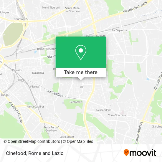
See Cinefood, Rome, on the map
Public Transit to Cinefood in Rome
Wondering how to get to Cinefood in Rome? Moovit helps you find the best way to get to Cinefood with step-by-step directions from the nearest public transit station.
Moovit provides free maps and live directions to help you navigate through your city. View schedules, routes, timetables, and find out how long does it take to get to Cinefood in real time.
Looking for the nearest stop or station to Cinefood? Check out this list of stops closest to your destination: Mirti (Mc); Robinie/Castani; Daffodils; Albizzie; Centocelle Park.
Bus: 213, 542, 544, 548, 556, 5BUS, NMC, C5, N5, 313, N543, 552, 450, 558.Train: FC1.Metro: C.
Want to see if there’s another route that gets you there at an earlier time? Moovit helps you find alternative routes or times. Get directions from and directions to Cinefood easily from the Moovit App or Website.
We make riding to Cinefood easy, which is why over 1.5 million users, including users in Rome, trust Moovit as the best app for public transit. You don’t need to download an individual bus app or train app, Moovit is your all-in-one transit app that helps you find the best bus time or train time available.
For information on prices of bus, metro and train, costs and ride fares to Cinefood, please check the Moovit app.
Use the app to navigate to popular places including to the airport, hospital, stadium, grocery store, mall, coffee shop, school, college, and university.
Cinefood Address: Via dei Narcisi, 36 00172 Roma street in Rome
- Via dei Narcisi 36,
- Broadway (Broadway Mediaport Cinema),
- Broadway Cinema Mediaport Cinema,
- Broadway Cinema,
- Pechen by Carlo Horvath and Paolo Nascenzi,
- The Needle Tailoring,
- Cento Auto,
- La Peonia SNC by Marinelli Bruno & C.,
- Casaburi Mario,
- Naima Nails Nail Center,
- Todis,
- Maurizio Massucci,
- Robinie Street,
- Castani Street 78,
- Ninfee Street 7,
- Dr. Pescosolido Francesca,
- Mirti (MC) (Metro-Mirti),
- Robinie/Tor De' Schiavi Stop,
- Ronconi Orthopedics,
- Le Robinie Upholstery by Pallucchini Vanessa
Places Near Cinefood (Rome)
- The Sail, Rome,
- Olympic Stadium, Rome, Rome,
- Tiber Island, Rome,
- Termini Station, Rome,
- Scuderie Del Quirinale, Rome,
- Cristo Re Hospital, Rome,
- Santa Maria Maggiore, Rome,
- IDI (Dermopatico Dell'Immacolata Institute), Rome,
- Villa Borghese, Rome,
- Tor Vergata, Rome,
- Gravity, Rome,
- Gemelli Polyclinic, Rome,
- Casilino Polyclinic, Rome,
- Paths, Rome,
- Trastevere Quarter, Rome,
- Sandro Pertini Hospital, Rome,
- The Wow Side, Fiumicino,
- Coppedè Quarter, Rome,
- Auditorium Music Park, Rome,
- Roma Est Shopping Center, Rome
How to get to popular places in Rome and Lazio with public transit
Get around Rome by public transit!
Traveling around Rome has never been so easy. See step by step directions as you travel to any attraction, street or major public transit station. View bus and train schedules, arrival times, service alerts and detailed routes on a map, so you know exactly how to get to anywhere in Rome.
When traveling to any destination around Rome use Moovit's Live Directions with Get Off Notifications to know exactly where and how far to walk, how long to wait for your line, and how many stops are left. Moovit will alert you when it's time to get off — no need to constantly re-check whether yours is the next stop.
Wondering how to use public transit in Rome or how to pay for public transit in Rome? Moovit public transit app can help you navigate your way with public transit easily, and at minimum cost. It includes public transit fees, ticket prices, and costs. Looking for a map of Rome public transit lines? Moovit public transit app shows all public transit maps in Rome with all Bus, Train, Metro, Light Rail, Ferry, Funicular and Gondola routes and stops on an interactive map.
Rome and Lazio has 7 transit type(s), including: Bus, Train, Metro, Light Rail, Ferry, Funicular and Gondola, operated by several transit agencies, including ATAC, Cotral, Trenitalia, Troiani Transportation Services, BIS, ATR Mobility, Tuscia, Shuttle, Seatour, Troiani Bus Lines, CSC Mobility, Terravision, ATRAL, Tambus and Sitbus